Gößgraben - Schneewinkelspitze (Detmolder Grat)
Starting point: Gößgraben (1600 m)
| Latitude/Longitude: | 46,98040°N 13,33510°E |
| |
Route name: Detmolder Grat
Walking time: 5 h
Difficulty: difficult marked way
Elevation gain: 1416 m
Elevation difference along the route: 1416 m
Map:
Recommended equipment (summer): helmet
Recommended equipment (winter): helmet, ice axe, crampons
Views: 360
 | 2 people like this post |
Access to starting point:
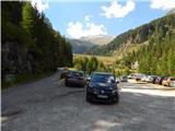
From the Karawanks Tunnel, we follow the highway towards Salzburg to the Gmünd exit. Then we follow the signs for the Maltatal valley. We follow the road that runs through the mentioned valley to the settlement Koschach. When we notice the Fallbach waterfall on the right (the highest waterfall in Koroška), we will soon come to a crossroads where we turn left across the bridge that crosses the Malta River. Shortly thereafter, we again turn left onto a narrower road that steeply ascends into the Gossgraben valley (signs for the Gießener Hütte mountain hut). We follow the road all the way to the large parking lot below the Goskarspeicher dam. The last few kilometers of the road are open only in the summer months, when the Gießener Hütte mountain hut is open (from the beginning of July to the end of September).
Route description:
From the parking lot, we continue on the asphalt road which is closed to traffic. After a few minutes of ascent, we come to a crossroads where we continue right onto the macadam road indicated by a sign reading »Gießener Hütte«. To the left is only a short ascent to Gößkarspeicher Lake.
At the junction, we also enter the Hohe Tauern National Park (Nationalpark Hohe Tauern). The road ascends continuously and increasingly beautiful views open up towards the Reißeck mountain group. During the ascent, we also cross grazing fences several times, as livestock grazes along the road in the summer months. Further on, we can walk along the road the whole time or take marked shortcuts. The forest becomes sparser and in the last part of the path to the hut, we walk beside rocky terrain. Here a nice view also opens up towards the Hochalmspitze summit and numerous streams flowing down the slope. We continue along the road and soon arrive at the Gießener Hütte hut.
From the hut, we continue on the footpath which immediately above the hut brings us to a junction. To the left, the path leads towards the Mallnitzer Scharte notch and the Arthur von Schmid Haus hut; we continue slightly right following the signs »Hochalmspitze«. Shortly after, an easy path to the nearby Winterleitenkopf summit branches off to the right.
The path further mostly runs over rocky slabs, which are initially nicely arranged so the ascent causes no difficulties. Here we enter the core area of the Hohe Tauern National Park and after a short ascent, we come to another junction.
To the right, the path leads along the eastern ridge to Hochalmspitze; we continue left along path 519, the Schwarzenburger Weg. From the junction, the path crosses the slopes towards the west for a while, crossing several streams. Later it turns slightly right and begins to ascend somewhat more steeply. The path, which mostly runs over rocky slabs, then brings us to a marked junction. Here the path to Hochalmspitze branches off to the right; we continue left towards Schneewinkelspitze and Säuleck. The path enters an area full of rocky blocks. Initially, we follow a small valley between larger rocks, then cross short smooth rocks, carefully following the blazes. The path leads below a short smooth wall and turns right. The path steeply ascends towards the saddle located east of the Schneewinkelspitze summit. While walking, take care that rocks do not shift underfoot or that we step into a hole between rocky blocks. After approximately 1.5 hours of walking in rocky terrain, we arrive at the mentioned saddle. Here we reach the Detmolder Grat path. From the right, the path from Hochalmspitze or the Lassacher Winklscharte notch joins. We continue left. The junction is unmarked. The path initially stays close to the ridge, then veers to its left side, leading us over a short steep step before returning to the ridge. Soon the path becomes somewhat steeper and bypasses all difficulties on the left side. After the steep section, we reach the forepeak. We continue along the ridge, walking over rocky blocks the entire time. In 45 minutes from the saddle, we reach the panoramic summit where a cairn stands.
The description and pictures from 41 onward refer to the condition in September 2024.

Photos:
 1
1 2
2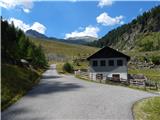 3
3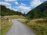 4
4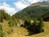 5
5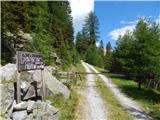 6
6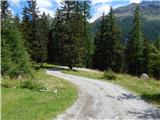 7
7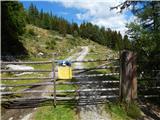 8
8 9
9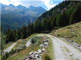 10
10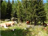 11
11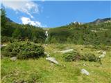 12
12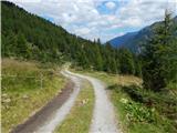 13
13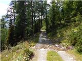 14
14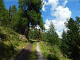 15
15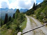 16
16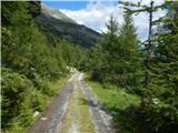 17
17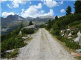 18
18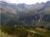 19
19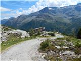 20
20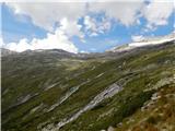 21
21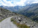 22
22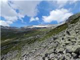 23
23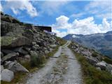 24
24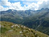 25
25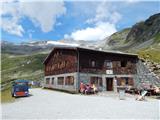 26
26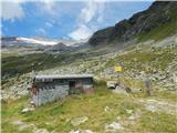 27
27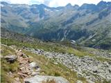 28
28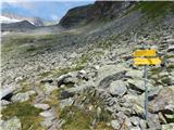 29
29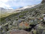 30
30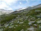 31
31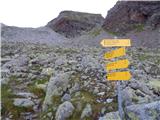 32
32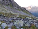 33
33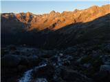 34
34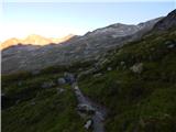 35
35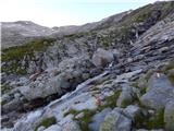 36
36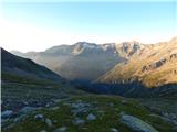 37
37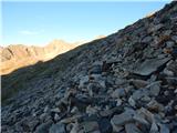 38
38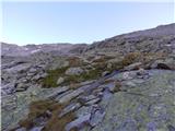 39
39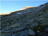 40
40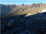 41
41 42
42 43
43 44
44 45
45 46
46 47
47 48
48 49
49 50
50 51
51 52
52 53
53 54
54 55
55 56
56 57
57 58
58 59
59 60
60 61
61 62
62 63
63 64
64 65
65 66
66
Discussion about the trip Gößgraben - Schneewinkelspitze (Detmolder Grat)
To post a comment you must log in:
If you do not yet have a username, you must first
register.