Gotenica - Goteniški Snežnik
Starting point: Gotenica (550 m)
| Latitude/Longitude: | 45,61480°N 14,74590°E |
| |
Walking time: 2 h 45 min
Difficulty: easy marked way
Elevation gain: 739 m
Elevation difference along the route: 800 m
Map:
Recommended equipment (summer): helmet
Recommended equipment (winter): helmet, ice axe, crampons
Views: 25.954
 | 1 person like this post |
Access to starting point:
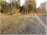
a) From Ljubljana we drive towards Kočevje. Soon after Ribnica, near Dolenja vas, we will notice signs for the villages Grčarice, Gotenica and Kočevska Reka, which direct us right from the main road. We follow the mentioned road to the beginning of the village Gotenica, where approximately 50 meters before the old petrol station we notice a parking lot and next to it mountain signs for Goteniški Snežnik. The starting point is on the right side of the road, just a few meters before the sign marking the beginning of Gotenica.
b) We can also reach the starting point from the direction of Kočevska Reka. In this case we drive on the regional road through the villages Borovec pri Kočevski Reki and Novi Lazi towards Gotenica. After crossing most of the village Gotenica and passing the old petrol station, a few meters after it on our left side (immediately after the sign for the end of the settlement Gotenica) there is a parking lot with mountain signs.
Route description:
From the parking lot, the signs for Goteniški Snežnik direct us onto a wide footpath, which first descends gently to a torrent stream and then begins to ascend. After a short climb we step onto a wide cart track, which we follow to the right. The cart track, which partly runs through the forest and partly across small clearings, leads us higher to a junction where we continue sharply left.
We continue the ascent along the cart track, which turns into dense forest and a little further changes into a relatively steep footpath. Higher up the mentioned path levels out slightly and begins to turn somewhat to the left, where we step onto the very steep slopes of Kameni zid. Here, due to the relatively narrow path often covered with leaves, there is a risk of slipping. The path from which beautiful views of the surroundings begin to open is also exposed to falling rocks on this steep section.
Higher up the path turns right and during a relatively steep ascent, which again runs through the forest, leads us to a small saddle where we notice signs for the viewpoint Kameni zid. Here we turn right onto a poorly trodden path, which in two minutes of further ascent takes us to the top of Kameni zid.
From Kameni zid we return to the small saddle and then continue the ascent towards Goteniški Snežnik. The path ahead ascends along a relatively gentle cart track, which higher up leads us to a place where it begins to descend. After a few minutes of descent we step onto a forest road, which we then follow to the left (right Medvedjek). This is followed by walking along a gentle road, which after some time leads us to a junction where we continue sharply left on the "main" road. The road ahead begins to ascend somewhat more noticeably and after a few minutes of further walking leads us to a small saddle where we notice signs for Goteniški Snežnik, directing us right onto a wide footpath towards Goteniški Snežnik. The wide path, which continues through dense forest, leads us somewhat higher to a place where we leave it, as the markings direct us onto a steep path, which in less than 2 minutes of further walking takes us to Goteniški Snežnik.
Gotenica - Kameni zid 1:30, Kameni zid - Goteniški Snežnik 1:15.

Photos:
 1
1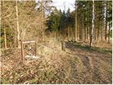 2
2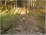 3
3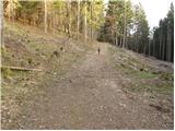 4
4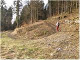 5
5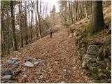 6
6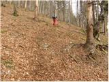 7
7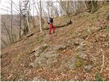 8
8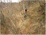 9
9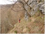 10
10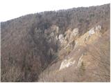 11
11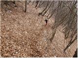 12
12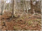 13
13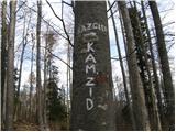 14
14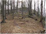 15
15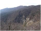 16
16 17
17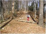 18
18 19
19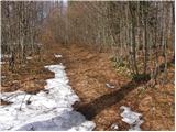 20
20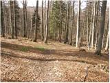 21
21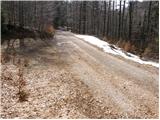 22
22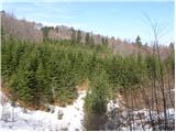 23
23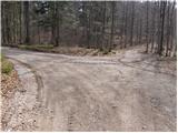 24
24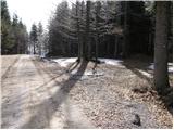 25
25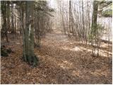 26
26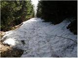 27
27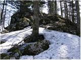 28
28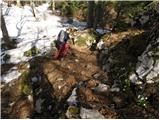 29
29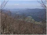 30
30 31
31
Discussion about the trip Gotenica - Goteniški Snežnik
|
| Tomaž0026. 12. 2023 05:57:33 |
Walked the path yesterday, very annoying wind on Kamenem zidu and Snežnik summit, otherwise nothing special, very nicely marked path, return on the same path
|
|
|
To post a comment you must log in:
If you do not yet have a username, you must first
register.