Gozd - Koča na Kriški gori (Ovčja pot)
Starting point: Gozd (891 m)
| Latitude/Longitude: | 46,34100°N 14,32830°E |
| |
Route name: Ovčja pot
Walking time: 1 h 30 min
Difficulty: easy unmarked way
Elevation gain: 580 m
Elevation difference along the route: 580 m
Map: Karavanke - osrednji del 1:50.000
Recommended equipment (summer):
Recommended equipment (winter): ice axe, crampons
Views: 21.532
 | 3 people like this post |
Access to starting point:
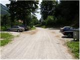
a) From the Ljubljana-Jesenice motorway, take the Kranj-west exit and continue along the road towards Golnik. Just a little after Golnik (more precisely after the settlement of Senično), a steep road branches off to the right uphill towards Zgornji Vetrni and Gozd. After the village of Zgornje Vetrno, the road mostly continues through the forest, and we follow it to the marked parking lot located in the immediate vicinity of the Shelter in Gozd.
b) From the Jesenice-Ljubljana motorway, take the Podbrezje exit, then continue driving towards Ljubelj and Tržič. Before the Petrol petrol station in Bistrica pri Tržiču, turn right and then drive into Tržič. When the road descends into the valley, continue sharply right towards Pristava and Križ, then drive along the main road leading to Zgornje and Spodnje Duplje, leave the mentioned main road at the settlement of Retnje, where we continue left towards the settlements of Križe and Golnik. Continue towards Golnik, and shortly after the settlement of Križe, we arrive at a small intersection where a steep road branches off to the left towards Zgornji Vetrni and Gozd. After the village of Zgornje Vetrno, the road mostly continues through the forest, and we follow it to the marked parking lot located in the immediate vicinity of the Shelter in Gozd.
Route description:
From the Shelter in Gozd, we walk to the nearby church of St. Miklavž, then arrive at a marked junction where the path from Golnik joins from the right. We continue left uphill along the increasingly rough road, which takes us to a junction in a few minutes.
Here we take the left path towards the Hut on Kriška gora (right: Tolsti vrh, Mala and Velika Poljana, and Storžič), which passes the water catchment and continues along the cart track. Just a few meters further, the cart track takes us to the next junction.
We continue straight along the cart track towards Kriška gora (forest path), with the usual marked path to the right. At this junction, an information sign warns us that we will continue along a path exposed to snow avalanches in winter. The cart track ascending through the forest takes us to grassy slopes 20 minutes from the junction. A short ascent follows to the point where the path reaches the scenic side ridge of Kriška gora. Here we encounter an orienteering loop. We continue along the right path, which ascends along the indistinct side ridge on the southern slope of Kriška gora. Slightly higher up, the path takes us to a point where we cross grassy slopes with a slight ascent, after which it leads into a short stretch of forest. A little further on, we reach a clearing above which we notice the route of a cargo cableway. The path continues ascending under the cableway all the way to the Hut on Kriška gora.
Starting point - St. Miklavž 0:05, St. Miklavž - junction above Gozd 0:10, junction above Gozd - Ovčja path junction 0:10, Ovčja path junction - Hut on Kriška gora 1:05.
PS: In the event that any object falls from the cableway and injures us, the cableway owner is not responsible for our accident, as the information sign states that we proceed at our own risk!

Along the route: Sveti Miklavž (Gozd) (890m), Gozd (890m), Razpotje nad Gozdom (950m), Odcep Ovčje poti (1008m)
Photos:
 1
1 2
2 3
3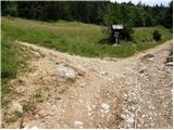 4
4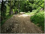 5
5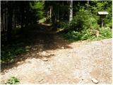 6
6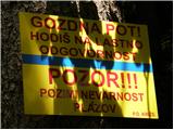 7
7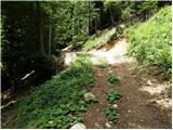 8
8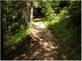 9
9 10
10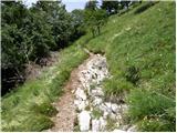 11
11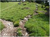 12
12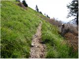 13
13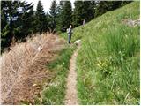 14
14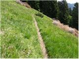 15
15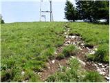 16
16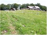 17
17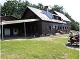 18
18
Discussion about the trip Gozd - Koča na Kriški gori (Ovčja pot)
|
| Gost10. 07. 2007 |
On "parking at the church" I would have one remark. Namely, for some time (about two years) from the shelter in Gozd to the end of the village parking is prohibited for visitors (although many don't follow it) and therefore a large parking lot is made before the village, also relatively large at the shelter in Gozd and some smaller ones along the road before it reaches the shelter. Crowds of visitors who parked (and park) cars everywhere along the village path seriously disturbed the normal life of villagers.
|
|
|
|
| caplja4. 12. 2010 |
I'm wondering if the path to Kriška is already trodden.
Thanks for the reply.
|
|
|
|
| Parkeljc4. 12. 2010 |
Given the popularity (even in winter time) it would really be strange if at least a track to the hut wasn't made. But it's true that given the snow depth the path won't be a "path" for quite some time!
|
|
|
|
| Otto4. 12. 2010 |
The path is trodden on both marked routes. The unmarked so-called Sheep path is anyway not recommended due to avalanches.
|
|
|
|
| caplja5. 12. 2010 |
Thanks to both Parkeljc and Otto for the information about the trail.
Best regards, Caplja
|
|
|
|
| velkavrh7. 01. 2016 |
Today via this path to Kriška gora. The path is trodden, little snow, nothing icy. On Kriška sunny and nice.
|
|
|
|
| Buxl24. 01. 2022 09:13:19 |
Yesterday the weather was nice, not even windy. For the last 800m I warmly recommend poles and crampons, of course there are heroes without them and then they just slide down on their butts.
|
|
|
To post a comment you must log in:
If you do not yet have a username, you must first
register.