Gozd Martuljek - Na Pečeh (via Kotli)
Starting point: Gozd Martuljek (750 m)
| Latitude/Longitude: | 46,48210°N 13,83780°E |
| |
Route name: via Kotli
Walking time: 4 h 30 min
Difficulty: difficult unmarked way, easy pathless terrain
Elevation gain: 1289 m
Elevation difference along the route: 1300 m
Map: Kranjska Gora 1:30.000
Recommended equipment (summer): helmet
Recommended equipment (winter): helmet, ice axe, crampons
Views: 13.242
 | 3 people like this post |
Access to starting point:
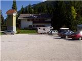
From Mojstrana we drive towards Kranjska Gora or vice versa, but only to the village Gozd-Martuljek, where we park on a parking lot near the bridge over the river Sava Dolinka (parking lot is located after the bridge, or before, if we come from Kranjska Gora).
Route description:
From the parking lot, we continue by the main road towards Kranjska Gora, but only to a spot where the cycling road branches off to the left (by the beginning of the cycling path there are also signposts which point us to the mentioned road). We follow the cycling road to the first crossroad, where we continue straight on a macadam road (cycling road turns right), which quickly brings us to the next crossroad.
We continue right and follow the traffic-closed road to the TNP sign. Further, the path splits into two parts. We continue straight upwards on a steep cart track which ascends on the right side of the Martuljška soteska gorge. The cart track, which mostly ascends through the forest, brings us after 15 minutes to a nice vantage point, where a view opens up to the valley. The path then goes back into the forest and continues to ascend. A little further, the path from the waterfall joins from the left, and a little further the path to the bivouac pod Špikom branches off to the right.
We take this path, which initially ascends gently on a cart track. The wide path we are ascending on then leads us past a rock with the inscription "pod Špik".
When the path approaches a torrent, we encounter an orientation loop. The path to the left leads to the torrent and then disappears; we continue straight past a smaller boulder with a trail blaze. After this, our path also approaches the torrent but does not cross it yet. It continues ascending on the right side and crosses it a little later. The crossing is not difficult, but the ascent from the torrent back to the path is somewhat harder. This section is only three meters long, so it causes no problems. Ahead, the path ascends gently through the forest to the next torrent, where a boulder with a large blaze stands. Ahead, the path begins to ascend steeply up the forest-covered slope. In the middle of this ascent, we come to a small spring, and a little further a pleasant bench. Further on, the forest thins out and the path brings us to the unvegetated slopes below Špik, where we encounter torrent stone deposits. At this point, we leave the marked path. The marked path turns right here and after a few minutes' ascent through the forest reaches the bivouac pod Špikom.
We head slightly left onto the wide bed of the torrent towards the east. We continue to the scree located to the left of the sheer walls of the peak Na Pečeh. On this scree, we can already see the narrow path from afar. When we reach the scree, the narrow path leads us up the steep valley to the right. We ascend along the right side of the valley, mostly steeply upwards through dwarf pines. This path brings us to Spodnji Kotel. Here the slope flattens, and due to the rocky terrain the path disappears briefly.
Most guidebooks describe the path which in Spodnji Kotel turns right and then ascends a very steep gully. The easier variant is to follow in Spodnji Kotel the path leading slightly left towards the southeast. In this case, the path brings us to a steep slope covered with dwarf pines. We enter the dwarf pines a few meters before the end of the scree, on the left side. From the scree, we must first climb a few meters, then a very narrow and somewhat overgrown path leads through the dwarf pines. After a short ascent, the path turns right and then crosses the slopes towards the southwest in a gentle ascent. Soon we emerge from the dwarf pines, and an ascent follows on a partly grassy and partly rocky slope which brings us to Srednji Kotel.
We continue up the valley, turning left towards the end of the valley. Here views begin to open towards Ponca and Oltar. Soon we reach a small saddle below the peak Na Pečeh. Here we continue right and soon reach the summit on the partly grassy slope. On the summit, wonderful views open up on all sides.

Photos:
 1
1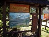 2
2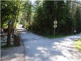 3
3 4
4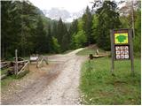 5
5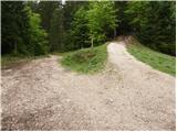 6
6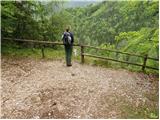 7
7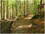 8
8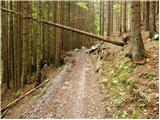 9
9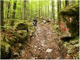 10
10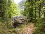 11
11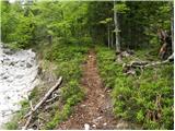 12
12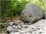 13
13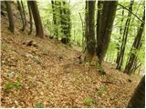 14
14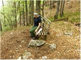 15
15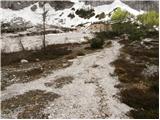 16
16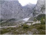 17
17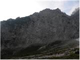 18
18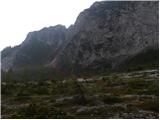 19
19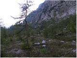 20
20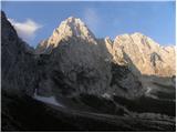 21
21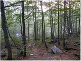 22
22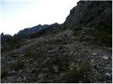 23
23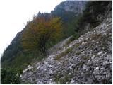 24
24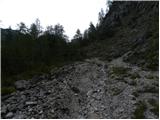 25
25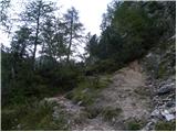 26
26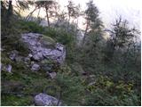 27
27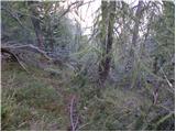 28
28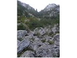 29
29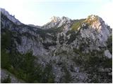 30
30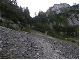 31
31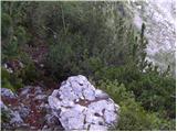 32
32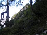 33
33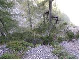 34
34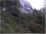 35
35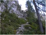 36
36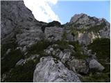 37
37 38
38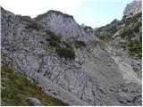 39
39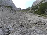 40
40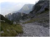 41
41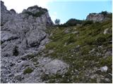 42
42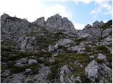 43
43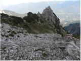 44
44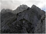 45
45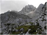 46
46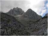 47
47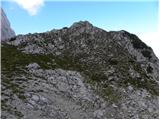 48
48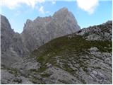 49
49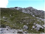 50
50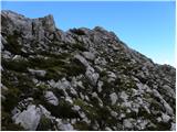 51
51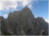 52
52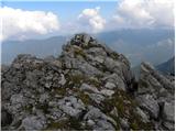 53
53
Discussion about the trip Gozd Martuljek - Na Pečeh (via Kotli)
|
| ljubitelj gora10. 10. 2012 |
This path also leads to Mala Martuljška Ponca.
|
|
|
|
| metod20. 08. 2014 |
17.8.2014: The path can be followed uphill without problems. For the descent, you need to be quite focused to find the correct entrances for the passage into the lower Kotle. From the lower to the Middle kotel, the left variant is perfectly fine.
If continuing to Mala Martuljška Ponca, avoid the unpleasant ridge to the right side, where the path becomes increasingly scree-covered. Descent is probably better past the Three Larches.
|
|
|
|
| JusAvgustin20. 08. 2014 |
Much more pleasant via Kotle, since there is no Veliki meli and no end to it. Also, the descent from the Za Ak larches can be difficult for many.
|
|
|
|
| ločanka20. 08. 2014 |
If you've never gone up through Kotle before, you'll probably struggle to find the descent variant. On the descent past the Three Larches, the route is clearer, I think. And you get even better views.
|
|
|
|
| djimuzl22. 09. 2019 |
The app also showed you that you are in the wall, you could hardly stand there 
Such data must be compulsorily compared with the actual, "live" situation in nature. You were definitely on Na Pečeh.
|
|
|
|
| ljubitelj gora23. 09. 2019 |
I think it hits the mark if you leave the phone alone for a while. The problem is with track recording, there the deviations are too large.
|
|
|
|
| djimuzl23. 09. 2019 |
Yes, I also had an interesting incident with this app  , it's not good to trust it 100%. , it's not good to trust it 100%.
|
|
|
|
| gregah26. 07. 2021 13:49:43 |
Today, 26.7.21, found a red Apple mobile phone on the path. Lying on the right, climbing path through the gully, on the middle kotel. Info Grega Hočevar 041 226 886
|
|
|
|
| capraibex2. 10. 2021 15:41:39 |
Did the path today, section from Spodnji kotel onwards barely traceable or overgrown, without markers.
|
|
|
|
| Kostja Jerovšek13. 11. 2022 14:09:18 |
Today, 13.11.2022 from below Špik over Kotle to the summit at Pečeh. The path is fine, recently someone cut through the brush not too much, just as needed. Higher up white and frozen.
|
|
|
To post a comment you must log in:
If you do not yet have a username, you must first
register.