Gozd - Vovar (Pot razgleda)
Starting point: Gozd (784 m)
| Latitude/Longitude: | 46,25780°N 14,65420°E |
| |
Route name: Pot razgleda
Walking time: 45 min
Difficulty: easy unmarked way
Elevation gain: 156 m
Elevation difference along the route: 175 m
Map:
Recommended equipment (summer):
Recommended equipment (winter): ice axe, crampons
Views: 3.813
 | 2 people like this post |
Access to starting point:
A) We drive to Kamnik, then continue driving in the direction of the Črnivec pass and Gornji Grad. After the settlement of Krivčevo we drive for a short time on the main road towards the Črnivec pass, then continue right in the direction of the Gozd settlement. When we arrive in Gozd from the first crossroad we continue straight (right the parish church of St. Ana in Gozd), from the second behind the houses we turn right. From the next crossroad at the hayrack we go straight (left hamlet Laze, right the previously mentioned church), then immediately once again right (left the road continues towards the settlement Brezje nad Kamnikom) and past a few houses we drive to the parking lot near the mortuary chapel.
B) We drive to the Volovljek pass or Črnivec pass, then we begin descending towards Kamnik. During the descent we leave the main road and continue driving left towards the Gozd settlement. When we arrive in Gozd from the first crossroad we continue straight (right the parish church of St. Ana in Gozd), from the second behind the houses we turn right. From the next crossroad at the hayrack we go straight (left hamlet Laze, right the previously mentioned church), then immediately once again right (left the road continues towards the settlement Brezje nad Kamnikom) and past a few houses we drive to the parking lot near the mortuary chapel.
Route description:
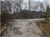
From the parking lot, we return to the nearby houses, where from the crossroad we continue straight (left the road from where we came to the starting point), and then the village quickly ends. Next follows a light descent through a meadow, from which a nice view opens up, reaching to the highest peaks of the Kamnik-Savinja Alps; when the descent ends, we start to ascend moderately. We quickly arrive at a crossroad, where a forest road branches off to the left, and we continue straight on the road that leads further towards the settlement Brezje nad Kamnikom. Approximately 50 meters ahead, we leave the road to the left onto a cart track that leads transversely to the left and takes us somewhat above the nearby meadow. Next follows a transverse ascent to the left; when we reach the indistinct ridge, the path splits.
To the right the eastern path continues, and we continue straight in the direction of the view path. A few steps further, the markers for the view path direct us right onto the ridge, along which we first still ascend through the forest, higher along a partly panoramic section. A few minutes further, we join the eastern path, then along a fairly level path we quickly reach the summit of Vovar.
Description and pictures refer to the condition in March 2020.

Photos:
 1
1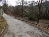 2
2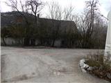 3
3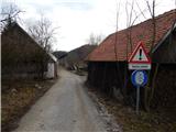 4
4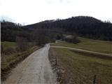 5
5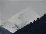 6
6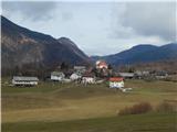 7
7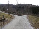 8
8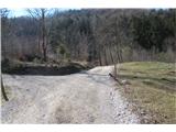 9
9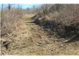 10
10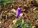 11
11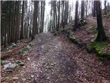 12
12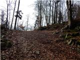 13
13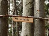 14
14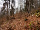 15
15 16
16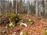 17
17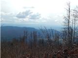 18
18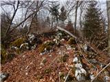 19
19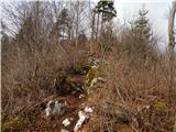 20
20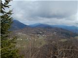 21
21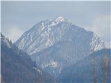 22
22 23
23 24
24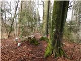 25
25 26
26
Discussion about the trip Gozd - Vovar (Pot razgleda)
|
| CarpeDiem24714. 03. 2020 |
Thanks for the very fresh description, as I'm going to this summit soon.
|
|
|
|
| zvončica15. 03. 2020 |
Today I climbed to Vovar and followed the path description consistently. Informing the administrator that part of the path needs to be changed. Namely, when returning, the farmer, owner of the meadow, told me not to walk across the meadow because they mow and to go along the cart track. So, at the intersection in picture 8 we don't go left onto the forest road, but straight along the road for about 50 m, where we turn onto the cart track (which we reach in picture 14 according to the current description). Really a simple solution to everyone's satisfaction, the farmer's and the hikers'. Lp
|
|
|
|
| zvončica15. 03. 2020 |
I wanted to attach two more photos, but I can't. Maybe later. Regards
|
|
|
|
| zvončica15. 03. 2020 |
Tadej, I've attached them, the road and the cart track, the one by the path twice by mistake . Regards . Regards
|
|
|
|
| Tadej16. 03. 2020 |
Thanks, I've corrected it in the description and added your photos.
|
|
|
|
| CarpeDiem24721. 03. 2020 |
Yesterday conquered this peak specifically from the village Soteska, about an hour and a half of moderate walking. Nice thing. Apparently barefoot hikers are very popular here on this peak?
|
|
|
|
| miri23. 03. 2020 |
Depends on the brand and model of the stroller.
|
|
|
|
| grega_p22. 10. 2020 |
Thanks for the nice description, it vividly guided me to the starting point and the summit. I would add that car access to the village of Gozd is possible from Tuhinjska dolina valley through Markovo and Laze. There is some gravel with potholes in between, but only about a kilometer.
The path is now spiced up with a gnome (in the picture), a bench with a view and tree painting. Local resident L.S. has beautified the panoramic path in his own way. Gnome
Nice day, nice experience and nice places.
On top of that, apricots and chanterelles for a snack...
|
|
|
To post a comment you must log in:
If you do not yet have a username, you must first
register.