Gračnica - Lisca (mimo Mlinariča)
Starting point: Gračnica (207 m)
| Latitude/Longitude: | 46,10878°N 15,22183°E |
| |
Route name: mimo Mlinariča
Walking time: 4 h 40 min
Difficulty: easy marked way
Elevation gain: 741 m
Elevation difference along the route: 1280 m
Map:
Recommended equipment (summer):
Recommended equipment (winter): ice axe, crampons
Views: 16
 | 1 person like this post |
Access to starting point:
Drive to Rimske Toplice, where we follow the signs for the railway station. From the railway station we drive along the road leading further towards Gračnica and Jurkloštr and soon pass through an underpass to the eastern side of the railway line. At the confluence of Gračnica and Savinja we reach an intersection, where we notice the first hiking directional signs. We turn right onto the road that continues along the railway and has markings for Veliko Kozje, but we park about 100 m further on the parking lot in front of the nearby company Pohištvo Pristanc. The parking lot by the factory is intended for the company's needs, but it is also fenced.
Route description:
From the parking lot, we continue along the asphalt road that heads south and bypasses the nearby factory on the left side. Here, the road begins to visibly ascend and soon turns sharply left, climbing to a hamlet of a few houses, where it turns back to the right; from the nearby intersection, we also go right (on some maps, it is indicated that the marked path continues along the left road).
A traverse ascent to the right follows, where we briefly get a nice view towards Kopitnik and Stražnik, and a bit further on, the road forks.
We continue along the slightly left road, where the markings continue (slightly right Zidani Most), and the asphalt ends. Higher up, there are a few minor intersections, mainly turnoffs to farms, and we follow the otherwise sparse markings in this section.
We walk along the gravel road to an elevation of 600 m, or to a cross, where the markings direct us sharply right onto an initially gentle path that traverses the slopes to the right. Already about a minute further, we go left uphill from the mentioned path onto a steep trail indicated by markings. A few minutes of steep ascent follow on a temporarily overgrown section of the path; when we return to the road, we easily climb along it to the Mlinarič farm.
Just above the farm, the road ends, and from the scenic spot, we get a nice view of the Posavsko hribovje; we continue along the lower marked cart track, which for a short time continues without major elevation changes, then, as the forest begins to thin, we start ascending more steeply. At the cart track fork, we choose the left one, which ascends quite steeply further on, and the path levels out only when we reach the indistinct ridge connecting Malo Kozje with Veliko Kozje.
A few minutes of moderate ascent through the forest follow, and we reach a marked junction, where we continue left downhill towards Lisca and sv. Lovrenc (right Veliko Kozje).
A fairly steep descent follows, where we lose about 100 gained elevation meters; from the next junction, we continue following the signs to Lisca and sv. Lovrenc.
Further on, there are a few more junctions, where we stick to the markings and the ridge connecting Veliko Kozje with Lisca; the path gradually widens into a gravel road, along which we arrive at a viewpoint from which we get a view to the south.
When we reach the junctions on a small pass a little further, where there is also a small shrine, we leave the road and continue along the marked path leading over Kozlov hrib. The marked path does not go over the highest point of the mentioned hill but gradually begins to descend behind the summit and widens into a cart track, along which we continue to the junction in front of the Centrih farm.
We continue slightly right (slightly left Lokovec and option to return to our starting point), and we also bypass the farm on the right side.
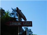
A little further on, we reach a chapel, where paths from Radeče and Breg join from the right; we continue towards Lisca and ascend along the fenced area to the church of sv. Lovrenc, from which we get a nice view.
We bypass the church on the right side and descend along the fenced path by the meadow to the gravel road, which we follow to the right; at the nearby intersection, we turn right again. Further on, we descend along the asphalt road; at the end of the meadow on the left side, we go left onto the marked path that continues along the right edge of the meadow; when the path enters the forest, we follow the markings. A few gentle to moderate ascents through the forest follow; when we leave the forest, a nice view opens up. Here, a short steep descent follows, and lower down, the path forks.
We head left onto the longer path, where the markings continue (the straight path leads across private land); we ascend along the cart track to the gravel road, which we follow to the right.
From the gravel road, we soon go right downhill onto the access road to the nearby house; before approaching the house, we go straight onto the path that ascends the western to southwestern grassy slopes of Njivce hill. Higher up, the path enters the forest, where we traverse the southern wooded slopes without major elevation changes, then from the cart track go right downhill onto a footpath that takes us lower to a meadow, across which we descend transversely. When the path levels out, another traverse through a strip of forest follows, and we reach the asphalt road, which we follow right towards Lisca. Some walking along the asphalt road with occasional views follows; when we return to the forest, we go right from the road towards Lisca, and a little further on, we cross the asphalt road again. Walking through a strip of bushes and low forest follows, then we reach another asphalt road and continue the ascent along it. When the road continuing towards Lisca turns left, we head right onto the cart track, which immediately forks. We choose the left cart track, which leads us past a chapel from 1900 uphill along the slope; when we reach the ridge connecting Zlaški hrib with Lisca higher up, we go left (here, the usual path from Breg to Lisca joins from the right); just one or two minutes further, past another marked junction, we arrive at the church of sv. Jošt.
We continue left from the church towards Lisca, first traversing uphill through the forest to the left, then the path turns right and traverses uphill to the right. A bit further on, a few other paths from the direction of Sevnica join from the right; we continue straight, where a little higher we leave the forest and walk along the lower edge of a larger meadow to Tončkov dom on Lisca, then quickly ascend past Jurčkova koča on Lisca to the scenic summit of Lisca.
Starting point - SE ridge of Veliko Kozje 1:55, SE ridge of Veliko Kozje - Gole junction 0:10, Gole junction - Centrih farm 0:45, Centrih farm - sv. Lovrenc 0:05, sv. Lovrenc - junction below sv. Jošt 1:10, junction below sv. Jošt - sv. Jošt 0:05, sv. Jošt - junction below Lisca 0:15, junction below Lisca - Lisca 0:10.
The description refers to the condition in April 2026, the photos are from May 2025 and April 2026.

Along the route: Gračnica (238m), Križ (601m), Mlinarič (657m), Razpotje na JV grebenu V. Kozja (929m), Razpotje Gole (828m), Razgledišče nad Žirovnico (760m), Petelinji greben (746m), Kozlov hrib (752m), Centrih (697m), Kapelica na Lovrencu (691m),
Sveti Lovrenc (above Okroglice) (722m), Lesa (684m), Rebeze (681m), Na vrhu (669m), Blatnik (725m), Kamrica (729m), Sele Imperl (655m), Most pod Selami (655m), Razpotje pod sv. Joštom (768m),
Sveti Jošt (below Lisca) (787m), Razpotje pod Lisco (887m)
Photos:
 1
1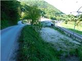 2
2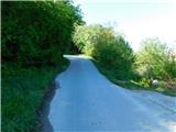 3
3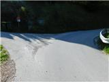 4
4 5
5 6
6 7
7 8
8 9
9 10
10 11
11 12
12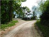 13
13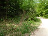 14
14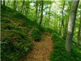 15
15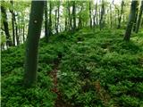 16
16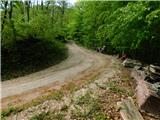 17
17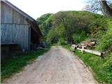 18
18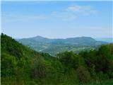 19
19 20
20 21
21 22
22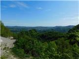 23
23 24
24 25
25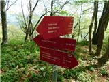 26
26 27
27 28
28 29
29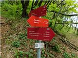 30
30 31
31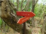 32
32 33
33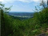 34
34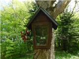 35
35 36
36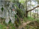 37
37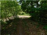 38
38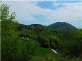 39
39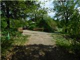 40
40 41
41 42
42 43
43 44
44 45
45 46
46 47
47 48
48 49
49 50
50 51
51 52
52 53
53 54
54 55
55 56
56 57
57 58
58 59
59 60
60 61
61 62
62 63
63 64
64 65
65 66
66 67
67 68
68 69
69 70
70 71
71 72
72 73
73 74
74 75
75 76
76 77
77 78
78 79
79 80
80 81
81 82
82 83
83 84
84 85
85 86
86 87
87 88
88 89
89 90
90 91
91 92
92 93
93 94
94 95
95 96
96 97
97 98
98 99
99 100
100 101
101 102
102 103
103 104
104
Discussion about the trip Gračnica - Lisca (mimo Mlinariča)
To post a comment you must log in:
If you do not yet have a username, you must first
register.