Dolina Gračnice (Blatnik) - Veliko Kozje
Starting point: Dolina Gračnice (Blatnik) (222 m)
| Latitude/Longitude: | 46,10623°N 15,23991°E |
| |
Walking time: 3 h 5 min
Difficulty: easy marked way
Elevation gain: 771 m
Elevation difference along the route: 835 m
Map:
Recommended equipment (summer):
Recommended equipment (winter): ice axe, crampons
Views: 101
 | 1 person like this post |
Access to starting point:
We drive to Rimske Toplice, where we follow the signs for the railway station. From the railway station we drive along the road that leads further towards Gračnica and Jurklošter and soon passes through an underpass to the eastern side of the railway line. At the confluence of Gračnica and Savinje we arrive at a crossroads, where we notice the first hiking direction signs. We continue left in the direction of Lisca and Lovrenc and then drive along the Gračnica valley. Later the path leads us past the NOB memorial park, but we drive a few 100 m further to the crossroads, where we go right across the bridge. Immediately after the bridge we notice red hiking direction signs, where the described path begins.
There are no designated parking spaces for hikers here, but there are some possibilities for parking further up along the road.
Route description:
From the bridge we head onto the side road with signs for Lisce and Lovrenc, which first leads past the Blatnik farmstead where there is a stamp, we continue along the gentle asphalt road leading through the Lokovec settlement, where the path runs through the valley along the Lokavški stream. Further on houses are more frequent along the road and we arrive at a marked intersection by a chapel, where we turn right onto the road following the signs for sv. Lovrenc (left sv. Kolman).
We also continue ascending along the Lokavški stream, walking on the asphalt road to the intersection where a gravel road branches right from the asphalt road.
We continue between both roads on the marked path which enters the forest and turns slightly left, where at junctions we follow the marks. Higher up we briefly step onto a cart track, from it we go steeply uphill on constructed steps. Further on we ascend steeply for some time, then the path levels out somewhat, higher it has a few more junctions where we cross a cart track or follow the marks. At an altitude of approximately 600 m we reach a somewhat wider cart track which a little further leads along the right side of the Dežan farmstead. On this section we get a nice view of the surroundings, the path then ascends transversely left behind the farmstead. As we approach the Centrih farm the path turns sharply right and takes us to a marked junction west of the farm.
Here the path to Lisce and the church of sv. Lovrenc branches left, about five minutes to the latter, we continue right towards Veliko Kozje.
The path ahead leads along a gentle cart track from which on a shorter section looking back we get a view towards Lisce, we do not walk the wider cart track for long as before the nearby small quarry where farmers usually store hay bales we go left onto the hiking path. A short ascent towards Kozlov hrib follows, the path bypasses the highest point of the summit on the left southern side. Some easy descent follows and we arrive at a forest road which we reach at a small intersection. We continue straight on the noticeably worse road which leads past a viewpoint with a bench, later the road first turns into a cart track then into a footpath. A bit further we briefly reach another cart track from which the marks quickly take us onto the marked path leading to the marked junction Gole where the path to Radeče branches left, we continue in the direction of Veliko Kozje.
The path ahead becomes quite steep in places, it levels out on the section where a marked path from the Gračnica settlement joins us from the right.
Here too we follow the signs for Veliko Kozje, we, after about ten minutes of moderate ascent through the forest, reach the highest point of Veliko Kozje where there is an information board for the Church Trail.
Although this is the highest point of the mountain the hiking signs for Veliko Kozje lead along the ridge further where we descend to the next junction where another path from Radeče and the path from Zidani Most join us from the left.
We continue straight along the gentle path which continues along the ever narrower ridge and in a few minutes arrive at a nice viewpoint where there is a logbook box, logbook and stamp.
Starting point - Centrih 1:40, Centrih - Gole 0:50, Gole - Junction on SE ridge of V. Kozje 0:15, Junction on SE ridge of V. Kozje - Veliko Kozje 0:20.
Description and photos refer to the condition in April 2026.

Along the route: Blatnik (224m), Križišče ob kapelici (277m), Dežan (614m), Centrih (697m), Kozlov hrib (752m), Petelinji greben (746m), Razgledišče nad Žirovnico (760m), Razpotje Gole (828m), Razpotje na JV grebenu V. Kozja (929m),
Veliko Kozje (993m), Razpotje na SZ grebenu V. Kozja (973m)
Photos:
 1
1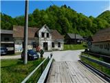 2
2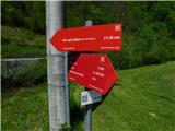 3
3 4
4 5
5 6
6 7
7 8
8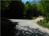 9
9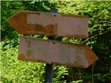 10
10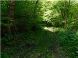 11
11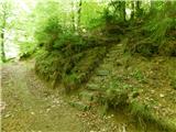 12
12 13
13 14
14 15
15 16
16 17
17 18
18 19
19 20
20 21
21 22
22 23
23 24
24 25
25 26
26 27
27 28
28 29
29 30
30 31
31 32
32 33
33 34
34 35
35 36
36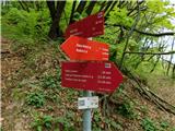 37
37 38
38 39
39 40
40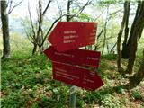 41
41 42
42 43
43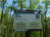 44
44 45
45 46
46 47
47 48
48 49
49 50
50 51
51 52
52
Discussion about the trip Dolina Gračnice (Blatnik) - Veliko Kozje
To post a comment you must log in:
If you do not yet have a username, you must first
register.