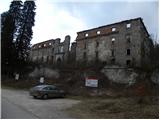
Grad Hošperk - Unška koliševka
Starting point: Grad Hošperk (450 m)
| Latitude/Longitude: | 45,82760°N 14,26460°E |
| |
Walking time: 30 min
Difficulty: easy unmarked way
Elevation gain: 144 m
Elevation difference along the route: 144 m
Map: Snežnik 1:50.000
Recommended equipment (summer):
Recommended equipment (winter): helmet, lamp
Views: 12.422
 | 1 person like this post |
Access to starting point:
From the Ljubljana–Koper motorway, take the Unec exit, then continue driving towards Planina. Further on, drive along a somewhat more winding road, which you follow to the junction situated just before the bridge over the Unica River. Here turn left and then after 100 m park in the parking area by Hošperk Castle, or Haasberg.
Route description:
From the parking lot, we walk to the nearby junction, from there we continue along the road towards Unška koliševka. The road first ascends past a house, then gradually enters the forest through which it moderately ascends. Higher up, the road from Malnov also joins from the right, we continue left and continue ascending through the forest. After a few minutes of further walking, the road almost completely flattens and brings us to a smaller junction, where we continue left. Only a few dozen more meters of walking follow and the road brings us to the information board at the upper edge of Unška koliševka.
From the information board we can descend the steep path to the bottom of the sinkhole, or with the help of a lamp and helmet explore the network of nearby passages.
Photos:
 1
1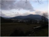 2
2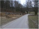 3
3 4
4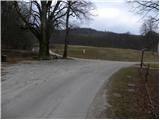 5
5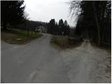 6
6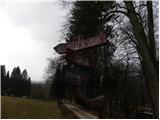 7
7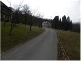 8
8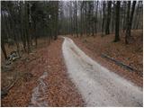 9
9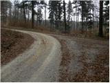 10
10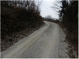 11
11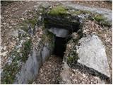 12
12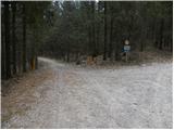 13
13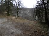 14
14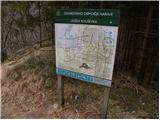 15
15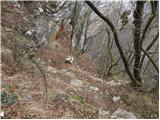 16
16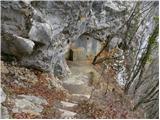 17
17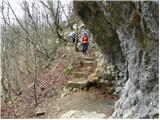 18
18 19
19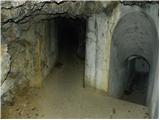 20
20
Discussion about the trip Grad Hošperk - Unška koliševka
|
| laik9. 03. 2013 |
Tomorrow I plan to see Unska Koliševka and Planinska Jama... is that wise given the weather conditions? thanks
|
|
|
To post a comment you must log in:
If you do not yet have a username, you must first
register.