Grad - Stiška vas (Way of the Cross)
Starting point: Grad (430 m)
| Latitude/Longitude: | 46,26528°N 14,49460°E |
| |
Route name: Way of the Cross
Walking time: 45 min
Difficulty: easy marked way
Elevation gain: 295 m
Elevation difference along the route: 295 m
Map:
Recommended equipment (summer):
Recommended equipment (winter):
Views: 1.340
 | 1 person like this post |
Access to starting point:
If we are coming from the highway Ljubljana-Jesenice, we take the Vodice exit, then follow the signs for Cerklje and Krvavec. We continue straight through Cerklje, past the pizzeria Pod Jenkovo lipo on the left side through the village Grad. We drive straight until the road splits towards the bottom station of the cableway (left) and Ambrož pod Krvavcem (right). Here we park at an appropriate place. Because it is a busy road that passes by the settlement leading towards Krvavec and the bottom station of the cableway, there are no designated parking lots. We can leave the car on the right side, before the road starts ascending towards Krvavec, or at an appropriate place that leads towards the bottom station of the cableway.
Route description:
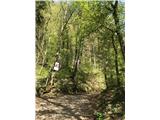
The path starts behind the house, at the junction of two busy roads. Already from the road we notice the first station of the Way of the Cross. The pilgrimage path leads there during the Lenten period. The path immediately starts to ascend, and there is a chapel at the bend. We follow the well-beaten path straight all the time, accompanied by blazes and pictures of the Way of the Cross. On the left, a view opens up back to the villages of Grad and Dvorje. The path continues ascending for some time, but after 20 minutes of ascent it gradually becomes flatter. We arrive at a wider junction (so-called "Skok"), from where we continue straight again, now along a tractor track. The forest slowly thins out, a view opens up to the village, with meadows to the left, in the distance Štefanja gora and on fine days also Triglav, while above the village there is forest and Krvavec. We continue straight towards the bus stop, the road becomes asphalted, then we turn left towards the village. In the center of the village we continue right towards the church, which leads us to a water trough where we can refresh ourselves, while to the left we continue to the church of the Holy Cross. At the church a view opens up on Štefanja gora, with Triglav greeting us in the background.

Photos:
 1
1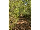 2
2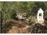 3
3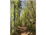 4
4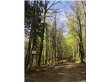 5
5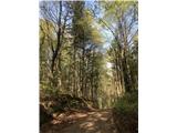 6
6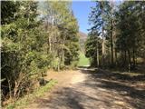 7
7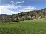 8
8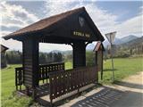 9
9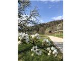 10
10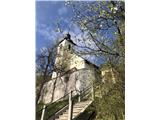 11
11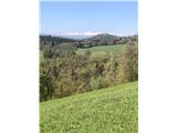 12
12
Discussion about the trip Grad - Stiška vas (Way of the Cross)
To post a comment you must log in:
If you do not yet have a username, you must first
register.