Starting point: Gradišče (460 m)
| Latitude/Longitude: | 46,51510°N 15,09740°E |
| |
Walking time: 3 h 15 min
Difficulty: easy marked way
Elevation gain: 550 m
Elevation difference along the route: 725 m
Map: Pohorje 1:50.000
Recommended equipment (summer):
Recommended equipment (winter): crampons
Views: 431
 | 1 person like this post |
Access to starting point:
We drive to Slovenj Gradec (from here from Velenje, Dravograd or Ravne na Koroškem), then from the roundabout at the Hofer store we take the exit Legen and Kope. Next follows driving through the Legensko naselje settlement, then we leave the road towards Kope and continue straight on a side road in the direction of Gradišče. Further, we drive through the valley of the stream Reka and soon turn left in the direction of the Gradiščar homestead. Next follows some diagonal ascent, where we go past a few houses, and when the road turns sharply right, we continue straight and park on the marked parking lot, which is situated by the crossroads and the sign.
Route description:
From the parking lot we continue on the asphalt road that continues towards the east (at the crossroads where we parked we can also start along the Stations of the Cross, or on an unmarked path that branches off from the road right at the crossroads - all paths join after a few minutes), and after about a minute of walking we join the marked path from Slovenj Gradec. We continue on the road for a short time, then the blazes direct us slightly left onto a footpath that ascends through the forest. Quickly the previously mentioned unmarked path joins us from the left, somewhat higher at the crossing of the macadam road the path along the Stations of the Cross also joins.
Next follows an ascent across a panoramic grassy slope, then after crossing a poor road we enter the forest again. We quickly leave the forest and arrive at another hayfield, along the edge of which we continue to a smaller hamlet where we step onto the road. Here, along the road which we follow for a few meters, we notice a cross and then turn left onto a wide cart track, which we leave after a few meters. The signs direct us right uphill onto a path that leads us through the forest to the next hamlet. Here we step onto the road again, which we follow left. After a few minutes of walking along the road we reach a junction where we continue straight on the lower road that brings us to the next hamlet. Just a few meters before the house the marked path turns left and continues along a cart track. We then follow this path to the next hamlet, after which we walk a few meters along the road. The blazes here direct us again onto a footpath which somewhat higher crosses the road once more. After that the path ascends a bit more steeply for a short time and brings us to a junction where the path from Dravograd joins. Here we continue right and after a short ascent on a partly bare slope we reach the Koča pod Kremžarjevim vrhom hut.
From the hut we continue in the direction of Kremžarjev vrh, Partizanski dom, Grmovškov dom, Vuzenica and Koča Planinc. After a few minutes of walking without major elevation changes we arrive at a chapel, next to which the path forks. Straight ahead the path continues towards Vuzenica and Kremžarjev vrh, but we continue slightly right and cross the southern slopes of Kremžarjev vrh. When we leave the forest a path joins from the left that leads over Kremžarjev vrh, but we continue straight where nice views accompany us on the right side. A bit further the path enters the forest and forks.
Slightly right the path continues towards Šmartno pri Slovenj Gradcu, but we continue slightly left in the direction of Partizanski dom and Grmovškov dom below Velika Kopa. Next follows some descent, lower at the junction we reach a macadam road. We continue straight onto the road, along which the blazes continue. Further we bypass Mačkov vrh on the right side, and after a few minutes of crossing we arrive at Brneško sedlo, where at the cross the path forks again.
The road ahead descends to Vuzenica, to the right a footpath branches off towards Partizanski and Grmovškov dom, but we continue straight onto the footpath that initially runs parallel to the road and along which there are signs for Koča Planinc. The path ahead initially continues without major elevation changes, at a few junctions we follow the blazes. After a while there follows a shorter noticeable descent along the cart track, from the cart track we go lower right onto the marked footpath. Further we cross the slopes to the right, such a path brings us to a marked junction where we join the marked path from Vuzenica.
Here we go right and after a few minutes of further walking we arrive at Koča Planinc.
Gradišče - Koča pod Kremžarjevim vrhom 1:45, Koča pod Kremžarjevim vrhom - Koča Planinc 1:30.

Photos:
 1
1 2
2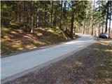 3
3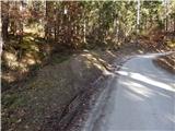 4
4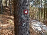 5
5 6
6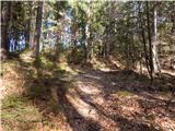 7
7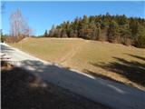 8
8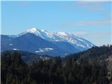 9
9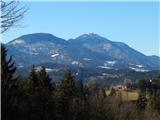 10
10 11
11 12
12 13
13 14
14 15
15 16
16 17
17 18
18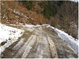 19
19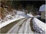 20
20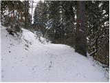 21
21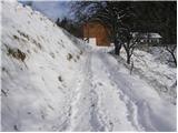 22
22 23
23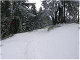 24
24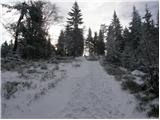 25
25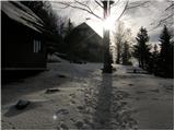 26
26 27
27 28
28 29
29 30
30 31
31 32
32 33
33 34
34 35
35 36
36 37
37 38
38 39
39 40
40 41
41 42
42 43
43 44
44 45
45 46
46 47
47 48
48 49
49 50
50 51
51 52
52 53
53 54
54 55
55 56
56 57
57 58
58 59
59 60
60 61
61 62
62
Discussion about the trip Gradišče - Koča Planinc
To post a comment you must log in:
If you do not yet have a username, you must first
register.