Grahovo ob Bači (Brelih) - Črvov vrh (via Žrelo)
Starting point: Grahovo ob Bači (Brelih) (452 m)
| Latitude/Longitude: | 46,15570°N 13,88080°E |
| |
Route name: via Žrelo
Walking time: 1 h 50 min
Difficulty: easy unmarked way
Elevation gain: 522 m
Elevation difference along the route: 530 m
Map:
Recommended equipment (summer):
Recommended equipment (winter): ice axe, crampons
Views: 908
 | 4 people like this post |
Access to starting point:
We drive into Baška grapa or to the settlement Grahovo ob Bači, where we turn onto a side road in the direction of Zakojce, Bukovega and the railway station. There follows some descent, and after crossing the railway track, we go left towards Bukovo (right: railway station Grahovo) and begin to ascend. There follows an ascent in a few hairpin turns; when we arrive at a crossroads where the road branches off sharply to the right to the nearby and from the road visible homestead Brelih, the described path begins. We park at a suitable place beside the road about 200 meters further ahead in the direction towards Bukovo, or already lower by the road.
We can also reach the starting point on foot from the railway station Grahovo, which takes approximately 30 minutes.
Route description:
From the crossroads near the homestead Brelih we continue along the road towards Bukovo (sharply right: Bukovski vrh and Črvov vrh past the homestead Pušnik) and ascend diagonally. Further on, we bypass a few houses on the right side (some of them are somewhat below the road); when we notice a few houses on the right, we are at the homestead Pšeničnik, where we leave the road and continue slightly right across the yard (or also behind the homestead right onto the cart track). Above the houses we continue on the cart track, which ascends diagonally to the left and first leads us across a panoramic slope before it enters the forest and splits.
We continue on the slightly left, lower cart track, which becomes steeper and less trodden and locally muddy. After a few minutes of steeper ascent we step onto the asphalt road, which we reach at the saddle Žrelo; we continue right towards Ponikve (left: Zakojca and Bukovo) and begin to ascend towards the Šentviška planota plateau. After two hairpin turns we already arrive at the first houses in the settlement Bukovski Vrh; after a smaller sign we leave the asphalt road and continue slightly right onto the steeper macadam road, which soon turns right and takes us to a garage.
At the garage we go left onto the cart track, which soon turns into a pleasant path; this brings us in a gentle ascent back to the asphalt road. We follow the road to the right along it to the marked crossroads, from which we continue right in the direction of Bukov gaj. A little further on we go left again (straight: homestead pri Pircu and Bukovski vrh), then continue in moderate ascent along the macadam road to a smaller saddle, where we go right in the direction of Bukov gaj (straight: Gorski Vrh).
A little after the crossroads we leave the macadam road, as a cairn directs us left onto a nicely trodden path, which after a few minutes returns to the macadam track, which we follow to the left. There follows some walking amid fine views reaching all the way to the Trnovski gozd; after crossing the pasture fence we already notice Bukov gaj on the right, where there is a spring below Črvov vrh.
From Bukov gaj we continue along the lower cart track, which leads towards Črvov vrh. There follows a few minutes of traversing amid fine views, then we ascend on the wide cart track to the panoramic summit.
The description and photos refer to conditions in December 2019 and February 2020.

Along the route: Žrelo (603m), Bukovski Vrh (830m)
Photos:
 1
1 2
2 3
3 4
4 5
5 6
6 7
7 8
8 9
9 10
10 11
11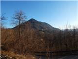 12
12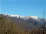 13
13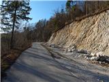 14
14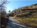 15
15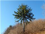 16
16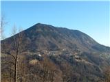 17
17 18
18 19
19 20
20 21
21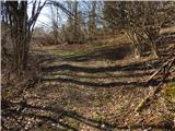 22
22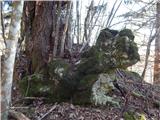 23
23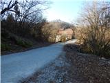 24
24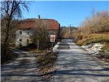 25
25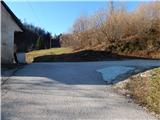 26
26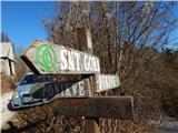 27
27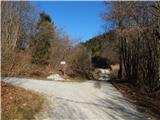 28
28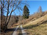 29
29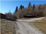 30
30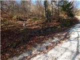 31
31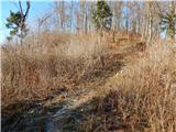 32
32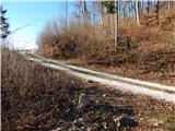 33
33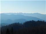 34
34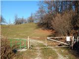 35
35 36
36 37
37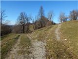 38
38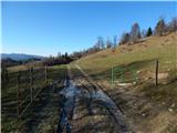 39
39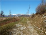 40
40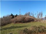 41
41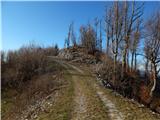 42
42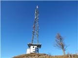 43
43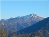 44
44 45
45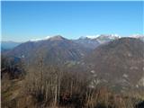 46
46 47
47
Discussion about the trip Grahovo ob Bači (Brelih) - Črvov vrh (via Žrelo)
|
| ločanka20. 02. 2020 |
Nice! You had a beautiful day . .
|
|
|
|
| Lapuh20721. 02. 2020 |
Nice hike. And accessible by train.
|
|
|
To post a comment you must log in:
If you do not yet have a username, you must first
register.