Grahovše - Bela peč (via rot)
Starting point: Grahovše (800 m)
| Latitude/Longitude: | 46,36640°N 14,35180°E |
| |
Route name: via rot
Walking time: 2 h 30 min
Difficulty: easy marked way
Elevation gain: 793 m
Elevation difference along the route: 800 m
Map: Karavanke - osrednji del 1:50.000
Recommended equipment (summer):
Recommended equipment (winter): ice axe, crampons
Views: 12.285
 | 2 people like this post |
Access to starting point:
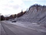
From the highway Ljubljana - Jesenice we go to the exit Ljubelj (Tržič), and then we continue driving towards Ljubelj. Just before the gas station in Bistrica pri Tržiču we leave the main road and continue driving right in the direction of Tržič. Further on, we drive through Tržič in the direction of Dolžanova soteska gorge, and then at the end of the town we continue right in the direction of Lom pod Storžičem and Grahovše. When we get to Grahovše we drive on the road to the nearby quarry, by which there is a marked parking lot.
Route description:
From the parking lot, we continue on the road by which we've parked and already after a few steps we come to two crossroads. In the first crossroad we continue straight (right over a bridge is a village), in the second we come to mountain signposts.
Here we go left on the upper path with signs Javornik, Stegovnik and Bela peč. The road here starts moderately ascending and in places takes us across panoramic meadows. The road then brings us to the next crossroad, where we go left again (right farm Rekar).
The road then crosses private land, where there is wood, and soon after that it comes to the next junction. Here we continue on the right road in the direction of the mountain pasture Javornik. The road from here ahead for some time runs almost horizontally, but then starts ascending again and brings us to a smaller hamlet. Here we continue ahead on the road, which slowly turns to the left. Soon after that the road makes a right turn and brings us to a signpost, where the path to Bela peč branches off to the left.
Here we continue ahead on the road and follow it to the spot where it starts descending.
Right here at the top of the road a second path to Bela peč branches off to the left (the turn-off is marked). We head onto the path that goes sharply left (straight cottage Pr Zdravc 2 minutes). The path initially ascends gently along the edge of a steep slope on the gentler side. The path then moves onto steeper slopes, which it crosses in a gentle ascent and brings us to the spot where it crosses a very steep slope. This spot is short and in the dry does not pose a greater danger. Caution is needed in wet conditions, snow and ice. Immediately after that the terrain flattens and the path crosses a fence. Soon after that the path brings us to a junction, where we go left towards the summit of the vantage point Bela peč. From there we have only 50 m of easy walking.

Photos:
 1
1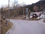 2
2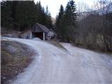 3
3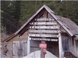 4
4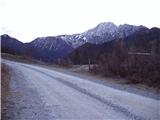 5
5 6
6 7
7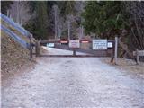 8
8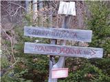 9
9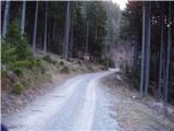 10
10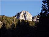 11
11 12
12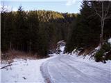 13
13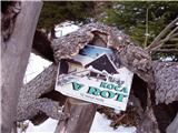 14
14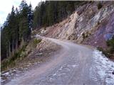 15
15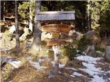 16
16 17
17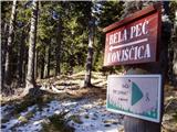 18
18 19
19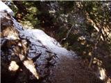 20
20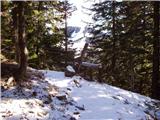 21
21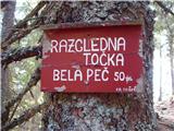 22
22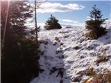 23
23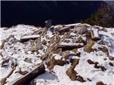 24
24 25
25
Discussion about the trip Grahovše - Bela peč (via rot)
To post a comment you must log in:
If you do not yet have a username, you must first
register.