Grahovše - Planina Spodnja Konjščica (past Pavšlna)
Starting point: Grahovše (800 m)
| Latitude/Longitude: | 46,36640°N 14,35180°E |
| |
Route name: past Pavšlna
Walking time: 1 h 45 min
Difficulty: easy marked way
Elevation gain: 651 m
Elevation difference along the route: 651 m
Map: Karavanke - osrednji del 1:50.000
Recommended equipment (summer):
Recommended equipment (winter):
Views: 10.957
 | 2 people like this post |
Access to starting point:
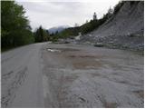
From the highway Ljubljana - Jesenice we take the exit Ljubelj (Tržič), then just before the gas station at Bistrica pri Tržiču, we turn right into Tržič. Further we drive through Tržič in the direction of Dolžanove soteske, then only a little before the end of the town we continue right upward in the direction of the villages Čadovlje, Lom and Grahovše. On the ascending road at the crossroads we follow the signs for the mountain hut Dom pod Storžičem and follow it to the large marked parking lot by the quarry in Grahovše.
Route description:
From the parking lot, we continue ahead on the road by which we parked and already after a few steps we come to two crossroads. In the first crossroads we continue straight (right over a bridge is a village), in the second we come to mountain signposts. Here we go left on the upper path with signs Javornik, Stegovnik and Bela peč.
The road here starts moderately ascending and in parts runs over panoramic meadows. The road then brings us to the next crossroads, where we go again left (right farm Rekar). The road then crosses private land, where there is wood and soon after that, it comes to the next junction. We go on the left road and we follow it to the spot, where the marked path to the mountain pasture Spodnja Konjščica branches off to the right.
The path ahead goes into the forest, steeply ascends and after good 20 minutes of additional walking brings us on the road. When we step on the road, marked path to a viewpoint "na Boštu" (5 minutes) branches off to the left, and we continue right on the road which after a short ascent brings us out of the forest on an ample mountain pasture Spodnja Konjščica, on which there are two smaller shepherd huts.

Photos:
 1
1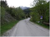 2
2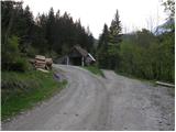 3
3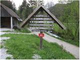 4
4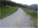 5
5 6
6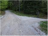 7
7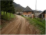 8
8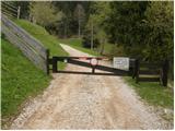 9
9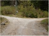 10
10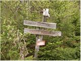 11
11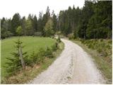 12
12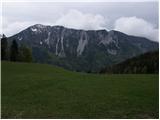 13
13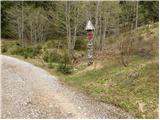 14
14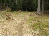 15
15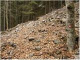 16
16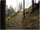 17
17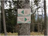 18
18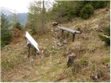 19
19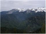 20
20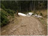 21
21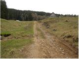 22
22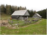 23
23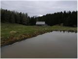 24
24
Discussion about the trip Grahovše - Planina Spodnja Konjščica (past Pavšlna)
|
| Gost30. 04. 2007 |
Such a walk mostly along the road isn't particularly attractive to me. To Konjščica I prefer going from another direction - I drive quite high to the Tič farm in Potarje, then walk on beautiful pastures and forests to Spodnja, Zgornja Konjščica and Bela peč. Recommended!
|
|
|
|
| velkavrh31. 08. 2013 |
I was here years ago, when my brother was still herding here with a colleague. I drove under the mountain pasture by car, because I brought him supplies. Now they say a famous Kranj amateur painter-Valenčič herds there. We have his picture. At that time I went further to Bela peči, where there is a logbook box. Here is that famous climbing wall of the Tržič alpinists.
|
|
|
|
| kurirček31. 08. 2013 |
Nice loop is from Grahovše to Konšica, Bela Peči, Planina Javornik, Ženiklovec and Dom pod Storžičem then back via hayfields to Grahovše.
|
|
|
To post a comment you must log in:
If you do not yet have a username, you must first
register.