Gravon di Gleris - Monte Chiavals
Starting point: Gravon di Gleris (1100 m)
Time of walking: 3 h
Difficulty: difficult marked way
Difficulty of skiing: no data
Altitude difference: 998 m
Altitude difference (by path): 1160 m
Map: Tabacco št. 018
Access to starting point:
From Ljubljana past Jesenice, Kranjska Gora and of Rateče we drive to Trbiž. We continue through the valley Kanalska dolina on the main road to Tablja (Pontebba); we can use also short section of highway. In Tablja (Pontebba) we turn towards the Aupa Valley (Val Aupa). Signs: Val Aupa, Studena alta. After ten minutes of driving between hamlets Frattis and Aupa we turn left into a valley of the stream Gravon di Gleris, where we for the first time see group Crete di Gleris. We continue through the valley on an asphalt road to altitude 1100 meters, where on the left side before the gate there is a parking lot.
Path description:
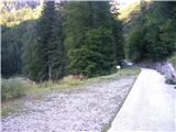
From the parking lot, we walk approximately 100 altitude meters on a concrete road, until on the right side we notice signs for the path towards the notch Škrbina Pecora (Forcella della Pecora; number of the path 430). Here is the end of easy warming up because the path steeply ascends through the forest. The footpath doesn't shows signs of a massive visit so it is narrow and in parts overgrown, but in spite of that easy to follow. At the altitude approximately 1500 meters we come to a crossing where we have two variants of ascent. The right path goes over notch Vacca (Forcella della Vacca); and straight uphill over notch Pecora (Forcella della Pecora). First one has less unpleasant gravel and it is appropriate for both ascent and descent, while second is for a descent a little unpleasant and requires more concentration; none of them for experienced mountaineer doesn't represent bigger problem. Both variant bring us on a ridge, where we join the beautiful high path (a sign 425; Alta Via C.A. I Moggio) on which we continue left. If we chose for the ascent right variant over notch Vacca, we will lose approximately 70 meters of height difference, but never mind; path is beautiful. In the distance we already see small saddle on the western ridge of Chiavals, which seems after strenuous ascent far, but we reach it surprisingly quickly. There signs lead steep left towards the summit. Among numerous edelweisses in 15 minutes we ascend to the summit.
Pictures:
 1
1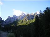 2
2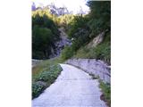 3
3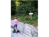 4
4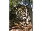 5
5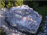 6
6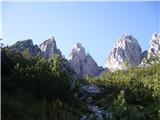 7
7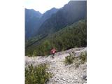 8
8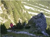 9
9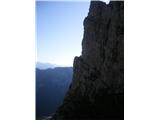 10
10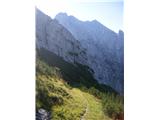 11
11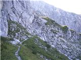 12
12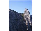 13
13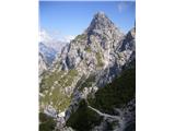 14
14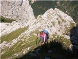 15
15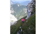 16
16 17
17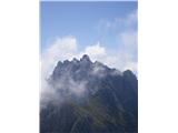 18
18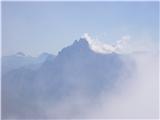 19
19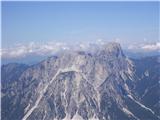 20
20