Grgar - Sveta Gora (via Frančiškov hrib)
Starting point: Grgar (286 m)
| Latitude/Longitude: | 45,99900°N 13,67410°E |
| |
Route name: via Frančiškov hrib
Walking time: 1 h 25 min
Difficulty: easy marked way
Elevation gain: 395 m
Elevation difference along the route: 400 m
Map: Goriška - izletniška karta 1:50.000
Recommended equipment (summer):
Recommended equipment (winter):
Views: 7.466
 | 1 person like this post |
Access to starting point:
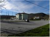
A) We drive to Nova Gorica, then continue driving towards Tolmin and Kobarid. We follow the main road towards Tolmin only to Solkan, where at the traffic-light intersection we continue right in the direction of Sveta Gora and Grgar. The ascending road further leads past the Solkan quarry, then a little higher it turns sharply to the right and brings us to the Skalnica inn, behind which we first reach an intersection where a steep road towards Sveta Gora branches off to the left, and only a little further to another intersection where the road towards Grgar, Čepovan and Banjšice branches off to the left (straight to Trnovo and Lokve). After a short descent we arrive in Grgar, where at the intersection by the NOB monument we continue straight to the nearby sports ground next to the elementary school, next to which we park on the large parking lot.
B) From Tolmin or Most na Soči we drive on the main road towards Nova Gorica, then only a little before Nova Gorica, more precisely at the traffic-light intersection in Solkan, we turn left in the direction of Sveta Gora and Grgar. The ascending road further leads past the Solkan quarry, then a little higher it turns sharply to the right and brings us to the Skalnica inn, behind which we first reach an intersection where a steep road towards Sveta Gora branches off to the left, and only a little further to another intersection where the road towards Grgar, Čepovan and Banjšice branches off to the left (straight to Trnovo and Lokve). After a short descent we arrive in Grgar, where at the intersection by the NOB monument we continue straight to the nearby sports ground next to the elementary school, next to which we park on the large parking lot.
C) From Goriška Brda we drive to Solkan, where at the first intersection after the new Solkan bridge we continue straight in the direction of Sveta Gora. The ascending road further leads past the Solkan quarry, then a little higher it turns sharply to the right and brings us to the Skalnica inn, behind which we first reach an intersection where a steep road towards Sveta Gora branches off to the left, and only a little further to another intersection where the road towards Grgar, Čepovan and Banjšice branches off to the left (straight to Trnovo and Lokve). After a short descent we arrive in Grgar, where at the intersection by the NOB monument we continue straight to the nearby sports ground next to the elementary school, next to which we park on the large parking lot.
Route description:
From the parking lot, we return to the NOB monument, from there we continue on the left road (viewed from the direction of access to the starting point, if we came from the direction of Nova Gorica), to which a "shortcut" soon joins from the right (from the parking lot we do not need to go to the monument, as a shorter road leads here, starting a little before the parking lot and continuing towards the west). For a short time we walk on the sidewalk, then at the place where the main road turns right we continue straight onto the narrower asphalt road. We walk good 50 meters along the mentioned road, then the signs for Sveta Gora direct us left onto another road, where we first pass the "last" house, then the road continues across the meadow. We walk along the asphalt to the marker for gas pipeline No. 443, from where we continue on the left road in the direction of Sveta Gora. Just a few steps further, a marked path to Sveta Gora via Križce branches off to the left from the macadam road, while we continue straight in the direction of Sveta Gora "in the middle" (the road we leave continues to the nearby house - it is also possible to continue along the road to the isolated house).
The path ahead leads us across a small meadow, then brings us to a wooden footbridge over the Slatnik stream, where it splits again.
We continue over the footbridge (if crossing the footbridge seems too dangerous, we can continue along the stream and cross it a little further on the rocks) on the path which on the other side enters the forest and turns slightly to the right. After a few dozen steps, a bypass path also joins us from the right, while we continue on the gradually steeper path, which higher up ascends in numerous switchbacks. For some time we ascend moderately to steeply, then we arrive at a marked junction, where we continue left (right: Sveta Gora - direct path) on a somewhat narrower trail in the direction of Sveta Gora via Frančiškov hrib. The path ahead ascends slightly to the left and brings us to the place where we join the path from Skalnica (path through ditches).
Here we continue slightly right and continue the ascent on the path that ascends transversely through the forest. Further on, the path leads us past a few smaller caverns, then temporarily ascends somewhat more steeply and brings us to Frančiškov hrib, from which a nice view opens up.
From Frančiškov hrib we continue along the wide ridge path, along which in good 5 minutes of further walking we arrive at the cemetery and a few dozen meters further to the summit of Sveta Gora.

The trip can be extended to the following destinations: Vodice
Photos:
 1
1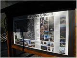 2
2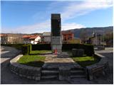 3
3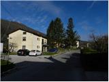 4
4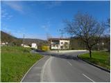 5
5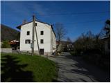 6
6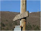 7
7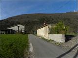 8
8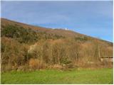 9
9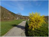 10
10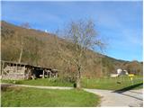 11
11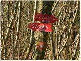 12
12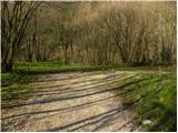 13
13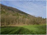 14
14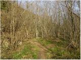 15
15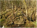 16
16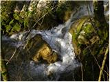 17
17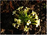 18
18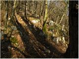 19
19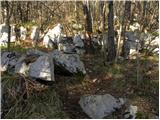 20
20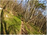 21
21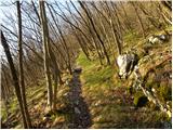 22
22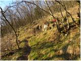 23
23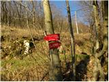 24
24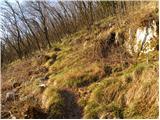 25
25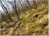 26
26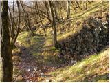 27
27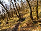 28
28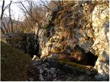 29
29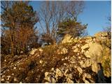 30
30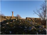 31
31 32
32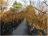 33
33 34
34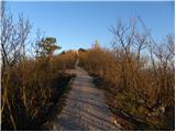 35
35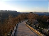 36
36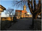 37
37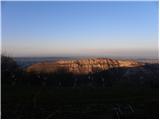 38
38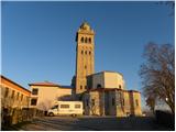 39
39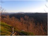 40
40
Discussion about the trip Grgar - Sveta Gora (via Frančiškov hrib)
|
| valerija11222. 02. 2014 |
Hello! If anyone browsing this forum knows the current conditions on this path, I'd appreciate an answer. I'm wondering if glaze ice has also caused damage in these parts. Thank you.
|
|
|
|
| alex.bensa22. 02. 2014 |
No worries... There hasn't been winter here yet this year... You'll probably just get mud, since it's been raining all day...
|
|
|
|
| valerija11222. 02. 2014 |
alex, thank you very much. Tomorrow there'll be sun, so everything will be nicer.
|
|
|
|
| jax22. 02. 2014 |
I haven't been on this one, but I have on the one from Solkan through the hole (which joins this one below Frančiškov hrib). Nothing special.
|
|
|
|
| valerija11223. 02. 2014 |
Today we walked the path Solkan-Sveta Gora-Grgar (down from the top along the path described above)-Solkan. Weather in the Goriška region was fairy-tale like, views superb. It needs to be repeated to escape winter in the Idrija area for a short time.
|
|
|
To post a comment you must log in:
If you do not yet have a username, you must first
register.