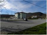
Starting point: Grgar (286 m)
| Latitude/Longitude: | 45,99900°N 13,67410°E |
| |
Route name: by road
Walking time: 1 h 15 min
Difficulty: easy unmarked way
Elevation gain: 365 m
Elevation difference along the route: 375 m
Map: Goriška - izletniška karta 1:50.000
Recommended equipment (summer):
Recommended equipment (winter):
Views: 945
 | 1 person like this post |
Access to starting point:
A) We drive to Nova Gorica, then continue driving towards Tolmin and Kobarid. We follow the main road towards Tolmin only to Solkan, where at the traffic-light intersection we continue right in the direction of Sveta Gora and Grgar. The ascending road further leads past the Solkan quarry, then a little higher it turns sharply to the right and brings us to the inn Skalnica, behind which we first arrive at a crossroads, where a steep road towards Sveta Gora branches off to the left, only a little further to another crossroads, where the road continues slightly to the left towards Grgar, Čepovan and Banjšice (slightly right Trnovo and Lokve). After a short descent we arrive in Grgar, where at the crossroads by the NOB monument we continue straight to the nearby sports field by the primary school, next to which we park on the large parking lot.
B) From Tolmin or Most na Soči we drive on the main road towards Nova Gorica, then only a little before Nova Gorica, precisely at the traffic-light intersection in Solkan we turn left in the direction of Sveta Gora and Grgar. The ascending road further leads past the Solkan quarry, then a little higher it turns sharply to the right and brings us to the inn Skalnica, behind which we first arrive at a crossroads, where a steep road towards Sveta Gora branches off to the left, only a little further to another crossroads, where the road continues slightly to the left towards Grgar, Čepovan and Banjšice (slightly right Trnovo and Lokve). After a short descent we arrive in Grgar, where at the crossroads by the NOB monument we continue straight to the nearby sports field by the primary school, next to which we park on the large parking lot.
C) From Goriška Brda we drive to Solkan, where at the first crossroads after the new Solkan bridge we continue straight in the direction of Sveta Gora. The ascending road further leads past the Solkan quarry, then a little higher it turns sharply to the right and brings us to the inn Skalnica, behind which we first arrive at a crossroads, where a steep road towards Sveta Gora branches off to the left, only a little further to another crossroads, where the road continues slightly to the left towards Grgar, Čepovan and Banjšice (slightly right Trnovo and Lokve). After a short descent we arrive in Grgar, where at the crossroads by the NOB monument we continue straight to the nearby sports field by the primary school, next to which we park on the large parking lot.
Route description:
From the parking lot, we return to the NOB monument, from there we continue on the left road (viewed from the direction of access to the starting point, if we came from the direction of Nova Gorica), to which a "shortcut" soon joins from the right (from the parking lot we do not need to go to the monument, as a shorter road leads here that starts a little before the parking lot and continues towards the west). For a short time we walk on the sidewalk, then at the place where the main road turns right we continue straight onto the narrower asphalt road. We walk good 50 meters on the mentioned road, then we notice signs for Sveta Gora that direct to the left road, but we continue straight on the road that continues through the settlement. While walking through the settlement we quickly arrive at the birth house of Uršula Ferligoj (to Uršula the heavenly Queen appeared in 1539). A little further the houses in Grgar end, and at the smaller crossroads we continue on the left road in the direction of Slatna and Sveta Gora. At the next crossroads, by the water intake we again continue left in the direction of Sveta Gora (right Slatna), and we continue further on the macadam road, which a little further temporarily gently descends, then crosses the Slatna stream. On the other side of the stream the road begins to ascend more steeply, along it after the left bend we arrive at the crossroads on the saddle Preški vrh.
On the saddle there is a junction of several paths, we continue right on the poorer ascending road in the direction of Vodice, which however we leave after just a few 10 steps, as the markers lead us left onto the marked footpath. The path ahead returns to the low forest, then continues in a moderate ascent. Further the path leads us past several ditches and a few caverns from the time of the First World War, then temporarily ascends somewhat more steeply. The steepness very quickly eases and a relatively gentle path brings us from the forest to an overgrown meadow, from which we already see the summit of Vodice, on which stands the mausoleum of General Gonzaga and which we reach after a few 10 steps of further walking.

Along the route: Preški vrh (503m)
The trip can be extended to the following destinations: Sveta Gora
Photos:
 1
1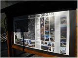 2
2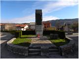 3
3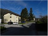 4
4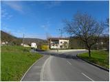 5
5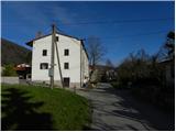 6
6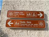 7
7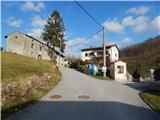 8
8 9
9 10
10 11
11 12
12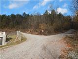 13
13 14
14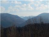 15
15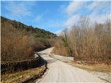 16
16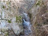 17
17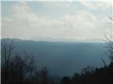 18
18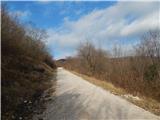 19
19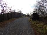 20
20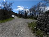 21
21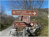 22
22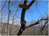 23
23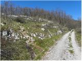 24
24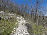 25
25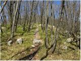 26
26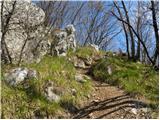 27
27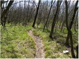 28
28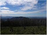 29
29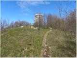 30
30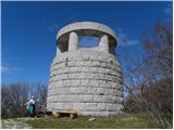 31
31 32
32
Discussion about the trip Grgar - Vodice (by road)
|
| mirank29. 02. 2016 |
Perhaps some construction enthusiast will be interested in the bridge of modest span (barely more than 6m arch) on pic 16. The left part-section was before expansion, it is truly a masterpiece of dry-stacked stones and so was the railing.
|
|
|
|
| mirank29. 02. 2016 |
Yes, but that's not a picture of this bridge before the intervention 15 years ago, but the arch is built in the same way
|
|
|
To post a comment you must log in:
If you do not yet have a username, you must first
register.