Griže - Kamnik (via Zahom)
Starting point: Griže (291 m)
| Latitude/Longitude: | 46,23068°N 15,15402°E |
| |
Route name: via Zahom
Walking time: 2 h 30 min
Difficulty: partly demanding marked way
Elevation gain: 570 m
Elevation difference along the route: 585 m
Map:
Recommended equipment (summer):
Recommended equipment (winter): ice axe, crampons
Views: 2.200
 | 1 person like this post |
Access to starting point:
We leave the Štajerska highway at the exit Žalec, and then we follow the signs for Žalec. Through Žalec we follow the signs for Griže, which we reach soon after the bridge over the river Savinja. In Griže we go right in the direction of the cemetery, and we park at the parking lot opposite the parish church of St. Pankracij.
Route description:
From the parking lot opposite the church we continue on the asphalt road upwards, at the nearby crossroad we go right in the direction of Hom and Šešč pri Preboldu. The path ahead leads us past two chapels, and then the road descends to a crossroad near the inn Gostišče pri Zibiki.
Here we go slightly left in the direction of Dom na Homu and tourist farm Kotar (straight - direct path to Hom and Hom via Lajnarjev hrib).
The path ahead again starts slightly ascending, and at first leads us past a few more houses. Griže soon ends, and the path along which we notice a few rare blazes temporarily leads through the forest. Higher, we arrive at a crossroad, where a road branches off to the right towards the tourist farm Kotar, and we continue on the main road, which continues moderately ascending.
Further on, at a few crossroads we follow the main road, then two short hairpin turns follow. A little further, the path from Zabukovica joins from the left, and from the settlement Pongrac we arrive at the settlement Matke (hamlet Zahom). Here we soon arrive at the smaller saddle between Kamnik on the left and Hom on the right.
We continue straight towards Matke (right - Hom), and after a short descent we arrive at a smaller hamlet, where there is a crossroad of several roads.
We continue straight on the side road, which ascends past a few houses. Behind the last house we arrive at a marked junction, where the path splits.
We continue on the slightly left cart track in the direction of Kamnik (slightly right - Matke and Golava), along which we ascend gently, and from it we soon go left onto the marked footpath, which past the water catchment passes into the forest. The moderately steep path, which leads us through the forest, after a few minutes of further walking brings us to the climbing area, which is located a few steps from the path. After the climbing area, the path becomes considerably steeper and higher brings us to the northwestern ridge of Kamnik, along which we continue the steep ascent. The steep path, which in several sections, especially when wet, is dangerous for slipping, then with occasional views of the surrounding hills brings us to the summit of Kamnik, where there is a smaller bivouac.

Along the route: Pongrac (319m), Matke (Zahom) (387m)
Photos:
 1
1 2
2 3
3 4
4 5
5 6
6 7
7 8
8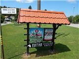 9
9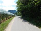 10
10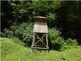 11
11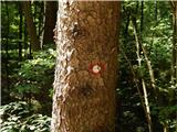 12
12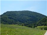 13
13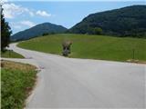 14
14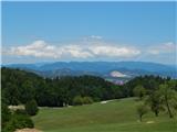 15
15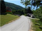 16
16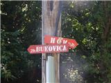 17
17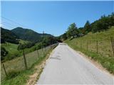 18
18 19
19 20
20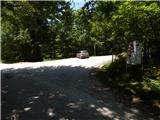 21
21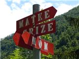 22
22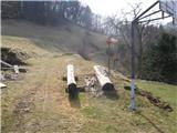 23
23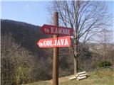 24
24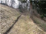 25
25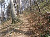 26
26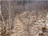 27
27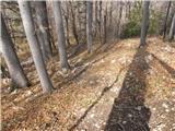 28
28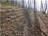 29
29 30
30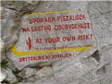 31
31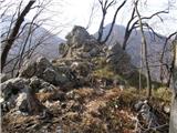 32
32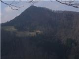 33
33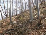 34
34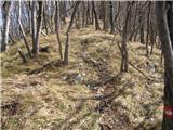 35
35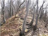 36
36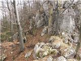 37
37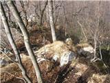 38
38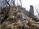 39
39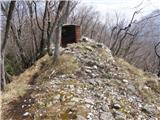 40
40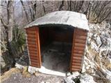 41
41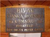 42
42 43
43
Discussion about the trip Griže - Kamnik (via Zahom)
To post a comment you must log in:
If you do not yet have a username, you must first
register.