Starting point: Gyulakeszi (150 m)
| Latitude/Longitude: | 46,87042°N 17,49092°E |
| |
Walking time: 35 min
Difficulty: easy marked way
Elevation gain: 226 m
Elevation difference along the route: 228 m
Map:
Recommended equipment (summer):
Recommended equipment (winter):
Views: 213
 | 1 person like this post |
Access to starting point:
Leave the Pomurska motorway at the Dolga vas exit, then continue driving towards Hungary. The route leads through the settlement of Redics, then follow the signs to the city of Zalaegerszeg, from there in the direction of Lake Balaton / Balaton, Heviz and Keszthely. When we reach Keszthely, turn onto the bypass and then follow the signs to Balatonfüred (roundabouts are located along the bypass). When the road to Sopron branches off at the end of Keszthely, we continue east, but only 2 km, then turn right towards the village of Badacsonytördemic. Continue through the village (the road in the middle of the village is cobblestoned). Drive further through the village of Nemesgulacs and reach the village of Gyulakeszi.
In the village, drive onto Jokai ut street (right behind the church) and continue. There will no longer be asphalt, and we reach the fenced parking lot at the foot of the volcano, where we leave the vehicle.
A slightly shorter route is Lendava - Pince - Tornyszentmiklos - Nagykanizsa - Balatonszentgyörgy exit - Keszthely, but it is considerably more difficult orientationally.
Route description:
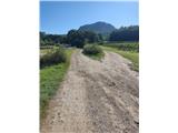
From the parking lot, proceed northeast. Orientation is easy because the volcano is in front of us. Continue along the parking lot fence and then straight at the junction, where the marker helps us.
The path begins to ascend first on dirt, then on asphalt. The path leads past several junctions that are well marked with signs for Vár (castle).
The asphalt then ends, and we continue among numerous vineyards.
When we reach the abandoned house, our path turns sharply right and enters the forest. Along the way, we cross two short clearings, and the path remains mostly gentle.
Higher up, we reach the next junction, where we turn sharply right again (here a path from the settlement Tapolca-Diszel joins us from the left).
After the junction, the path becomes steeper, and higher up we leave the forest and are rewarded with an exceptional view to the south and west.
The path ahead leads us to a left bend secured with concrete steps. A short flat section follows, then a rockier ascent and another sharp right bend, after which we arrive at the upper part of the mountain. A few minutes further, we reach the next junction, where another path from the settlement Tapolca Diszel joins us. Just a few steps further, we are at the ruins of the old castle.
Despite the opinion of many, the old castle is not the highest point of the volcano, but it is in the bushes and cannot be reached.
Despite its modest elevation, Csobánc is an exceptional viewpoint on nearby volcanoes and over Lake Balaton. To the west, on a clear day, the view extends all the way to the Alps.

Photos:
 1
1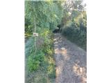 2
2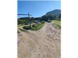 3
3 4
4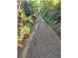 5
5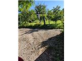 6
6 7
7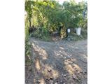 8
8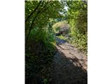 9
9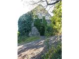 10
10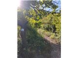 11
11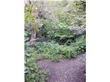 12
12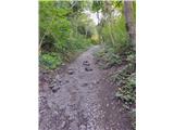 13
13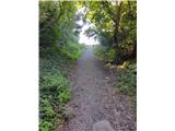 14
14 15
15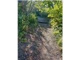 16
16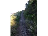 17
17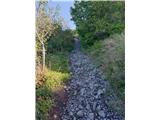 18
18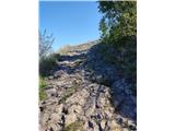 19
19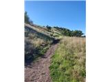 20
20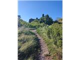 21
21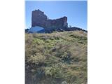 22
22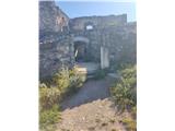 23
23 24
24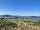 25
25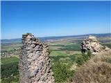 26
26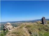 27
27
Discussion about the trip Gyulakeszi - Csobánc
To post a comment you must log in:
If you do not yet have a username, you must first
register.