Imov / Haimach - Aussicht Petelinz
Starting point: Imov / Haimach (575 m)
| Latitude/Longitude: | 46,55300°N 14,31610°E |
| |
Walking time: 15 min
Difficulty: easy marked way
Elevation gain: 29 m
Elevation difference along the route: 35 m
Map: Karavanke - osrednji del 1:50.000
Recommended equipment (summer):
Recommended equipment (winter): crampons
Views: 1.070
 | 2 people like this post |
Access to starting point:
From the highway Ljubljana - Jesenice, we take the exit Ljubelj (Tržič), and then continue driving in the direction of Celovec / Klagenfurt. After the bridge over the river Drava / Drau, the road starts ascending more steeply, while we drive on the main road towards Celovec / Klagenfurt for only a few more kilometers, then turn right in the direction of Žihpolje / Maria Rain. Further on, we drive along Göltschacher Straße, which first leads through the settlement Žihpolje / Maria Rain. The mentioned settlement quickly ends, and the road brings us to the next village Št. Urh / St. Ulrich. After the mentioned village, the road descends a little and temporarily leads us through a strip of forest. When the forest ends, we drive past a few more houses, and then arrive at a smaller crossroads, where a somewhat narrower road branches off to the right. At the crossroads, our path begins, but since there are no arranged parking spaces here, we must park at a suitable spot nearby.
Route description:
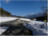
From the crossroads, we continue on the initially still asphalted road, which descends a little. The asphalt quickly ends, and a quite panoramic road leads us across panoramic meadows or fields. A little before the end of the road, we arrive at the "private" sign, where the markers lead us right into the forest. Through the forest, we ascend gently to moderately, and we follow the mentioned path all the way to the Petelinz viewpoint, from where a beautiful view opens up towards the Drava River, Borovlje and the Karawanks.
Photos:
 1
1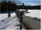 2
2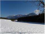 3
3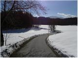 4
4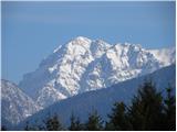 5
5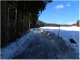 6
6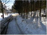 7
7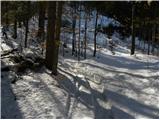 8
8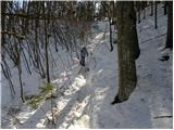 9
9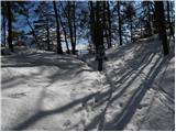 10
10 11
11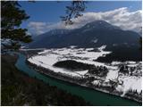 12
12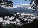 13
13
Discussion about the trip Imov / Haimach - Aussicht Petelinz
To post a comment you must log in:
If you do not yet have a username, you must first
register.