Hegyesd (vas) - Hegyesd (northern path)
Starting point: Hegyesd (vas) (160 m)
| Latitude/Longitude: | 46,91618°N 17,52054°E |
| |
Route name: northern path
Walking time: 20 min
Difficulty: partly demanding marked way
Elevation gain: 121 m
Elevation difference along the route: 121 m
Map:
Recommended equipment (summer):
Recommended equipment (winter): crampons
Views: 165
 | 1 person like this post |
Access to starting point:
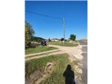
From the Mura motorway, we take the Dolga vas exit, then continue driving towards Hungary. The route then takes us through the town of Redics, after which we follow the signs for the city of Zalaegerszeg, from there we continue driving towards Blatno Lake / Balaton, Heviz and Keszthely. When we arrive in Keszthely, we turn onto the bypass and then follow the signs for Balatonfuered (there are roundabouts along the bypass). When the road to Sopron branches off at the end of Keszthely, we continue east, but only for 2 km, then turn right towards the village of Badacsonytördemic. We continue through the village (the road in the middle of the village is cobblestoned) and drive to the settlement of Tapolca. In Tapolca, we head for Veszprém and drive another five minutes until we see the left turn-off to the settlement of Hegyesd. In the village, we park in a suitable place.
A slightly shorter route is Lendava - Pince - Tornyszentmiklos - Nagykanizsa - Budimpešta / Budapest - Tapolca - Hegyesd, but it is much more difficult orientation-wise.
Route description:
From the place where we parked, we walk to the northern edge of the settlement Hegyesd. Here we notice signs for Petöfi ut street and a direction sign for Vár, which directs us left onto the path across the meadow. Orientation is easy because the summit is in front of us.
Behind the field is the entrance to the forest and the first junction, where the signs direct us left towards Várhegy and Tanosveny. Soon we arrive at the next junction, where we go right towards Várrom (left path Tanosveny, which bypasses the volcano at the base).
Further on, the path begins to ascend quite steeply and in a few minutes we reach the steps. When the path becomes even steeper, the railing also helps us. Such a steep path quickly brings us to the top.
The path is routed so that it does not go to the very summit. The path to the summit is technically demanding. Experienced hikers will cross the shorter difficult section without using hands, but it is faster with the use of hands.
The summit offers an exceptional view. To the north we see the place Hegyesd with the lake, to the west the settlement Tapolca and the hills behind it, to the south extinct volcanoes and Blatno Lake.

Photos:
 1
1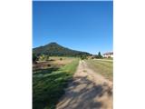 2
2 3
3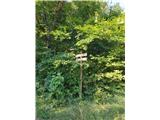 4
4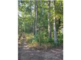 5
5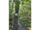 6
6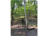 7
7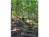 8
8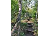 9
9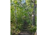 10
10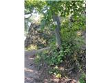 11
11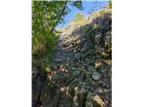 12
12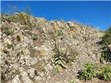 13
13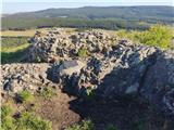 14
14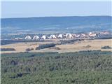 15
15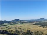 16
16
Discussion about the trip Hegyesd (vas) - Hegyesd (northern path)
To post a comment you must log in:
If you do not yet have a username, you must first
register.