Hegyesd (vas) - Hegyesd (southern path)
Starting point: Hegyesd (vas) (160 m)
| Latitude/Longitude: | 46,91618°N 17,52054°E |
| |
Route name: southern path
Walking time: 40 min
Difficulty: partly demanding marked way
Elevation gain: 121 m
Elevation difference along the route: 125 m
Map:
Recommended equipment (summer):
Recommended equipment (winter): crampons
Views: 110
 | 1 person like this post |
Access to starting point:
From the Mura motorway, we take the Dolga vas exit, then continue driving towards Hungary. The route then takes us through the town of Redics, then we follow the signs for the city of Zalaegerszeg, from there we continue driving towards Lake Balaton / Balaton, Heviz and Keszthely. When we arrive in Keszthely, we turn onto the bypass and then follow the signs for Balatonfuered (there are roundabouts along the bypass). When the road to Sopron branches off at the end of Keszthely, we continue east, but only for 2 km, then turn right towards the village of Badacsonytördemic. We continue through the village (the road in the middle of the village is cobblestoned) and drive to the settlement of Tapolca. In Tapolca, we head for Veszprém and drive another five minutes until we see the left turn-off to the settlement of Hegyesd. In the village, we park in a suitable place.
A somewhat shorter route is Lendava - Pince - Tornyszentmiklos - Nagykanizsa - Budapest - Tapolca - Hegyesd, but it is orientationally much more difficult.
Route description:
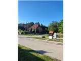
From the place where we parked, we first walk to the intersection by the fountain and telephone booth, from there we continue the path south. We quickly leave the settlement behind and arrive at pastures, where the markers assist us. When we reach a small saddle higher up, we briefly descend slightly from it, then the path enters the forest.
At the entrance to the forest there is an arranged rest area, the path then makes a larger bend to the right, then we arrive at a junction. Here we go left following the signs for Várrom (right path along the base of the volcano). The path ahead rises gently and takes us past two benches to the stairs.
Here the path becomes quite steep and in a few switchbacks brings us to the castle ruins. When we reach yet another bench, the steep section ends.
The path is routed so that it does not go to the very summit. The path to the summit is technically demanding. Experienced hikers will manage the short difficult part without using their hands, but it is faster with hand use.
The summit offers an exceptional view. To the north we see the town of Hegyesd with the lake, to the west the settlement of Tapolca and the hills behind it, to the south extinct volcanoes and Lake Balaton.

Photos:
 1
1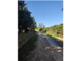 2
2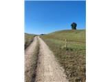 3
3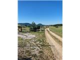 4
4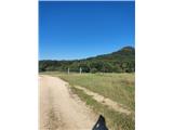 5
5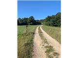 6
6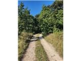 7
7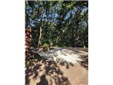 8
8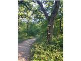 9
9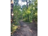 10
10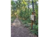 11
11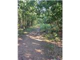 12
12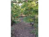 13
13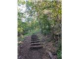 14
14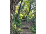 15
15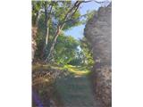 16
16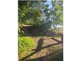 17
17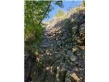 18
18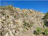 19
19 20
20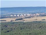 21
21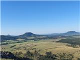 22
22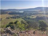 23
23
Discussion about the trip Hegyesd (vas) - Hegyesd (southern path)
To post a comment you must log in:
If you do not yet have a username, you must first
register.