Heidi Alm - Falkert (direct way)
Starting point: Heidi Alm (1872 m)
| Latitude/Longitude: | 46,86340°N 13,83130°E |
| |
Route name: direct way
Walking time: 1 h 15 min
Difficulty: easy marked way
Elevation gain: 436 m
Elevation difference along the route: 436 m
Map:
Recommended equipment (summer):
Recommended equipment (winter): ice axe, crampons
Views: 4.479
 | 1 person like this post |
Access to starting point:
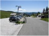
A) Through the Karawanks Tunnel, we drive to Austria, then continue on the Tauern motorway, which we leave already at the Villach bypass and continue towards the town of Feldkirchen. Further, we drive along Osojsko jezero / Ossiacher See to the already mentioned town. In Feldkirchen, we continue left in the direction of the Turacher Höhe pass and drive past the towns of Himmelberg, Gnesau, Mitterdorf to the town of Wiedweg, where from the left the road from Bad Kleinkirchheim also joins. From the mentioned junction, we continue towards the Turacher Höhe pass only a few hundred meters, then signs for the Heidialm alpine pasture and village and Falkertsee lake direct us left onto an ascending road. We follow the mentioned road to its end, where we park on one of the many parking lots.
B) From Štajerska or Koroška, we first drive to Dravograd and then across the Vič border crossing to Austria, where we follow signs for Celovec / Klagenfurt. Further, we drive on the so-called Southern motorway, which we leave at Celovec (direction Feldkirchen). Further, we drive on the regional road, by which we arrive at the already mentioned town. In Feldkirchen, we continue right in the direction of the Turacher Höhe pass and drive past the towns of Himmelberg, Gnesau, Mitterdorf to the town of Wiedweg, where from the left the road from Bad Kleinkirchheim also joins. From the mentioned junction, we continue towards the Turacher Höhe pass only a few hundred meters, then signs for the Heidialm alpine pasture and village and Falkertsee lake direct us left onto an ascending road. We follow the mentioned road to its end, where we park on one of the many parking lots.
Route description:
From the parking lot, we walk to the end of the road, where the hotel Heidi stands. Near the mentioned hotel, we notice yellow hiking signposts, which over the pasture fence direct us onto a gentle grassy slope, along which we ascend in a few steps to a marked junction.
At the junction, we continue straight upwards (left Falkertsee lake, right Falkert via Hundsfeldscharte saddle, Klomnock and Mallnock) and continue the ascent along an initially moderately steep grassy slope. After a few minutes, we arrive at the edge of steep slopes, along which with a nice view of Falkertsee lake we begin to ascend ever more steeply. Higher, the path distances itself from the lake, but an increasingly panoramic path, from which beautiful views open up onto the neighbouring Rodresnock and other surrounding peaks, quickly leads us to a smaller side ridge, where the climbing path to Falkert joins.
Here we continue slightly right and after approximately 10 minutes of further walking we arrive at the panoramic summit.

Photos:
 1
1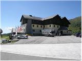 2
2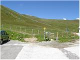 3
3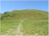 4
4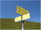 5
5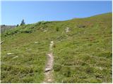 6
6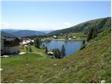 7
7 8
8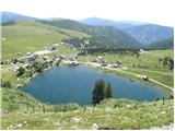 9
9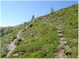 10
10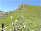 11
11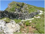 12
12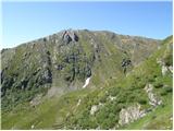 13
13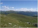 14
14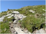 15
15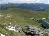 16
16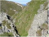 17
17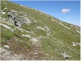 18
18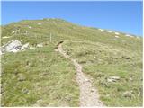 19
19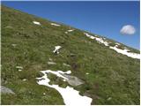 20
20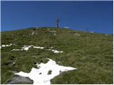 21
21 22
22 23
23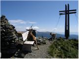 24
24
Discussion about the trip Heidi Alm - Falkert (direct way)
To post a comment you must log in:
If you do not yet have a username, you must first
register.