Heidi Alm - Mallnock (via Klomnock)
Starting point: Heidi Alm (1872 m)
| Latitude/Longitude: | 46,86340°N 13,83130°E |
| |
Route name: via Klomnock
Walking time: 2 h 45 min
Difficulty: easy marked way
Elevation gain: 354 m
Elevation difference along the route: 600 m
Map:
Recommended equipment (summer):
Recommended equipment (winter): ice axe, crampons
Views: 3.654
 | 2 people like this post |
Access to starting point:
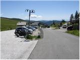
A) Through the Karawanks Tunnel, we drive to Austria, and then we continue driving on the Tauern Autobahn, which we leave already on the Villach bypass and continue driving towards the town of Feldkirchen. Further, we drive along Ossiacher See / Osojsko jezero to the already mentioned town. In Feldkirchen we continue left in the direction of the mountain pass Turacher Höhe and we drive ahead past the towns of Himmelberg, Gnesau, Mitterdorf to the town of Wiedweg, where from the left the road from Bad Kleinkirchheim also joins. From the mentioned crossroad, we continue towards the mountain pass Turacher Höhe only a few hundred meters, then signs for mountain pasture Heidialm and village and lake Falkertsee point us to the left on an ascending road. We follow the mentioned road to its end, where we park on one of the many parking lots.
B) From Štajerska or Koroška, we first drive to Dravograd and then over the border crossing Vič into Austria, where we then follow the signs for Celovec / Klagenfurt. Further, we drive on the so-called South Autobahn, which we leave at Klagenfurt (direction Feldkirchen). Further, we drive on a regional road, on which we arrive at the already mentioned town. In Feldkirchen we continue right in the direction of the mountain pass Turacher Höhe and we drive ahead past the towns of Himmelberg, Gnesau, Mitterdorf to the town of Wiedweg, where from the left the road from Bad Kleinkirchheim also joins. From the mentioned crossroad, we continue towards the mountain pass Turacher Höhe only a few hundred meters, then signs for mountain pasture Heidialm and village and lake Falkertsee point us to the left on an ascending road. We follow the mentioned road to its end, where we park on one of the many parking lots.
Route description:
From the parking lot, we walk to the end of the road, where the Hotel Heidi stands. Near the mentioned hotel we notice yellow hiking signposts, which over a pasture fence direct us onto a gentle grassy slope, on which we ascend in a few steps to a marked junction.
To the left upwards leads the direct path to Falkert, we continue right following the signs Klomnock, Falkert 1h 15min. The path then in a gentle ascent crosses slopes below the cable car and then crosses a stream. Further, the path turns slightly to the left and follows the ascent on a grassy slope all the way to the notch Hundsfeldscharte between the peaks Falkert and Falkertköpfl.
On the notch where there is a junction we continue straight. First we cross the fence then we cross slopes below the peak Falkertköpfl towards the northwest. From the path, we have a nice view of the nearby Falkert, and in the distance we can also nicely see the Julian and Carnic Alps. When we come near the saddle between the peaks Falkertköpfl and Steinnock, the path turns to the left and crosses the grassy slope below the peak Steinnock to the saddle Flache Scharte where the slopes become gentler.
On the saddle we continue straight and begin to ascend again. The path soon brings us to a junction with signposts. We continue straight following the signs Klomnock, Malnock. To the right branches off the path to the hut Prießhütte, to the left to the hut Falkertschutzhaus. After a short ascent we cross the fence and the path brings us again to a junction. We continue right upwards following the signs Klomnock, to the left leads the direct path to Malnock.
Further, the path ascends somewhat more steeply for quite some time on the grassy slope along the ridge. In the last part, from the right the path from the pass Schiestelscharte also joins us and only a short ascent follows to the panoramic summit.
From the summit we continue towards the west and begin to descend along a fairly steep ridge. The path then brings us to a memorial with a cross. Further, the slope becomes gentler, and we continue descending along the ridge to the saddle below the summit Malnock. On the saddle we continue along the fence and on the gentle grassy slope soon reach the summit.

Photos:
 1
1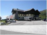 2
2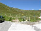 3
3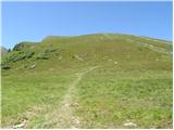 4
4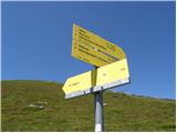 5
5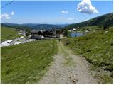 6
6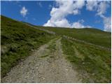 7
7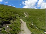 8
8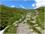 9
9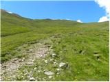 10
10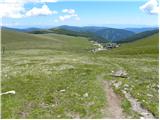 11
11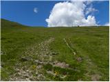 12
12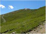 13
13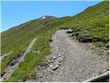 14
14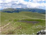 15
15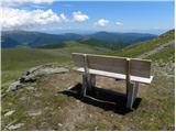 16
16 17
17 18
18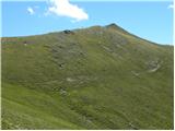 19
19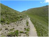 20
20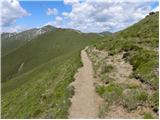 21
21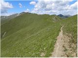 22
22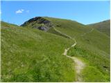 23
23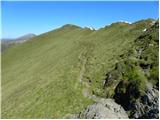 24
24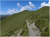 25
25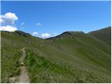 26
26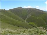 27
27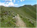 28
28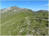 29
29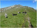 30
30 31
31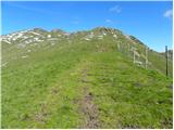 32
32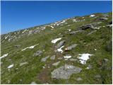 33
33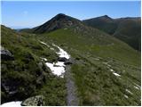 34
34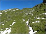 35
35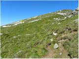 36
36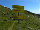 37
37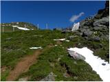 38
38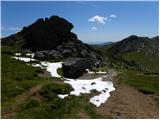 39
39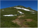 40
40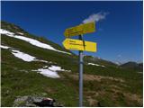 41
41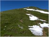 42
42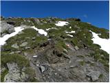 43
43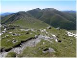 44
44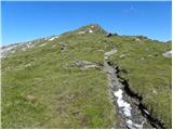 45
45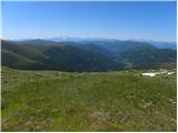 46
46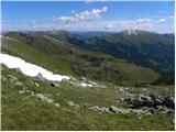 47
47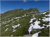 48
48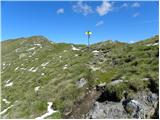 49
49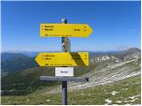 50
50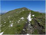 51
51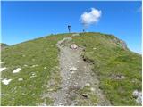 52
52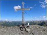 53
53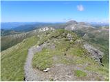 54
54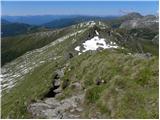 55
55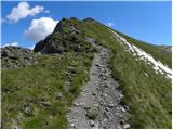 56
56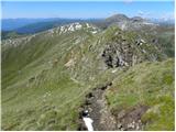 57
57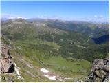 58
58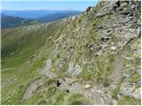 59
59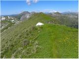 60
60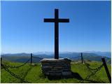 61
61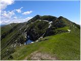 62
62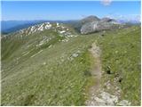 63
63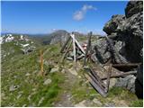 64
64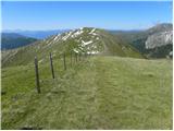 65
65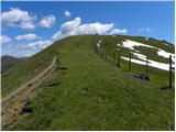 66
66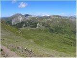 67
67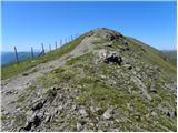 68
68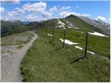 69
69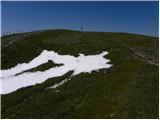 70
70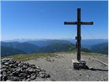 71
71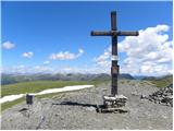 72
72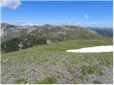 73
73
Discussion about the trip Heidi Alm - Mallnock (via Klomnock)
To post a comment you must log in:
If you do not yet have a username, you must first
register.