Hinterstoder - Prielschutzhaus
Starting point: Hinterstoder (625 m)
| Latitude/Longitude: | 47,68196°N 14,11990°E |
| |
Walking time: 2 h 15 min
Difficulty: easy marked way
Elevation gain: 795 m
Elevation difference along the route: 800 m
Map:
Recommended equipment (summer):
Recommended equipment (winter): ice axe, crampons
Views: 1.897
 | 2 people like this post |
Access to starting point:
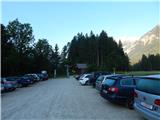
Via the border crossing Šentilj we continue on the motorway past the town of Gradec / Graz and follow the signs for Salzburg and then Linz. The road also passes through two toll tunnels (8€ and 4.5€ - August 2013). When we exit the second tunnel (a little after the town of Liezen), we continue past the town of Spital am Pyhrn, and then we leave the motorway at the exit for the town of Hinterstoder. We continue driving through the town of Hinterstoder and then approximately 2 km after the end of the settlement we turn right slightly downhill onto a narrow road that leads towards the parking lot. At the crossroads there are also yellow mountain signposts with markings for the hut Prielschutzhaus. We park on the larger paid parking lot (1 day: 3€, 2 days: 5€ - August 2013).
From the Gorenjska side: Through the Karawanks Tunnel we drive into Austria, and then we continue driving on the Tauern motorway. Further we drive through the Katschberg Tunnel and later also the Tauern Tunnel / Tauerntunnel, but we follow the motorway towards Salzburg (also Solnograd) only to the exit for Radstadt, Schladming. We continue on the road past the towns of Schladming and Liezen. At the town of Liezen we head onto the motorway towards the town of Linz. We leave the motorway at the exit for the town of Hinterstoder. Further, we follow the above description.
Route description:
From the parking lot, we head onto a gentle macadam road towards the east. The road through the forest quickly brings us to a crossroads at the farm Klinser. We continue on the main road slightly right following the signs »Prielschutzhaus«, and a little more sharply right leads the path towards the settlement Hinterstoder and lake Schiederweiher.
From the crossroads the path leads along pastures and then crosses a bridge over the river Steyr. After the bridge, the road turns left and for some time runs along the mentioned river. The road then leads us past the inn Polsterstüberl and brings us to a crossroads where from the right joins the road past the lake Schiederweiher.
At the crossroads, we continue left on the still gentle road and follow the signs for the hut Prielschutzhaus. Further the road runs through the forest, at the junctions we always follow the signs for Prielschutzhaus. Later the road brings us to a junction where signposts direct us right onto a footpath, straight ahead leads the road towards the cargo cableway.
The path here runs through high shrubbery and then soon starts to ascend. Initially we ascend the eastern slopes and occasionally a view opens towards the starting point and the nearby lower peaks. Such a path then brings us to the waterfall Klinserfall, which is located by the path. At the waterfall the path turns slightly to the right onto somewhat steeper slopes. The path here is not particularly demanding, nevertheless at a few places a steel cable assists us. The path then soon turns left and leads us below the rock face (Grosser Ofen) and brings us to a less vegetated slope from which a nice view opens towards the summit Spitzmauer.
A little higher the path turns right and brings us into the forest on the slopes below the cargo cableway. Further on, the path runs all the time near the cargo cableway all the way to the hut Prielschutzhaus at which a beautiful view also opens towards the summit Großer Priel.

Along the route: Klinserfall (1060m)
The trip can be extended to the following destinations: Großer Priel
Photos:
 1
1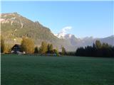 2
2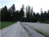 3
3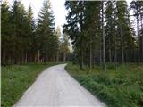 4
4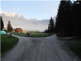 5
5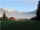 6
6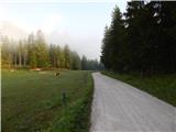 7
7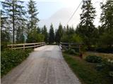 8
8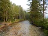 9
9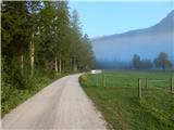 10
10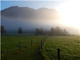 11
11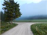 12
12 13
13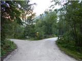 14
14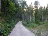 15
15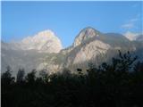 16
16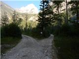 17
17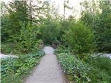 18
18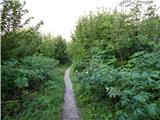 19
19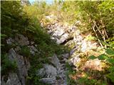 20
20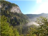 21
21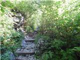 22
22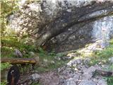 23
23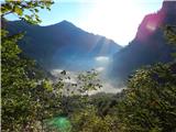 24
24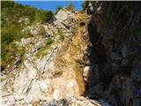 25
25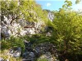 26
26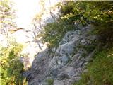 27
27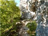 28
28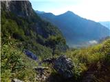 29
29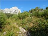 30
30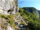 31
31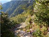 32
32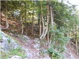 33
33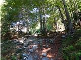 34
34 35
35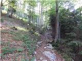 36
36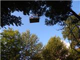 37
37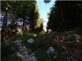 38
38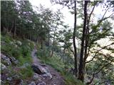 39
39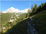 40
40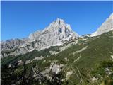 41
41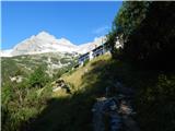 42
42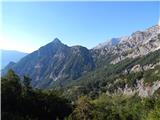 43
43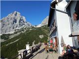 44
44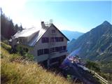 45
45
Discussion about the trip Hinterstoder - Prielschutzhaus
To post a comment you must log in:
If you do not yet have a username, you must first
register.