Hirschegg - Hirschegger Alm (southern peak) (via Bernsteinhütte)
Starting point: Hirschegg (899 m)
| Latitude/Longitude: | 47,02020°N 14,95836°E |
| |
Route name: via Bernsteinhütte
Walking time: 3 h
Difficulty: easy marked way
Elevation gain: 868 m
Elevation difference along the route: 880 m
Map:
Recommended equipment (summer):
Recommended equipment (winter): ice axe, crampons
Views: 105
 | 1 person like this post |
Access to starting point:
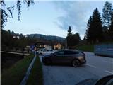
a) We leave the A2 highway Celovec / Klagenfurt - Graz at the Packsattel exit, then follow the signs for Gradec and Pack. At the settlement Stampf we leave the old road towards Graz and continue driving in the direction of the village Hirschegg, where we park in the marked parking area beside the main road.
b) We leave the A2 highway Graz - Celovec / Klagenfurt at the Modriach exit, then follow the signs for Packer Stausee lake and the village Hirschegg, where we park in the marked parking area beside the main road.
Route description:
At the end of the parking lot, we go left and cross the Teigitsch river over a bridge, then ascend to the nearby church, where the path splits.
We continue on the left road (the right road leads to the inn Pongratzwirt), which quickly brings us to the inn Hirscheggerhof, where the path splits once again.
Here we choose the slightly left path, which continues parallel to a somewhat wider road and leads us along the lower edge of the ski slope or pasture. For some time we ascend along the right edge of the pasture; higher up, at the viewpoint overlooking the settlement Hirschegg, the path turns into the forest, where we follow the blazes. Higher up, we return to the edge of the pasture or ski slope, and a few minutes higher the blazes lead us back into the forest. Here we follow a poorer footpath to an old decaying mountain hut; the path then disappears completely in places for a while, and blazes are also quite sparse. Higher up, the path temporarily flattens and leads us past a small chapel to an asphalt road, which we follow to the upper part of the settlement Bernstein.
Above the settlement the asphalt ends; at junctions we follow the blazes and further on we several times take marked shortcuts that cut across the forest road. Further on there is still some ascent through the forest, then the path flattens and leads us across a grassy area to a junction near the Bernsteinhütte mountain hut, where we turn right and quickly reach the aforementioned hut.
We bypass the cottage on the left and continue towards Peterer Sattel. Next follows a moderate ascent by the edge of the grazing area, and the path a little higher splits once again.
To the left leads the path towards the mountain huts Görlitzerhütte and Schrotthütte, and we continue straight, where a few minutes higher, we leave the thin forest. The path continues with a fairly steady moderate ascent along a panoramic grassy ridge; when the path flattens, just before it begins to descend, we leave it and continue to the right, reaching the summit with a cross in three minutes of further walking.
Hirschegg – Bernsteinhütte 2:10, Bernsteinhütte – Hirschegger Alm (southern summit) 0:50.
The description and photographs reflect the conditions in July 2023 and September 2025.

Photos:
 1
1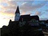 2
2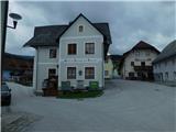 3
3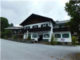 4
4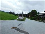 5
5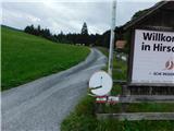 6
6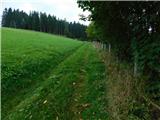 7
7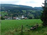 8
8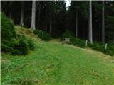 9
9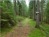 10
10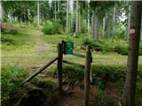 11
11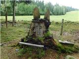 12
12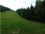 13
13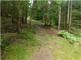 14
14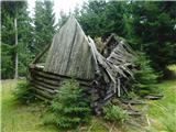 15
15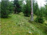 16
16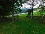 17
17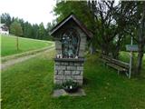 18
18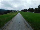 19
19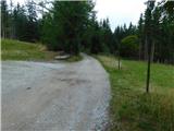 20
20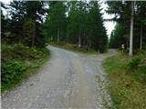 21
21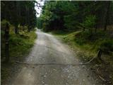 22
22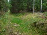 23
23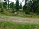 24
24 25
25 26
26 27
27 28
28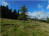 29
29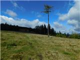 30
30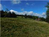 31
31 32
32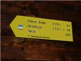 33
33 34
34 35
35 36
36 37
37 38
38 39
39 40
40 41
41 42
42 43
43 44
44 45
45 46
46 47
47 48
48
Discussion about the trip Hirschegg - Hirschegger Alm (southern peak) (via Bernsteinhütte)
To post a comment you must log in:
If you do not yet have a username, you must first
register.