Starting point: Hirschegg (899 m)
| Latitude/Longitude: | 47,02020°N 14,95836°E |
| |
Walking time: 50 min
Difficulty: easy marked way
Elevation gain: 278 m
Elevation difference along the route: 278 m
Map:
Recommended equipment (summer):
Recommended equipment (winter):
Views: 79
 | 1 person like this post |
Access to starting point:
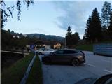
a) We leave the A2 highway Celovec / Klagenfurt - Gradec / Graz at the Packsattel exit, then follow the signs for Gradec and Pack. At the settlement Stampf we leave the old road towards Graz and continue driving in the direction of the village Hirschegg, where we park in the marked parking area beside the main road.
b) We leave the A2 highway Gradec / Graz - Celovec / Klagenfurt at the Modriach exit, then follow the signs for Packer Stausee lake and the village Hirschegg, where we park in the marked parking area beside the main road.
Route description:
At the end of the parking lot, we turn left and cross the Teigitsch river over a bridge, then ascend to the nearby church, where we turn right. We continue following the signs for guesthouse Pongratzwirt, mountain hut Saureishütte and the peak Seinerkreuz, walking along trail no. 540. The compact part of the settlement soon ends and the path ahead leads us along an ascending asphalt road which the marked trail crosses several times; we follow the blazes and signs for Pongratzwirt. In the final section of the ascent to guesthouse Pongratzwirt, we climb over a panoramic pasture, then pass mountain direction signposts and arrive at the aforementioned guesthouse.
The description and photos reflect the conditions in September 2025.
Photos:
 1
1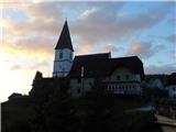 2
2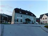 3
3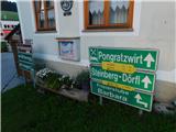 4
4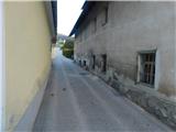 5
5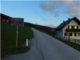 6
6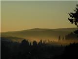 7
7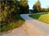 8
8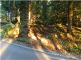 9
9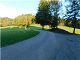 10
10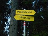 11
11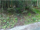 12
12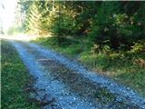 13
13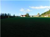 14
14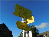 15
15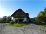 16
16
Discussion about the trip Hirschegg - Pongratzwirt
To post a comment you must log in:
If you do not yet have a username, you must first
register.