Starting point: Hosta (347 m)
| Latitude/Longitude: | 46,16200°N 14,32410°E |
| |
Walking time: 2 h 10 min
Difficulty: easy unmarked way
Elevation gain: 511 m
Elevation difference along the route: 550 m
Map: Ljubljana - okolica 1:50.000
Recommended equipment (summer):
Recommended equipment (winter): crampons
Views: 1.600
 | 1 person like this post |
Access to starting point:
A) From the road Medvode - Škofja Loka, at the beginning of Škofja Loka we drive in the direction of Poljanska dolina, after that from the roundabout before the tunnel Sten we turn in the direction of Sora, and when we reach the road Sora - Puštal we go once again left. We quickly get to the settlement Hosta, where soon on the left we notice a larger macadam area, where we park.
B) From Poljanska dolina we drive towards Škofja Loka and then on the bypass and through the tunnel Sten. After the tunnel we turn right in the direction of Sora, and when we reach the road Sora - Puštal we go left. We quickly get to the settlement Hosta, where soon on the left we notice a larger macadam area, where we park.
Route description:
From the starting point, we continue on the road in the direction of Sora, where we go past company Srečno življenje d.o.o., and only a little further we get to the bus stop Hosta, where we leave the road towards Sora and we go right past a few houses, after which we continue on a cart track which slightly ascends towards the left. At the nearby crossing, we go sharply right and we continue walking on a worse forest road which passes into the forest, and in the forest, we quickly leave it and we continue sharply left on a beaten footpath which starts ascending. The path ahead mostly moderately ascends, only occasionally steeper, and at the crossings we follow it in the direction where it is better beaten. Higher, the footpath flattens and turns a little to the left, so that there follows a shorter crossing to the spot, where we join the marked path Škofja Loka - Osolnik.
We follow the marked path left and we descend along it to a smaller saddle, where from the right also the path from the valley Hrastnica joins (in the description starting point Puštal (Na Dobravi)), and we continue straight on the marked path, which ascends through the forest.
The path ahead for quite some time leads us through a dense forest, where we follow the blazes. After a while we step out of the forest onto a panoramic hayfield, where the path temporarily gets lost a bit. Only a little higher we step on a cart track and we follow it to the right, and it quickly brings us to a smaller sign and NOB monument, where we continue slightly left. Behind the monument the path turns slightly to the right and a little higher brings us into a forest belt.
When we again step out of the forest, we will notice on the left side a lonely homestead, and on the right a fenced pasture. We continue straight on the path which goes into the forest, and it soon brings us to a macadam road which we follow to the right. There follows a few minutes' walk on the road, and then we get to a crossroad, where we continue straight across the asphalt road onto a cart track. We continue on the marked cart track which then has in a short time quite a few crossings, and we all the time stick to the blazes. The cart track higher changes into a footpath, and it starts ascending steeply by the pasture fence. A little further from the left joins the path from the village Sora, and we continue right and in some 10 steps of further walking we get to the top of Osolnik, on which stands the church of St. Mohor and Fortunat.
The description refers to the condition in November 2019, and the pictures are from various periods.

Along the route: Vrh Rebra (682m)
Photos:
 1
1 2
2 3
3 4
4 5
5 6
6 7
7 8
8 9
9 10
10 11
11 12
12 13
13 14
14 15
15 16
16 17
17 18
18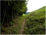 19
19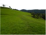 20
20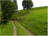 21
21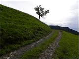 22
22 23
23 24
24 25
25 26
26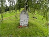 27
27 28
28 29
29 30
30 31
31 32
32 33
33 34
34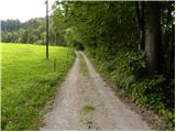 35
35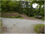 36
36 37
37 38
38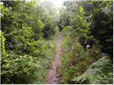 39
39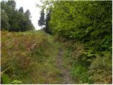 40
40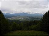 41
41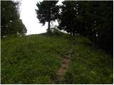 42
42 43
43 44
44
Discussion about the trip Hosta - Osolnik
To post a comment you must log in:
If you do not yet have a username, you must first
register.