Hotavlje - Štor (via Slajka)
Starting point: Hotavlje (409 m)
| Latitude/Longitude: | 46,10720°N 14,11760°E |
| |
Route name: via Slajka
Walking time: 2 h 50 min
Difficulty: easy marked way
Elevation gain: 596 m
Elevation difference along the route: 640 m
Map: Škofjeloško in Cerkljansko hribovje 1:50.000
Recommended equipment (summer):
Recommended equipment (winter): ice axe, crampons
Views: 1.060
 | 2 people like this post |
Access to starting point:
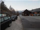
A) From Železniki, Kranj or Medvode we drive to Škofja Loka, and from there we continue driving in the direction of Gorenja vas in Poljanska dolina and Žiri. After Gorenja vas, in the settlement Hotavlje, at the crossroad behind Gostilna Lipan we leave the main road towards Žiri and continue driving right in the direction of the ski slope Cerkno and village Leskovica. Immediately after the crossroad, we park at a suitable place by the road.
B) From Horjul or Polhov Gradec we drive to Lučine, from there we descend into Gorenja vas. In Gorenja vas we continue left towards Žiri, then in Hotavlje at the crossroad behind Gostilna Lipan we continue right in the direction of the ski slope Cerkno and village Leskovica. Immediately after the crossroad, we park at a suitable place by the road.
C) From Vrhnika, Logatec or Spodnja Idrija we drive to Žiri, and from there we continue driving towards Gorenja vas and Škofja Loka, but we drive on the main road only to the settlement Hotavlje, where we turn left in the direction of the ski slope Cerkno and village Leskovica. Immediately after the crossroad, we park at a suitable place by the road.
D) First, we drive to Cerkno, and from there we continue driving through the saddle Kladje (Podlanišče) towards Sovodenj. From Sovodenj we continue driving along the stream Hobovščica, then at a somewhat larger crossroad we continue left in the direction of Gorenja vas (right Žiri). On the main road towards Škofja Loka we drive to the settlement Hotavlje, where we turn left in the direction of the ski slope Cerkno and village Leskovica. Immediately after the crossroad, we park at a suitable place by the road.
Route description:
From the starting point, where nearby there is a vending machine of the farm pr Šupc, we continue on the road towards the village Leskovica and in the direction of the hiking paths to Blegoš, Ermanovec and Slajko. We walk for a few minutes by the edge of the road, partly also on the sidewalk, then the signs for Ermanovec and Slajko direct us to the left (straight ahead Blegoš), where over the bridge we cross Kopačnica, immediately after the bridge at the church of St. Lovrenc we continue right and gradually begin to ascend. At first we ascend past a few more houses, then the signs direct us sharply left, where we continue for some 10 steps on a cart track, on the hay meadow the cart track changes into a footpath, which turns somewhat to the right and leads us past one more house. Higher we cross some worse cart tracks, the markings through a strip of somewhat overgrown path bring us to an asphalt road, which we just cross. On the other side of the road we first ascend more steeply, then continue on a narrower path, which continues through a small valley, where the power line route also runs. From the valley we soon ascend transversely to the right, where we reach the ridge (here another footpath joins us from the right), here the path turns left. A little further we cross another cart track, when we leave the forest we quickly ascend to the asphalt road, which we follow to the right. The asphalt road then leads us past a bench, where to the right a path branches off towards Vrh Slajke, we follow the road, which turns semicircularly to the left, to the nearby farm, from which to Dom na Slajki only a minute of walking separates us.
From the hut we return to the nearby farm, where we bypass the main buildings on the upper side and continue with the path on the macadam road, which on the nearby meadow changes into a cart track. Follows walking through a strip of forest, then we arrive at the grassy slopes of Špik or Vranškov grič (both names appear on maps), which we cross with nice views. When we reach a worse macadam road we descend on it (right private land), when the road levels out we join a wider macadam road, which we reach above the farm Hom.
We continue in the direction of Ermanovec and then walk for quite some time on the macadam road, which later becomes asphalt. Follows some more descent with nice views, then from a smaller crossroad we continue slightly right (slightly left we can descend to the church of St. Pavel in Stara Oselica), from the next crossroad we go slightly left (slightly right farm Rotovž).
Follows a gentle ascent and the path brings us to the place where the marked path splits.
We continue on the slightly right path, which continues on the road (left peak Ermanovec, it is also possible to reach Dom na Ermanovcu, but the path is somewhat longer) and further ascend transversely. Higher we continue slightly left, at the hamlet of a few houses the road turns sharply right, then with nice views it brings us to the marked junction by the chapel and bell.
We continue straight in the direction of Dom na Ermanovcu (sharply left peak Ermanovec, left road that descends to Sovodenj) and continue walking on the gentle asphalt road, to which a little further a marked path from Sovodenj joins.
From the mentioned junction only some 10 steps of easy walking follow and we arrive at Dom na Ermanovcu.
At the hut we notice the mountain direction sign for Štor, which directs us to the footpath that ascends steeply through the forest. The path soon levels out and brings us from the forest to a panoramic meadow, where the markings end. Here we continue right into the dense forest and continue the ascent on the gentle unmarked footpath, on which in 2 minutes of further walking we arrive at the indistinct and forest-covered peak.
Hotavlje - Dom na Slajki 1:15, Dom na Slajki - Dom na Ermanovcu 1:30, Dom na Ermanovcu - Štor 0:05.

Photos:
 1
1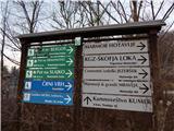 2
2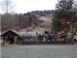 3
3 4
4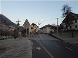 5
5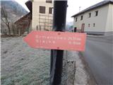 6
6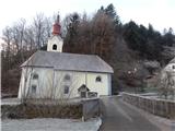 7
7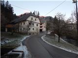 8
8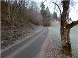 9
9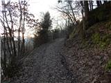 10
10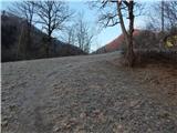 11
11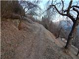 12
12 13
13 14
14 15
15 16
16 17
17 18
18 19
19 20
20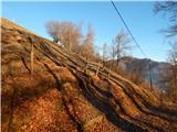 21
21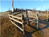 22
22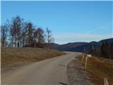 23
23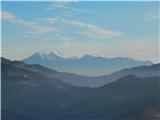 24
24 25
25 26
26 27
27 28
28 29
29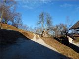 30
30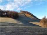 31
31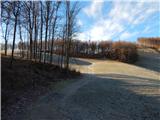 32
32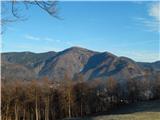 33
33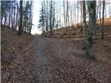 34
34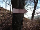 35
35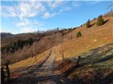 36
36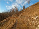 37
37 38
38 39
39 40
40 41
41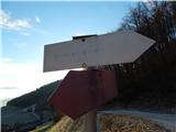 42
42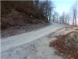 43
43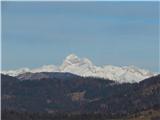 44
44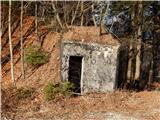 45
45 46
46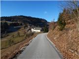 47
47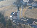 48
48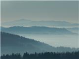 49
49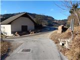 50
50 51
51 52
52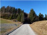 53
53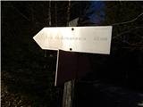 54
54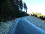 55
55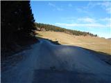 56
56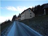 57
57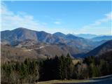 58
58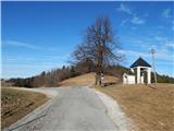 59
59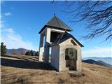 60
60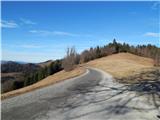 61
61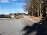 62
62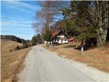 63
63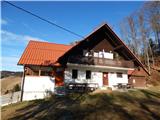 64
64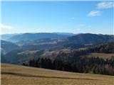 65
65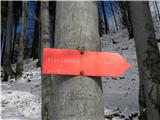 66
66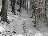 67
67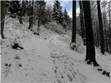 68
68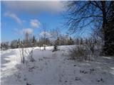 69
69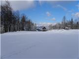 70
70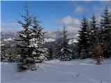 71
71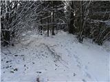 72
72 73
73
Discussion about the trip Hotavlje - Štor (via Slajka)
To post a comment you must log in:
If you do not yet have a username, you must first
register.