Starting point: Hotovlja (400 m)
| Latitude/Longitude: | 46,11840°N 14,19440°E |
| |
Walking time: 1 h 45 min
Difficulty: easy marked way
Elevation gain: 620 m
Elevation difference along the route: 640 m
Map: Škofjeloško in Cerkljansko hribovje 1:50.000
Recommended equipment (summer):
Recommended equipment (winter):
Views: 25.488
 | 1 person like this post |
Access to starting point:
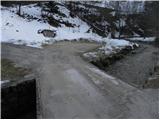
From Škofja Loka we drive towards Gorenja vas. The road then brings us to the traffic-light intersection in the village Poljane nad Škofjo Loko. Here we turn left towards the village Hotovlja. The road immediately after the intersection crosses Poljanščica over a bridge and then brings us to the next intersection, where we continue left. Further, the road brings us among the houses in the village Hotovlja, where we also notice the beginning of the footpath to Bukov vrh. Here we drive a few tens of meters further to the parking lot, which we notice on the other side of the stream, along which we are driving.
Route description:
From the parking lot, we return a few meters along the road back to the marked beginning of the mountain path to Bukov vrh. The path then crosses the stream over a small bridge and steeply ascends on the other side. The path ahead ascends for a good 20 minutes through the forest, then brings us to a sparsely vegetated slope, where the steepness eases. Here along the path we notice two crosses, which are only a few meters apart. Only a little further ahead the path brings us to a smaller hamlet, where we continue along a poor road, which we follow only briefly. When we reach the fence we continue through the gate and then gently ascend between fences. We follow this path, along which the blazes are rarer, for a few minutes to the place where we step onto a poorer road. Here we notice a sign for Bukov vrh, which directs us across a grassy slope towards the church, which we already see ahead of us. A little below the summit the path briefly steepens somewhat and quickly brings us to the summit amid ever finer views, in the middle of which stands the Church of Our Lady of Sorrows.
From Bukov vrh we continue straight down (south direction) and after a short descent across a meadow we arrive at a smaller hamlet in the village Bukov vrh. Here on one of the houses we notice the inscription Vinharje, Pasja ravan and Črni vrh, which directs us onto a cart track that begins to ascend gently and quickly brings us to a panoramic grassy ridge. We walk across the panoramic slope, then the cart track turns slightly right, bringing us to the edge of the forest. Here the cart track brings us to a smaller junction, where we continue left, relatively steeply upwards. Higher up the cart track levels off temporarily, while we continue following the signs for Pasja ravan, which lead us from the cart track onto a wide footpath. Higher we cross the cart track again, then continue the ascent along an occasionally somewhat steeper marked path, which after a good 15 minutes of further walking brings us to a macadam road, which we follow left. We continue along the said road, arriving at the expansive summit of Pasja ravan in less than 5 minutes.

Photos:
 1
1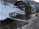 2
2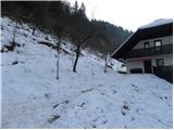 3
3 4
4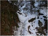 5
5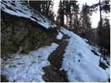 6
6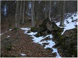 7
7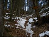 8
8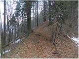 9
9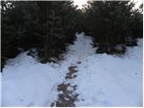 10
10 11
11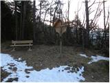 12
12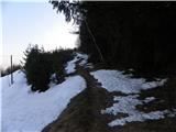 13
13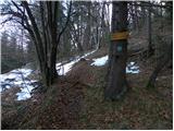 14
14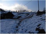 15
15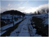 16
16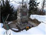 17
17 18
18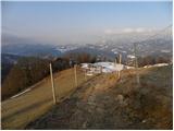 19
19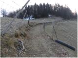 20
20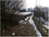 21
21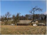 22
22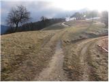 23
23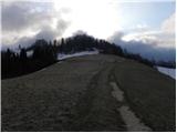 24
24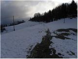 25
25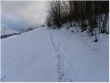 26
26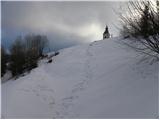 27
27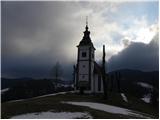 28
28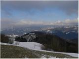 29
29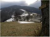 30
30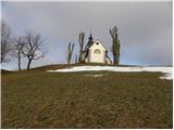 31
31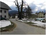 32
32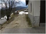 33
33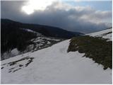 34
34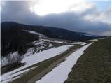 35
35 36
36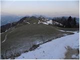 37
37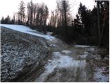 38
38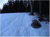 39
39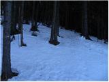 40
40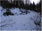 41
41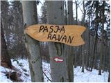 42
42 43
43 44
44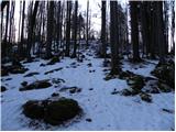 45
45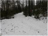 46
46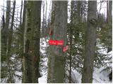 47
47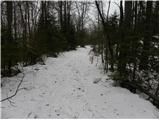 48
48 49
49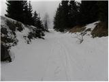 50
50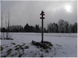 51
51 52
52
Discussion about the trip Hotovlja - Pasja ravan
|
| KARAMELICA16. 03. 2014 |
I was up there today, but we didn't start in Hotovlja at Poljane, but at Vrtovčev dom Na Logu, then past Bukov vrh to Pasja ravan. It was beautiful, just the signs on the boards at the church on Bukov vrh and at Pasja ravan summit need refreshing, as they are very poorly visible (winter did its thing). And maybe a bench on the plateau at the top of Pasja ravan would be useful.
|
|
|
|
| LidijaJesih1. 03. 2015 |
The marker and footbridge from picture 2 are gone, cross the stream at the house seen in picture 2 and then left past it (picture 3). Marked quite Gorenjska-style. 
|
|
|
|
| Vassago14. 09. 2019 |
Do you on this site know what "marked trail" means or is it used arbitrarily "by ear"? A marked trail is one with visible and followable markers even for those unfamiliar with the path.
|
|
|
|
| margu5015. 09. 2019 |
The footbridge was washed away by water, like some others further up the valley. Also this one in the second photo, just that they put it back.
|
|
|
To post a comment you must log in:
If you do not yet have a username, you must first
register.