Hrib-Loški Potok - Koča na Kamnem griču
Starting point: Hrib-Loški Potok (755 m)
| Latitude/Longitude: | 45,70180°N 14,59080°E |
| |
Walking time: 1 h 15 min
Difficulty: easy marked way
Elevation gain: 261 m
Elevation difference along the route: 300 m
Map:
Recommended equipment (summer):
Recommended equipment (winter):
Views: 4.880
 | 2 people like this post |
Access to starting point:
From Sodražica, Nova vas na Bloke or Loška dolina we drive to the settlement Hrib-Loški Potok, where on a marked parking lot in the middle of the settlement, opposite the cultural tourist center we also park.
We can also reach the starting point from the direction of Stari Kot and Draga.
Route description:
From the parking lot, we continue on the road which ascends above the main road, after that a little higher at the crossroad we continue left and we walk to a crossroad, by which there is a chapel. At the chapel, we go right, after that at a few smaller crossroads we continue straight. Higher, the road flattens and leads us past a few more houses, and after the sign, which marks the end of the settlement, we continue slightly left, on the road in the direction of Kamni grič and Travna Gora. The road on which we continue a little further gradually starts descending, and then it brings us to the spot, where the path splits into two parts. We can continue on a marked road (blazes are rare), or left on a cart track which cuts a quite long (approximately 3 km) U-turn. It is nicer to continue on the approximately half shorter cart track, where the orientation is a little harder, but if at the crossings we follow northern or northeastern directions, then we will reach the road near the marked crossing.
If we decided for walking on the cart track, then when we reach the road we continue right, and from the road then after some 10 meters slightly left, otherwise sharply right, on a marked cart track in the direction of the mountain hut Koča na Kamnem griču.
From the spot, where we leave the road we continue in the direction of Koča na Kamnem griču, and we notice the sign on the tree by the road some 10 strides west from the beginning of the cart track. The cart track at first gently ascends into a strip of forest and then continues without large changes in altitude, partly through the forest, and partly through mowed meadows. Further, the cart track starts moderately ascending, and higher it brings us to a meadow, where the footpath is lost. Here we continue straight upwards, and when we again step into the forest, the footpath also appears. Before we step into the forest it is worth turning back, because a nice view opens up, which reaches all the way to Snežnik. In the forest beside the blazes we notice also the inscription KG (Kamni grič), which confirms that we are on the right path. When we again step out of the forest we arrive at the next hayfield, where again a poorly visible path turns left. Next follows a moderate ascent, and then the path returns into the forest, where the path leads us through a shorter strip, where the footpath is a little more overgrown, but nicely followable. After that part follows a short descent, and then we reach a wider cart track and marked crossing.
From the crossing, we continue straight in the direction of the mountain hut Koča na Kamnem griču to which we have still 5 minutes of moderate ascent on a mostly grassy slope.
From the hut we can in a few steps ascend also to the nearby peak, from which a nice view opens up, which reaches all the way to the Alps.
Description and pictures refer to the condition in the year 2016 (August).

Photos:
 1
1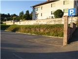 2
2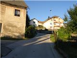 3
3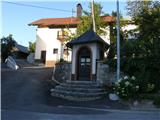 4
4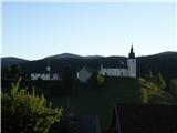 5
5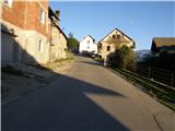 6
6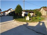 7
7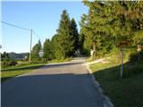 8
8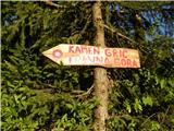 9
9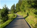 10
10 11
11 12
12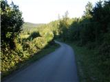 13
13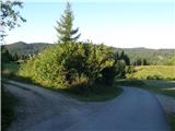 14
14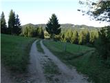 15
15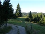 16
16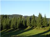 17
17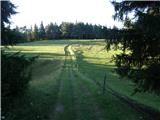 18
18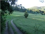 19
19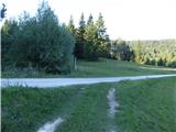 20
20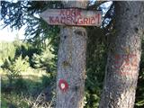 21
21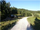 22
22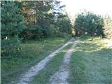 23
23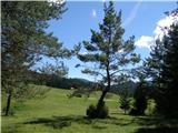 24
24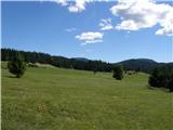 25
25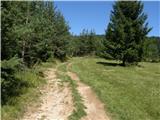 26
26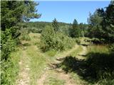 27
27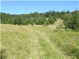 28
28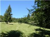 29
29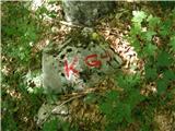 30
30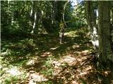 31
31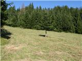 32
32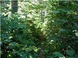 33
33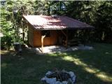 34
34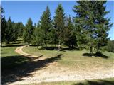 35
35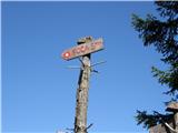 36
36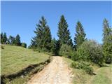 37
37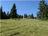 38
38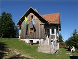 39
39 40
40
Discussion about the trip Hrib-Loški Potok - Koča na Kamnem griču
To post a comment you must log in:
If you do not yet have a username, you must first
register.