Starting point: Hruševka (520 m)
| Latitude/Longitude: | 46,23350°N 14,72600°E |
| |
Walking time: 2 h 30 min
Difficulty: easy marked way
Elevation gain: 643 m
Elevation difference along the route: 685 m
Map:
Recommended equipment (summer):
Recommended equipment (winter): ice axe, crampons
Views: 9.597
 | 3 people like this post |
Access to starting point:
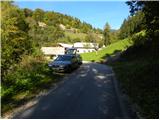
A) First, we drive to Kamnik, then continue driving through Tuhinjska dolina. Further we drive through the localities Vrhpolje, Soteska, Srednja vas, Loke and Potok. At the village Potok, a road branches off to the left towards Terme Snovik spa, and we follow the main road only a few 100 m or to the spot where signs for Hruševka direct us left onto a narrower local road. Up the mentioned road we ascend to some sort of village center, where signs for the footpath to St. Miklavž direct us right downwards. Here the road first descends a little, then starts gently ascending along Podbreški potok stream. After a short ascent we come to the "last" house in the village, and we park a few 10 m before, at an appropriate place by the road.
B) From the Maribor–Ljubljana highway we take the Vransko exit, then continue driving on the parallel old road towards Ljubljana. At the end of Vransko we come to a junction where we turn right towards Tuhinjska dolina. Further we drive through the localities Motnik, Špitalič, Cirkuše, Laze, Šmartno and Buč. After the village Buč, signs for Hruševka direct us right onto a narrower local road. Up the mentioned road we ascend to some sort of village center, where signs for the footpath to St. Miklavž direct us right downwards. Here the road first descends a little, then starts gently ascending along Podbreški potok stream. After a short ascent we come to the "last" house in the village, and we park a few 10 m before, at an appropriate place by the road.
Route description:
From the starting point we continue sharply right in the direction of the footpath to St. Miklavž. The path first ascends through a strip of forest, then brings us to the edge of pastures, from where a nice view of the surroundings opens up. The initially somewhat more overgrown path temporarily returns to the forest, then leads us past a log cabin, after which we cross a strip of bushes. After the bushes, the path widens into a cart track, which turns sharply left and brings us into dense forest. For a short time we still walk on the cart track, then marks direct us right onto an increasingly steep footpath. We follow this quite steep path, which ascends through the forest the whole time, all the way to the church of St. Miklavž on Gora, from which a beautiful view opens up.
From the church of St. Miklavž we continue on the macadam road in the direction of Prevala. The road first starts to descend slightly, then brings us to the spot where a short footpath branches off to the left downwards to the nearby spring; we continue further on the road, which starts gently ascending. After a short ascent, the road brings us to a smaller saddle, where a marked footpath to Prevala branches off to the right. We head onto the mentioned path, which temporarily descends slightly, then transitions to the ridge called V grebenih.
Here the path becomes quite steep and continues along and beside a locally quite steep and in places somewhat exposed ridge (especially when wet there is a risk of slipping on certain sections). Higher up the path levels out and brings us from the ridge to the edge of a larger overgrown clearing. Here the path turns left into the forest and gently descends to the nearby forest road, which we follow left. For some time we descend along the mentioned road, then arrive at a junction in the middle of which stands a cross. From the junction we continue on the marked cart track in the direction of Prevala, to which we have 40 minutes of ascent left. The cart track further ascends relatively steeply through the forest, higher it crosses an old clearing, then levels out and brings us to a poorly marked junction.
At the place where the cart track turns left, a marked footpath continues straight ahead, which first ascends moderately, higher steeply through the forest. We follow this path, which in the last section before Prevala is also overgrown with raspberry bushes, all the way to the Prevala saddle, from which a nice view opens up.

Photos:
 1
1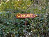 2
2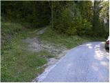 3
3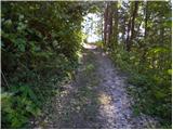 4
4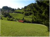 5
5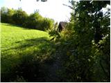 6
6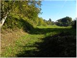 7
7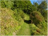 8
8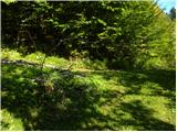 9
9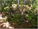 10
10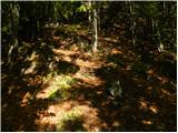 11
11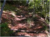 12
12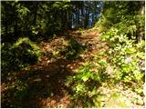 13
13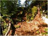 14
14 15
15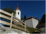 16
16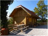 17
17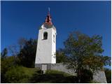 18
18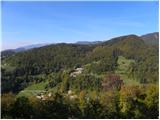 19
19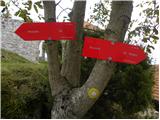 20
20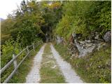 21
21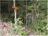 22
22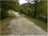 23
23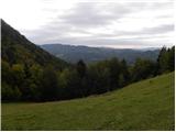 24
24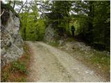 25
25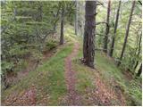 26
26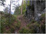 27
27 28
28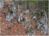 29
29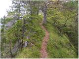 30
30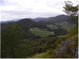 31
31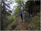 32
32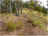 33
33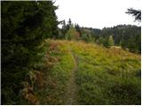 34
34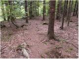 35
35 36
36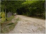 37
37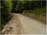 38
38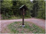 39
39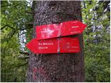 40
40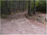 41
41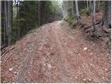 42
42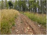 43
43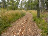 44
44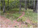 45
45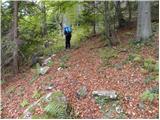 46
46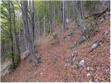 47
47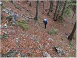 48
48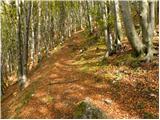 49
49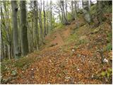 50
50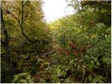 51
51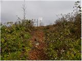 52
52 53
53 54
54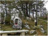 55
55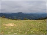 56
56
Discussion about the trip Hruševka - Prevala
|
| krpak29. 07. 2012 |
Today my friend and I walked from Buča. The path is wonderful, only in the upper part there are some fallen trees on the path. Weather at the pass also wonderful - no wind and with Lepenatka right in front of us. At the shepherd's there's also something for a dry throat.
|
|
|
|
| docepe219. 01. 2015 |
Every year on Veliki Šmaren, pilgrims from Zagorje return here from Nova Štift towards home or Zgornji Tuhinj.
The cross bears the year of erection, the chapel was blessed in 2000.
On the last holiday, a little bell was also installed.
Anecdote: The guys who went to dig behind the chapel equipped with a generator and appropriate hand tools could only manage on the second day because the rock is so hard, so the shelter was rather added on.
The greatest merit for all three constructions goes to Mr. Smrkolj Jože from Izlake.
|
|
|
|
| vilma1719. 06. 2018 |
In the path description it says:
From the church of St. Nicholas continue along the gravel road towards Prevala.
From the church of St. Nicholas there is no gravel road onwards. Only a barely visible path that locals didn't know led to Prevala.
The correct path is approx. 300 m before St. Nicholas, but the marker (arrow without text) is visible only when returning. The whole path is very poorly marked and impossible to reach anywhere without help from passers-by. The last 10 min. of the path could not be found as all options were overgrown to impassability.
The path itself is otherwise interesting and very nice in certain sections.
|
|
|
|
| di25. 02. 2025 15:43:13 |
Not recommended for most.
|
|
|
To post a comment you must log in:
If you do not yet have a username, you must first
register.