Hruševka - Sveti Miklavž na Gori
Starting point: Hruševka (520 m)
| Latitude/Longitude: | 46,23350°N 14,72600°E |
| |
Walking time: 30 min
Difficulty: no data
Elevation gain: 237 m
Elevation difference along the route: 237 m
Map:
Recommended equipment (summer):
Recommended equipment (winter):
Views: 11.707
 | 1 person like this post |
Access to starting point:
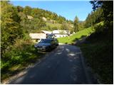
A) First, we drive to Kamnik, and then we continue driving through Tuhinjska Valley. We then drive through settlements Vrhpolje, Soteska, Srednja vas, Loke and Potok. At the village Potok a road branches off to the left towards spa Terme Snovik, and we follow the main road only a few 100 meters or to the spot where signs for Hruševka point us to the left on a narrower local road. On the mentioned road, we ascend to some sort of center of the village, where signs for a footpath to St. Miklavž point us to the right downwards. Here the road at first descends a little and then starts gently ascending by stream Podbreški potok. After a short ascent, we come to the "last" house in the village, and we park a few 10 meters before, on an appropriate place by the road.
B) From highway Maribor - Ljubljana we go to the exit Vransko, and then we continue driving on the parallel old road towards Ljubljana. At the end of Vransko we arrive at an intersection, where we turn right towards Tuhinjska Valley. We then drive through settlements Motnik, Špitalič, Cirkuše, Laze, Šmartno and Buč. After the village Buč, signs for Hruševka point us to the right on a narrower local road. On the mentioned road, we ascend to some sort of center of the village, where signs for a footpath to St. Miklavž point us to the right downwards. Here the road at first descends a little and then starts gently ascending by stream Podbreški potok. After a short ascent, we come to the "last" house in the village, and we park a few 10 meters before, on an appropriate place by the road.
Route description:
From the starting point, we continue sharply right in the direction of the footpath to St. Miklavž. The path at first ascends through a strip of forest, then brings us along the edge of pastures, from where a nice view opens up on the surroundings. Initially somewhat more overgrown path temporarily returns into the forest, then leads past a log cabin, behind which we cross also a strip of bushes. After the bushes, the path widens into a cart track, which turns sharply to the left and brings us into a dense forest. For a short time we still walk on the cart track, then blazes point us to the right on an increasingly steep footpath. This quite steep path, which ascends through the forest all the time, we then follow all the way to the church of St. Miklavž on Gori, from which a beautiful view opens up.
Photos:
 1
1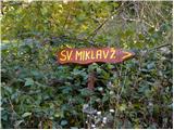 2
2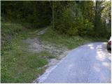 3
3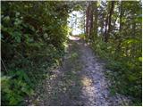 4
4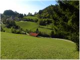 5
5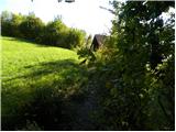 6
6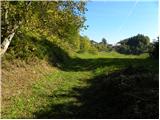 7
7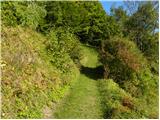 8
8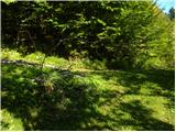 9
9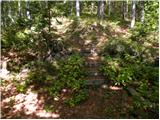 10
10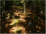 11
11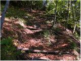 12
12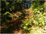 13
13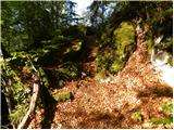 14
14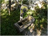 15
15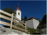 16
16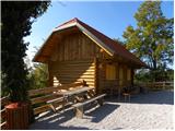 17
17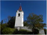 18
18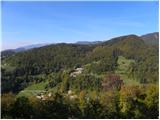 19
19
Discussion about the trip Hruševka - Sveti Miklavž na Gori
|
| grega_p27. 05. 2015 |
Nice short hike that takes care of breathless lungs with the final steep section. At the top, really nice cluster of buildings, from the chapel, church, inn, fountain, wall - all really nicely renovated with natural materials.
Views are oriented mainly towards the south (from nearby Limbarska gora all the way to distant Snežnik) and west (foothills and distant Julijci, interesting view of Kamniške), north is closed by Prevala or the massif of Menina planina.
I recommend on a non-windy day, the north wind today really tousled the hair. Good luck!
|
|
|
To post a comment you must log in:
If you do not yet have a username, you must first
register.