Hrušica - Hruška planina (via Češnjevec)
Starting point: Hrušica (610 m)
Route name: via Češnjevec
Walking time: 2 h
Difficulty: easy unmarked way
Elevation gain: 768 m
Elevation difference along the route: 768 m
Map: Karavanke - osrednji del 1 : 50.000
Recommended equipment (summer):
Recommended equipment (winter): ice axe, crampons
Views: 4.215
 | 3 people like this post |
Access to starting point:
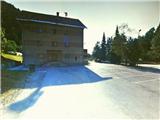
From the highway Ljubljana - Karavanke Tunnel, we take the last exit Hrušica, and turn right, back towards Jesenice. After 200 meters of driving, we come to an intersection, where we turn left onto the uphill road, which leads through a right bend. At the top of the hill we again come to an intersection, where we again choose the left direction. After a further 100 meters of driving, we turn right onto the side road, along which heading right we reach a large parking lot in front of the building of the Local Community Hrušica.
Route description:
From the starting point, we go in the direction of east, past the building of KS, and immediately run into the railway and the railway tunnel Karavanke. On the left side of the tunnel, behind the residential building we look for a footpath which brings us above the railway tunnel, and continue past a military bunker to a macadam road. We turn right and walk on this road 200 meters, to the first houses on our left. Here we notice two paths, which lead far left, and choose the higher - cart track which leads into the forest, by which stands a yellow sign. The path (wide, partly stone cart track) ascends moderately to more steeply, and windingly in the direction of northwest. After some time, we run into the first important junction, where we continue on the left cart track. When the path flattens for a short time, we run into a wooden shed, and the path again ascends through a mostly beech forest. The steepness decreases for the second time, and the path brings us near the gorge of the stream Dobršnik, where we can hear the murmur of the waterfalls. Soon after, the path briefly brings us out of the forest past a hayloft on the left and hay sheds on the right. Immediately after, we also run into an old stone-built stable, past which we go on the right. A little higher, the path once again approaches the gorge, after which, when it withdraws from it somewhat, we run into yet another more important junction. Here we again choose left, and continue through the beech forest, where the moderately ascending and occasionally flat path, which holds to the left, somewhat disappears, but we easily recognize it by the characteristic stone base. After moderate ascent the path then begins to turn right, somewhat higher it ends on the road, at Rogarjev rovt. We cross the road and step onto the cart track which leads across the meadow, uphill towards the north. This quickly brings us into the forest, where it begins to ascend moderately to more steeply. When the path turns somewhat right and splits, we continue on the right, past the barrier, somewhat more steeply uphill. The path increasingly takes on the appearance of a maintained forest road. After a few turns the steepness gradually begins to decrease, and when the view towards the saddle Rožca and Klek opens on the right, the forest road finally flattens. After a short time the path again ascends only somewhat, soon after we already run into a fence with a gate or barrier. We enter the mountain pasture, where we first notice Hruški vrh, and the path through a few turns, after crossing the stream and the last gentle ascent, brings us to the mountain hut on Hruška planina. On the wall, before the entrance to the hut, we will find an attached logbook box.

Photos:
 1
1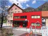 2
2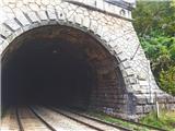 3
3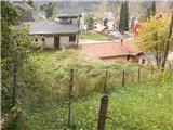 4
4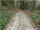 5
5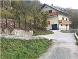 6
6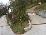 7
7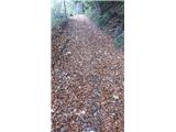 8
8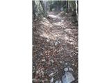 9
9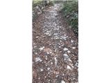 10
10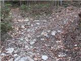 11
11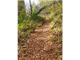 12
12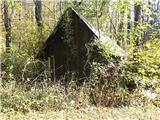 13
13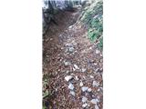 14
14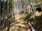 15
15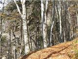 16
16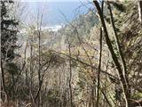 17
17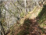 18
18 19
19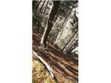 20
20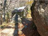 21
21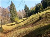 22
22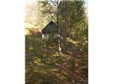 23
23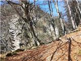 24
24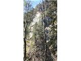 25
25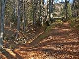 26
26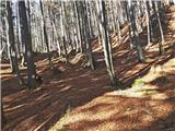 27
27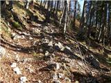 28
28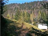 29
29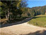 30
30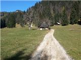 31
31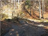 32
32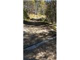 33
33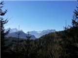 34
34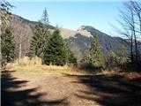 35
35 36
36 37
37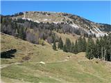 38
38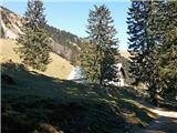 39
39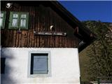 40
40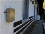 41
41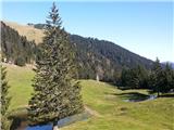 42
42
Discussion about the trip Hrušica - Hruška planina (via Češnjevec)
|
| Jusk29. 07. 2020 |
Today on this path, I met no one It was stuffy and hot, plus nice steepness quick hike to the pasture, back on the road past Plavški rovt.. on the pasture peace and quiet, livestock grazed today high on the slope of Hruški vrh It was stuffy and hot, plus nice steepness quick hike to the pasture, back on the road past Plavški rovt.. on the pasture peace and quiet, livestock grazed today high on the slope of Hruški vrh
|
|
|
To post a comment you must log in:
If you do not yet have a username, you must first
register.