Hrušica - Rosenkogel/Hruški vrh (via Češnjevec and Hruška planina)
Starting point: Hrušica (610 m)
Route name: via Češnjevec and Hruška planina
Walking time: 3 h
Difficulty: easy unmarked way
Elevation gain: 1166 m
Elevation difference along the route: 1166 m
Map: Karavanke - osrednji del 1 : 50.000
Recommended equipment (summer):
Recommended equipment (winter): ice axe, crampons
Views: 3.497
 | 3 people like this post |
Access to starting point:
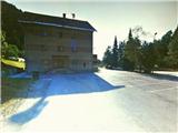
From the highway Ljubljana - Karavanke Tunnel, we take the last exit Hrušica, and turn right, back towards Jesenice. After 200 meters of driving, we come to a crossroad, where we turn left onto the uphill road, which leads through a right turn. At the top of the hill, we again run into a crossroad, where we again choose the left direction. After a further 100 meters of driving, we turn right onto the side road, along which heading right we reach a large parking lot in front of the building of the local community Hrušica.
Route description:
From the starting point, we go in the direction of east, past the building of KS, and immediately run into the railway and the Karawanks railway tunnel. On the left side of the tunnel, behind the residential building we look for a footpath which brings us above the railway tunnel, and continue past the military bunker to a macadam road. We turn right and walk on this road 200 m, to the first houses on our left. Here we notice two paths which lead far left, and choose the higher - cart track which leads into the forest, by which stands a yellow sign. The path (wide, partly stony cart track) ascends moderately to more steeply, and windingly in the direction of northwest. After some time, we run into the first important junction, where we continue on the left cart track. When the path flattens for a short time, we run into a wooden shed, and the path again ascends through mostly beech forest. The steepness decreases for the second time, and the path brings us near the gorge of the stream Dobršnik, where we can hear the murmur of the waterfalls. Soon after, the path briefly brings us out of the forest past the hayrack on the left and hay shed on the right. Immediately after, we also run into an old masonry cattle shed, past which we go on the right. A little higher the path once again approaches the gorge, after which, when it withdraws from it somewhat, we run into yet another more important junction. Here we again choose left, and continue through beech forest, where the moderately ascending and occasionally flat path which holds left somewhat disappears, but we easily recognize it by the characteristic stony base. After moderate ascent the path then begins to turn right, somewhat higher it ends on the road at Rogarjev rovt. We cross the road and step onto the cart track which leads across the meadow, uphill towards the north. This quickly brings us into the forest, where it begins to ascend moderately to more steeply. When the path turns somewhat right and forks, we continue on the right, past the barrier, somewhat more steeply uphill. The path increasingly takes on the appearance of an arranged forest road. After a few turns the steepness gradually begins to ease and when a view opens to the right towards the saddle Rožca and Klek, the forest road finally flattens. After a short time the path rises just a little again, soon after we already run into a fence with gate or barrier. We enter the alpine pasture, where we first glimpse Hruški vrh, and the path through a few turns, after crossing the stream and the last gentle ascent brings us to the mountain hut on Hruška planina. On the wall, before the entrance to the hut, we will find an attached stamping box.
We continue the path behind the hut in the direction of northwest, towards the part of the south slope of Hruški vrh overgrown with larches. When we climb over somewhat boggy terrain towards the mentioned larches, we run into remains of the path, which ascends in switchbacks further in the direction somewhat left, towards the dwarf pine ridge Črničje with elevation 1610 (name not on maps). Near the top of the valley between the slope of Hruški vrh and the mentioned ridge the several times interrupted path turns left to the pasture fence. We step over the latter, and continue sharply right on the poorly visible path, steeply uphill (straight ahead the path towards the alpine pasture Dovška Rožca). Follows approx. 15 min. of steep ascent on grassy terrain (on descent when wet danger of slipping) along both sides of the pasture fence. When the steepness eases and we have crossed the mountain trail (Via Alpina), we arrive at "Izidorjevo znamenje" on the summit of Hruški vrh, from where we continue just a few meters to the right, to the bench with stamp and summit log.

Photos:
 1
1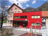 2
2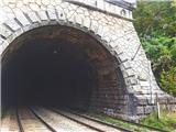 3
3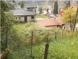 4
4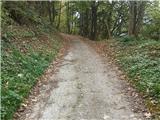 5
5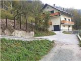 6
6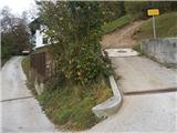 7
7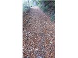 8
8 9
9 10
10 11
11 12
12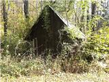 13
13 14
14 15
15 16
16 17
17 18
18 19
19 20
20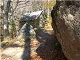 21
21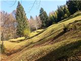 22
22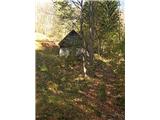 23
23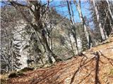 24
24 25
25 26
26 27
27 28
28 29
29 30
30 31
31 32
32 33
33 34
34 35
35 36
36 37
37 38
38 39
39 40
40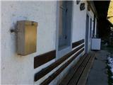 41
41 42
42 43
43 44
44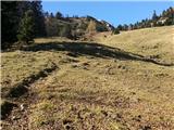 45
45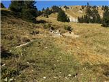 46
46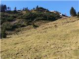 47
47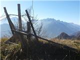 48
48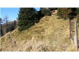 49
49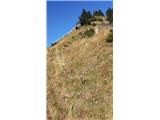 50
50 51
51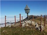 52
52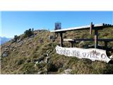 53
53 54
54
Discussion about the trip Hrušica - Rosenkogel/Hruški vrh (via Češnjevec and Hruška planina)
|
| Jusk3. 06. 2020 |
On Hruška planina and higher on Rožca and Hruški vrh full of various colorful flowers, there are still some narcissus on Rožca. I didn't hike this trail exactly as described, but went via Rožca to the top. Nice, quiet, no people, at least today it was like that
|
|
|
To post a comment you must log in:
If you do not yet have a username, you must first
register.