Starting point: Hudajužna (385 m)
| Latitude/Longitude: | 46,17470°N 13,91510°E |
| |
Walking time: 3 h 15 min
Difficulty: easy marked way
Elevation gain: 1245 m
Elevation difference along the route: 1245 m
Map: Julijske Alpe - vzhodni del 1:50.000
Recommended equipment (summer):
Recommended equipment (winter): ice axe, crampons
Views: 28.332
 | 2 people like this post |
Access to starting point:
From Most na Soči we go towards Idrija. In Bača pri Modreju we turn left in the direction of Podbrdo. We drive through the villages Klavže, Kneža and Grahovo, and after Koritnica we arrive in Hudajužna. Roughly 50 meters before the sign which marks the end of the village, on the right we notice a small bridge over the river Bača. Immediately after we cross it, on the left we notice a space where we can park the car.
Route description:
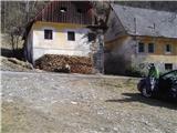
From the parking lot we go under the railway underpass and after a few steps we come upon a decaying house, where the marking for Porezen is clearly visible. We follow the torrent, above which runs a poorly visible and quite worn-out path. After a few moments the path brings us to the remains of a bridge (three pieces of iron), from where we walk along the bed of the torrent for approximately another hundred meters, then on the right side we notice a pile of fallen trees and above it markings. When we manage to climb above the torrent, the path improves and the markings are more frequent from here on.
Further walking brings us to an old house, where the path turns in another direction. It begins with a moderate ascent that brings us to the ridge. For a while we walk along the ridge, past almost collapsed structures, then we ascend steeply and reach the summit of Durnik.
Along the varied ridge we continue towards the east, past Robija vrh, until we reach the edge of the plateau, where a magnificent view opens up to the south. The path through the spruce forest leads right above the southern edge of the plateau, until we emerge from the dense forest and join the path that comes from Podbrdo. After a few steps we are again at a trail junction, where we keep left. To the summit there remain the last hundred elevation meters of walking along the ridge.

Along the route: Durnik (1152m)
The trip can be extended to the following destinations: Dom na Poreznu
Photos:
 1
1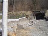 2
2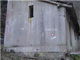 3
3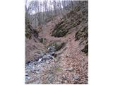 4
4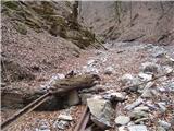 5
5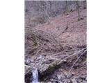 6
6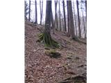 7
7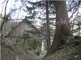 8
8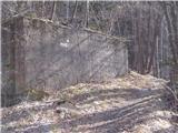 9
9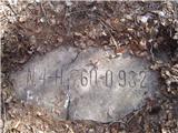 10
10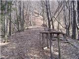 11
11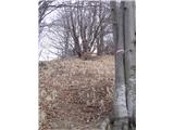 12
12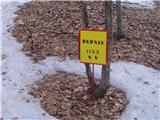 13
13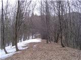 14
14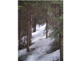 15
15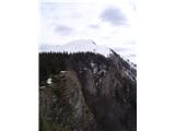 16
16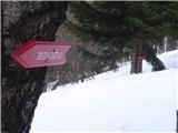 17
17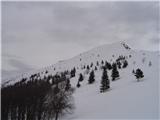 18
18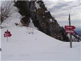 19
19 20
20
Discussion about the trip Hudajužna - Porezen
|
| marinka673. 08. 2014 |
If we start from the railway station, is it close? We would arrive by train from Boh. Bistrica. Can we start from Podbrd already, if something is marked? Unfortunately we don't know these beautiful places at all. How much walking to Porezen summit? Thanks.
|
|
|
|
| marinka677. 08. 2014 |
Miri, thanks, I know that myself too, but I'm interested if there is a marked path from PODBRDO, you probably meant Petrovo brdo?
Thanks again.
|
|
|
|
| valerija1127. 08. 2014 |
Marinka, there is also a marked path from Podbrdo to Porezen. You start near the railway station.
Safe steps and plenty of enjoyment.
|
|
|
|
| valerija1127. 08. 2014 |
Adding, the approximate walking time Podbrdo - hut on Porezen is 3 hours.
|
|
|
|
| marinka6711. 08. 2014 |
Thanks, great. So we'll combine two experiences: train ride through the tunnel and ascent to Porezen. Great for kids and big "kids"! 
|
|
|
|
| LidijaJesih17. 01. 2016 |
The markings on the hut in picture 3 are repainted, the path through the gully is difficult to pass. Immediately after the passage from picture 2, a steep trail rises to the right leading to the ridge and if followed joins the marked path after about half an hour. This change is not specially marked anywhere, a local woman at the starting point said.
|
|
|
|
| Matjaž6093. 01. 2020 |
The approach from Hudajužna to Porezen has changed. The approach at the railway station is being abandoned, no longer maintained. Across the Bača river, you need to go where the sign for Zakojca is. After a few hundred meters, new markings that coincide with marathon markings. The new path later joins the old one that goes over Durnik.
|
|
|
|
| Lapuh20719. 09. 2021 16:06:04 |
We used yesterday's nice afternoon to climb from this starting point in Hudajužna to Durnik (1152m); for more, darkness would already catch us. The new approach mentioned above by Matjaž starts in lower Hudajužna, less than a kilometer from the railway station along Bača downhill. But we checked the variant mentioned above by Lidija, and we didn't regret it. 100m after passing under the railway (right near the station) in the gully, still before the building in picture no. 3, a path branches sharply to the right into considerable steepness, but soon reaches the ridge. Now sharply left and straight up through a small meadow into the forest, where a path winds, actually several paths. You can also follow the poles of the power line, and soon you reach the abandoned farm Na Rovtu. Above the farm, continue straight up on a poorly visible path in the forest and a little below the ridge you reach the marked path along which the mountain marathon of four municipalities runs. Forests, steep slopes, desolation, peace, beautiful views. I'll upload some photos to the forum. We met no one.
|
|
|
To post a comment you must log in:
If you do not yet have a username, you must first
register.