Iličev rovt / Illitsch Rauth - Kamnica (Komnica) / Ferlacher Spitze
Starting point: Iličev rovt / Illitsch Rauth (1180 m)
| Latitude/Longitude: | 46,52390°N 13,95130°E |
| |
Walking time: 1 h 35 min
Difficulty: easy marked way
Elevation gain: 562 m
Elevation difference along the route: 562 m
Map:
Recommended equipment (summer):
Recommended equipment (winter): ice axe, crampons
Views: 1.480
 | 1 person like this post |
Access to starting point:
Through the Karawanks Tunnel, we drive to Austria, and then we drive on the highway towards Beljak, which we leave at the first exit Kot / Winkl. When we reach the main road through Rož / Rosental, we continue right in the direction of Baško jezero / Faaker See. On the main road we drive for a few kilometers, and then at the beginning of the settlement Spodnje Dobje / Unteraichwald, we continue quite sharply left onto the local road, by which there are signs (signs are from the opposite direction and harder to notice from our side) for Kepa / Mittagskogel, Koča Berta / Bertahütte and Kopanje / Kopein (we leave the main road about 200 meters before Hotel Mittagskogel). Further on, we first still drive on the asphalt road, which we follow at the crossroads in the direction of Koča Berta hut. Higher up, the macadam road becomes quite bad, but we drive on it to the marked parking lot on Iličev rovt / Illitsch Rauth. If the road seems too bad to us, we can park already lower, at a suitable spot beside the road.
Route description:
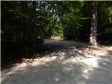
From the parking lot, we continue to the gate, and behind it, the path splits. We choose the left path, which goes into the forest (straight path on the road) and gradually starts to ascend steeply. Soon a path from the lower starting point joins us from the left, and we continue the ascent. Higher, we twice temporarily step onto the road, and then we continue on the footpath towards Koča Berta hut. Further, the path turns a little to the right and gradually becomes less steep. When we step out of the forest, we already see Koča Berta hut in front of us, to which only a short walk remains.
From the hut, we continue in the direction of Kamnica and quite quickly start to ascend quite steeply, mostly through the forest. Higher, the path temporarily flattens, then becomes steep again, and occasionally some views open up onto Kepa and the Julian Alps. A little below the summit, the path flattens once again, or even descends for a few steps, and then we quickly arrive at the panoramic summit.
Iličev rovt - Koča Berta 0:55, Koča Berta - Kamnica 0:40.
Description and pictures refer to the condition in 2018 (August).

Photos:
 1
1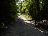 2
2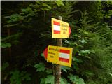 3
3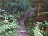 4
4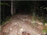 5
5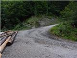 6
6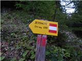 7
7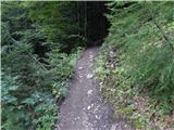 8
8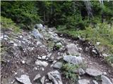 9
9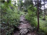 10
10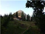 11
11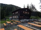 12
12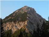 13
13 14
14 15
15 16
16 17
17 18
18 19
19 20
20 21
21 22
22 23
23 24
24 25
25 26
26
Discussion about the trip Iličev rovt / Illitsch Rauth - Kamnica (Komnica) / Ferlacher Spitze
To post a comment you must log in:
If you do not yet have a username, you must first
register.