Starting point: Ilovec (1162 m)
| Latitude/Longitude: | 46,32800°N 14,02750°E |
| |
Walking time: 25 min
Difficulty: easy unmarked way
Elevation gain: 103 m
Elevation difference along the route: 115 m
Map: TNP 1:50.000
Recommended equipment (summer):
Recommended equipment (winter):
Views: 4.210
 | 1 person like this post |
Access to starting point:
A) From Bled or Jesenice we drive to Pokljuka, then, once we are already on the plateau, we turn left in the direction of Bohinj. Further on, we drive along the road towards Gorjuše, between road signs 4.5 and 5 km, on the left we notice a cart track and by it signs for Galetovec. At the starting point, there are no arranged parking spots.
B) From Železniki or Podbrdo we drive to Bohinjska Bistrica, then we continue driving in the direction of Bled. Soon after the Petrol gas station, which is located just a little after Bohinjska Bistrica, we continue driving left in the direction of Pokljuka and Jereka. Further on, the road first ascends steeply, then after Korita gradually flattens and brings us to a crossroads by the bus stop, where we continue right in the direction of Pokljuka, Koprivnik and Jereka (straight Srednja vas). Immediately after the crossroads we arrive in Jereka, and from the crossroads in front of the church we continue straight towards Pokljuka (left Podjelje). After Jereka the road again starts to ascend more steeply, higher it flattens and continues along the Mrzli potok, where the road to Koprivnik v Bohinju branches off to the left, and we continue straight towards Pokljuka and Gorjuše. After Gorjuše the road passes into the forest, and we drive along it to the road sign between 5 and 4.5 km, where on the right we notice a cart track and by it signs for Galetovec. At the starting point, there are no arranged parking spots.
Route description:
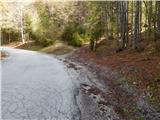
From the main road the signs for Galetovec lead us onto a cart track, which immediately splits into two parts. We continue on the right one, or also the left, as after the initial ascent the cart tracks quickly join. The path further leads us past a smaller landmark, then further on a gently sloping cart track brings us out of the forest, where we reach the edge of the mountain pasture Ilovec. Here we continue straight, somewhat downhill, to the nearby shepherd hut, where from the right the path from Bohinjska Bela also joins - path over the mountain pasture za Jamo.
From the shepherd hut onwards we ascend on a worse cart track, which takes us to the upper part of the mountain pasture, where the path splits once again.
We can continue right, or continue straight and go right in the direction of Galetovec at the next marked junction. After a short ascent both paths join, and we then reach the panoramic Galetovec through a belt of forest.
Description and pictures refer to the condition in the year 2017 (May).

Photos:
 1
1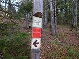 2
2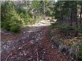 3
3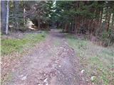 4
4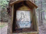 5
5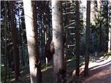 6
6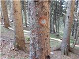 7
7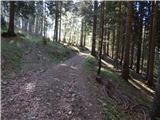 8
8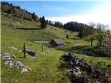 9
9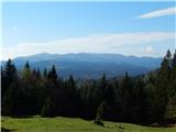 10
10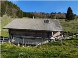 11
11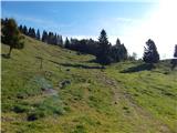 12
12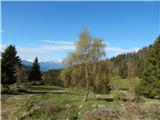 13
13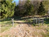 14
14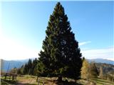 15
15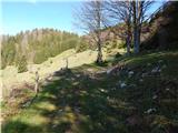 16
16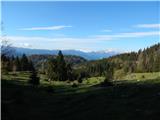 17
17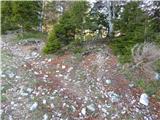 18
18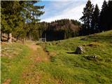 19
19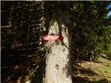 20
20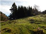 21
21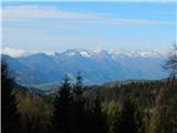 22
22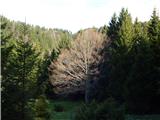 23
23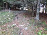 24
24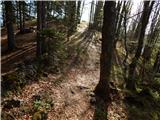 25
25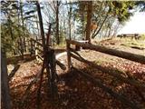 26
26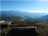 27
27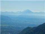 28
28
Discussion about the trip Ilovec - Galetovec
To post a comment you must log in:
If you do not yet have a username, you must first
register.