Starting point: Iška (337 m)
| Latitude/Longitude: | 45,93100°N 14,51550°E |
| |
Walking time: 2 h 10 min
Difficulty: easy marked way
Elevation gain: 770 m
Elevation difference along the route: 785 m
Map: Ljubljana - okolica 1:50.000
Recommended equipment (summer):
Recommended equipment (winter):
Views: 85.726
 | 3 people like this post |
Access to starting point:
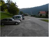
From the southern Ljubljana bypass, we head to the exit for the industrial zone Rudnik, and then we continue driving in the direction of Ig. At the main roundabout on Ig we continue "right" (direction Iški Vintgar and Iška vas), and then we continue on the main road towards Iški Vintgar. Immediately after Iška vas we arrive in the village Iška, where just before the intersection, where the road branches off sharply to the right towards Gornji Ig and Rakitna, we park on the parking lot by the road.
Route description:
At the crossroad in the immediate vicinity of the starting point we continue straight in the direction of the footpath to Krim. At first, we walk on an asphalt road towards Iški Vintgar, and then the blazes direct us to the right onto a cart track which bypasses the local residential house on the right side. Immediately after the house the path turns slightly left and starts ascending diagonally through the forest. Further on, we ascend diagonally for quite some time, and then at the cross the path turns a little to the right, where after a few minutes it brings us to the edge of the forest. Here the path turns left and continues through the forest. Only a little further, we bypass a lonely hut, behind which we step onto a macadam road.
Here the "demanding" path from Iški Vintgar joins from the left, and we continue on the road, which we follow in the direction of Krim at the next few successive crossroads.
At the cave Velika Pasica we leave the asphalt and continue to Krim first on a macadam road and higher on a cart track. The cart track a little higher (at the power line) crosses a wider macadam road, behind which it starts to ascend a little steeper. After a few minutes of moderate ascent we arrive at a marked junction, where we continue "straight" in the direction of Krim (left Iški Vintgar - normal path, right Strahomer).
The path ahead starts to ascend quite steeply along a partly rocky cart track, which we follow all the way to the road that leads to Krim. Here we cross the road and past a cross and military structures ascend to the mountain hut on Krim in less than 5 minutes.

Along the route: Gornji Ig (636m)
Photos:
 1
1 2
2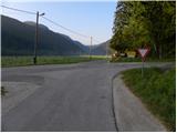 3
3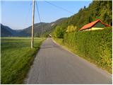 4
4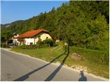 5
5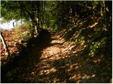 6
6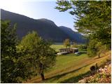 7
7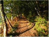 8
8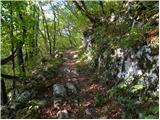 9
9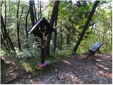 10
10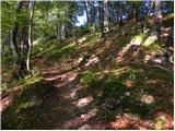 11
11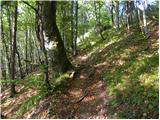 12
12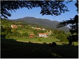 13
13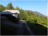 14
14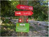 15
15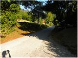 16
16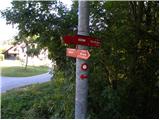 17
17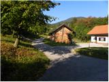 18
18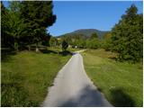 19
19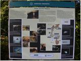 20
20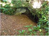 21
21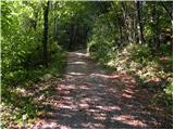 22
22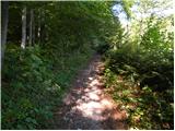 23
23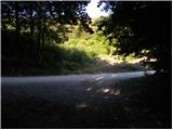 24
24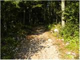 25
25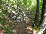 26
26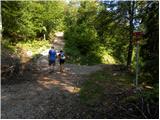 27
27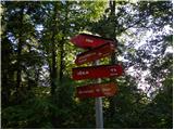 28
28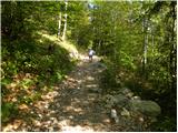 29
29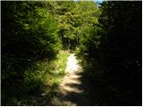 30
30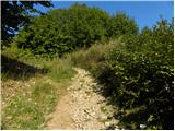 31
31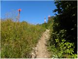 32
32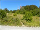 33
33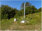 34
34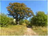 35
35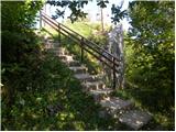 36
36 37
37
Discussion about the trip Iška - Krim
|
| zokipoki12. 08. 2014 |
very enjoyable ascent... it always surprises me again with the fitness demands of the last 30 min before the summit  .. no slacking... I like going to Krim.. recommend... .. no slacking... I like going to Krim.. recommend...
|
|
|
|
| Mikens23. 06. 2019 |
IMPORTANT!
I ask all hikers to keep their dogs on a leash! (bear area.)
Nice hunting regards.
Klement Mal, LD Tomišelj
|
|
|
|
| modrook1224. 05. 2020 |
Today first time on Krim. Trail without special features, markings ok, friendly staff. Trail suitable also for small children
|
|
|
|
| zajko31. 05. 2020 |
On 22.5.2020 at the "parking lot" Gornji Ig while resting I forgot my hiking boots. Please finder call tel. 041 881 148
|
|
|
|
| J.P.5. 04. 2021 17:13:14 |
From the starting point on pic 1 drive another 100m ahead, parking on the right. Currently free. LP
|
|
|
|
| exwannabe9. 04. 2021 15:31:24 |
J.P. I don't understand what you mean? That parking lot in picture 1 is always free. 100m ahead or back there is no parking lot.
|
|
|
|
| J.P.10. 04. 2021 18:23:10 |
Yes, further towards Vintgar. Gravel parking lot. Useful when crowded at the parking lot in picture 1. LP
|
|
|
|
| tomas10. 04. 2021 18:25:44 |
Yes it is. New parking lot is just under 200 meters ahead towards Vintgar on the right. And the path leads right at the beginning of the parking lot up and continues on the same path. It's free for now. How long still???
|
|
|
|
| exwannabe12. 04. 2021 09:54:01 |
Hm, this parking lot must be quite new, as I haven't spotted it yet, but I know there's another one much closer to Vintgar (about 2 km). I'd add a photo, but can't attach it here, so I'm putting it under conditions at this link. So if I understand correctly the parking lot is somewhere opposite the first farm from the junction towards Vintgar. https://www.hribi.net/trenutne_razmere/slo/krim/26/917
|
|
|
|
| Kafetarca14. 04. 2021 10:11:51 |
Wow, I hear this for the first time. If there is really free parking, that's great.
|
|
|
|
| julius14. 04. 2021 13:04:36 |
Kafetarca
The "free" gentleman died long ago. They buried him at the taxpayers' expense.
|
|
|
|
| tomas14. 04. 2021 17:09:49 |
Right after the first farm on the same side. The path is the same as from the first parking lot, only here you go a bit uphill right away and you're on the path. We no longer burden the farm owners.
|
|
|
|
| tomas3. 06. 2023 17:52:14 |
Yesterday a phone was found at the parking lot to Krim from Iška. Whoever misses it should contact me.
|
|
|
|
| Enka9. 02. 2024 11:57:28 |
The paid parking lot, which is now the starting point for the path from Iška, is regularly (daily) targeted by burglars. I advise against leaving the car at this parking lot, if you like your own car of course.
|
|
|
To post a comment you must log in:
If you do not yet have a username, you must first
register.