Ivarčko jezero - Dom na Uršlji gori (Grofovska pot)
Starting point: Ivarčko jezero (633 m)
| Latitude/Longitude: | 46,50660°N 14,96890°E |
| |
Route name: Grofovska pot
Walking time: 2 h 40 min
Difficulty: easy unmarked way
Elevation gain: 1047 m
Elevation difference along the route: 1047 m
Map: Koroška 1:50.000
Recommended equipment (summer):
Recommended equipment (winter): ice axe, crampons
Views: 2.000
 | 1 person like this post |
Access to starting point:
A) From the highway Ljubljana - Maribor, we take the exit Žalec, and then continue driving in the direction of Velenje, Mislinja and Slovenj Gradec. In Slovenj Gradec at the traffic light (traffic light at the store Lidl), we turn left, and then at the crossroads we follow the road in the direction of Ravne na Koroškem and Kotlje. From Slovenj Gradec, the road ascends for a few kilometers, and then descends to Kotlje, where at the crossroad we continue left towards Ivarčko jezero (right Ravne na Koroškem). Further, we follow a somewhat narrower road in the direction of Ivarčko jezero (also ski slope Ivarčko-Ošven), near which we park on one of the several arranged parking places.
B) From Koroška, we first drive to Ravne na Koroškem, and then continue driving towards the place Kotlje. From Kotlje onwards, we follow the signs for Ivarčko jezero and ski slope Ivarčko-Ošven. We park on the parking lot by the lake, or on the parking lot by the ski slope.
Route description:
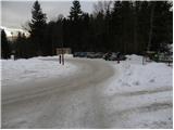
From the parking lot, we first walk to the nearby roundabout, from there we continue on the forest road, along which we notice signs for Uršlja gora - Železarska pot. For a short time we walk on the road, then after the small bridge we turn right onto the marked footpath, which ascends along the stream Uršeljca. Higher, the path steeply ascends for a short time, then flattens and brings us to the nearby road, which we follow to the left. The road then brings us below the farm Jurček to the crossroad by the NOB monument.
At the monument, we leave the marked path and continue on the left road, which we follow for approximately 500 m. After approximately 500 m we come to a smaller junction, where we step onto the Grofovska pot, which continues sharply to the right from the road.
We continue the ascent on the so-called Grofovska pot, which further ascends in zigzags across a relatively steep slope. Higher, we cross a smaller cart track, but we follow the forest path to the place where we step onto a wider cart track and follow it to the right. The cart track then quickly brings us to the "bife pod jelko", and we follow it in a moderate ascent mostly to the right. Higher, the cart track ends, and we continue on a somewhat steeper path for a short time, which quickly flattens and shortly afterwards joins the Železarska pot.
We continue past the spring and further the relatively gentle path quickly brings us to the place where the path from Poštarski dom joins from the left. We continue to the right and somewhat higher we step onto the macadam road, which we follow to the right. We walk along the road to the first left bend, where by the bench we notice the continuation of the mountain path. The path ahead first steeply ascends, then in a moderate ascent crosses increasingly panoramic slopes. Higher, the path turns somewhat more to the right and flattens even more. A few 10 m higher we step out of the forest, and we follow the increasingly panoramic path to the Dom na Uršlji gori.

Photos:
 1
1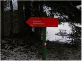 2
2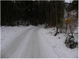 3
3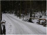 4
4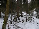 5
5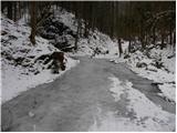 6
6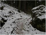 7
7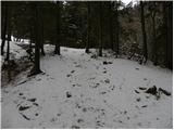 8
8 9
9 10
10 11
11 12
12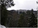 13
13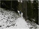 14
14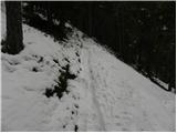 15
15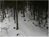 16
16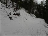 17
17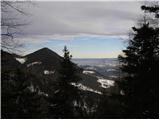 18
18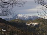 19
19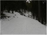 20
20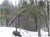 21
21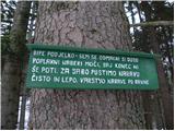 22
22 23
23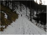 24
24 25
25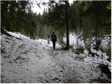 26
26 27
27 28
28 29
29 30
30 31
31 32
32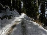 33
33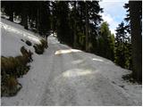 34
34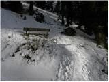 35
35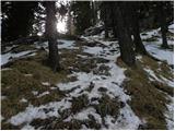 36
36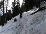 37
37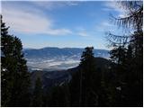 38
38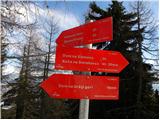 39
39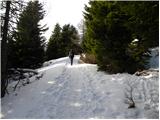 40
40 41
41 42
42 43
43 44
44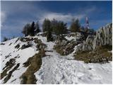 45
45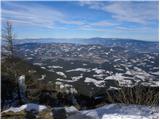 46
46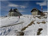 47
47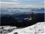 48
48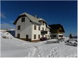 49
49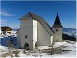 50
50
Discussion about the trip Ivarčko jezero - Dom na Uršlji gori (Grofovska pot)
To post a comment you must log in:
If you do not yet have a username, you must first
register.