Jablance - Skalica (Bohor) (via Travni laz)
Starting point: Jablance (500 m)
| Latitude/Longitude: | 46,04670°N 15,44540°E |
| |
Route name: via Travni laz
Walking time: 2 h
Difficulty: easy unmarked way
Elevation gain: 451 m
Elevation difference along the route: 550 m
Map: Posavsko hribovje Boč - Bohor 1:50.000
Recommended equipment (summer):
Recommended equipment (winter):
Views: 9.695
 | 2 people like this post |
Access to starting point:
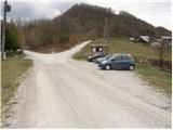
From Krško we drive towards Sevnica or vice versa. Soon after Krško, the road branches off to the right towards Brestanica (from Sevnica a little before Krško to the left). We follow this road ahead towards Senovo, where we notice the first signs for Bohor (in Senovo we turn left). The road, which then runs along the stream upwards, brings us higher to a poorly marked crossroad, where we continue slightly left upwards (the road which goes straight, still along the stream brings us to the mountain hut Koča na Bohorju. Our left road then makes two sharp turns and soon brings us out of the forest, where after additional 100 meters of driving, we park on a parking lot by the information board.
Route description:
From the parking lot, we continue on the left unmarked road, which after 10 minutes of walking brings us to the sharp left turn. In the middle of the turn, on the right along the stream upwards, a cart track branches off in the direction of the Ubijavnik waterfall. The cart track soon turns into a footpath, which several times crosses the mentioned stream and brings us after a while below the waterfall. Only a few meters before the waterfall, the path turns right and with the help of fixed safety gear steeply ascends. The ascent in dry conditions is not demanding, but it is exposed to falling stones. At the top of this ascent we step onto the road, where we continue left. After a few additional minutes of walking, the increasingly poor road crosses the stream (before the bridge to the right - mountain hut Koča na Bohorju). Here we continue on the cart track, which ascends along the stream upwards. The increasingly steep cart track soon brings us to the next junction, where we continue left in the direction of the hospital (right - mountain hut Koča na Bohorju). The path ahead crosses a torrent stream and in a short diagonal ascent brings us to the partisan hospital on Travni laz.
From the hospital we continue in the direction of Javornik, on a marked path, which moderately ascends through the forest. After a short ascent, we step on the forest road, which we follow to the left, still towards Javornik. The road on which we walk brings us after approximately 15 minutes of walking to a junction, where the path to Javornik - Bohor branches off to the right upwards. Here we continue on the road in the direction of Lisca to the next crossroad, where we leave the road and continue on a cart track in the direction of Lisca. The path ahead first slightly ascends through the forest and then in a gentle descent crosses a larger clearing, behind which we arrive on an indistinct ridge of Bohor. The cart track then brings us past a cross to the next junction, where we continue right downwards in the direction of Skalica. After a short descent, we cross the forest road and then in a moderate ascent, in a few minutes ascend to the summit of Skalica.

Along the route: Slap Ubijavnik (680m), Partizanska bolnica (800m)
Photos:
 1
1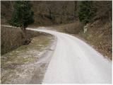 2
2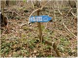 3
3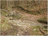 4
4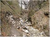 5
5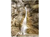 6
6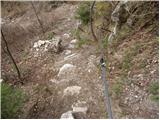 7
7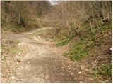 8
8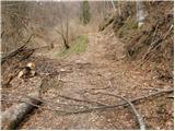 9
9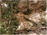 10
10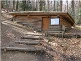 11
11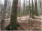 12
12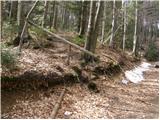 13
13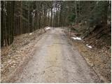 14
14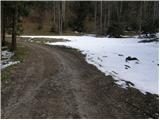 15
15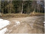 16
16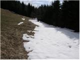 17
17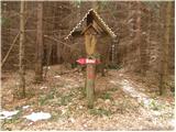 18
18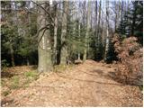 19
19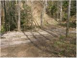 20
20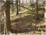 21
21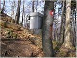 22
22 23
23
Discussion about the trip Jablance - Skalica (Bohor) (via Travni laz)
|
| Arafat7624. 01. 2010 |
Please, moderator, correct the path description right at the beginning, because Brestanica is not a village, let alone a place. And Senovo is a village; time to check 4th grade elementary school. Disaster. And Senovo is a village; time to check 4th grade elementary school. Disaster.
|
|
|
|
| 75'er22. 08. 2014 |
In ideal weather, from Skalica, or rather from the ridge below the summit, there is a nice view stretching from Snežnik, Krn in the Julians, over Triglav to the Kamnik Alps, Ojstrec (Hoch Obir) in Austria, and Raduha.
Snežnik, Julijci, Kum, Kamniške z vrha.
Od Julijcev do Raduhe.
Bližnja okolica.
|
|
|
To post a comment you must log in:
If you do not yet have a username, you must first
register.