Jakobe - Končnikov vrh (easy path)
Starting point: Jakobe (1410 m)
Starting point Lat/Lon: 46.4784°N 14.7999°E 
Path name: easy path
Time of walking: 2 h 45 min
Difficulty: easy marked way
Difficulty of skiing: no data
Altitude difference: 699 m
Altitude difference (by path): 825 m
Map: Kamniške in Savinjske Alpe 1:50.000
Access to starting point:
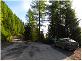
A) We drive to Črna na Koroškem, and then we follow the signs for Koprivna and Podpeca. For some time we drive by the river Meža, we then go at a crossroad right in the direction of Podpeca, Dom na Peci and Koča na Pikovem. In Podpeca asphalt ends, and we follow the signs for mountain hut Dom na Peci. Higher, on a saddle Vrh šteng, from the right joins also the road from Mežica, we still follow the signs for Dom na Peci, in some parts we also notice signs "avtocesta" (highway). We continue driving on a macadam road, in last crossroad we follow the signs for a parking lot. The mentioned road, we follow to its end, where we park on a parking lot Jakobe.
B) We drive to Luče (to here from Mozirje or from Kamnik over mountain pass Volovljek (Kranjski Rak)), and then we continue driving towards Logarska dolina. In the village Solčava we leave the main road towards Logarska dolina and we continue driving right in the direction of Podolševa, mountain pass Spodnje Sleme and Črna na Koroškem. Further road loses an asphalt covering, and after few kilometers at the crossroad in Podolševa we turn right towards Črna na Koroškem. The road which is further mostly ascending diagonally, eventually brings us to mountain pass Spodnje Sleme. From the mountain pass the road starts descending, and we follow it in the direction of Črna na Koroškem. When after few kilometers we descend to the valley, at the crossroad we turn right towards Črna na Koroškem (left Koprivna). On the main road we are descending towards Črna na Koroškem, and the road at first leads past the turn off into a valley Tople, a little lower also to the turn-off of the road towards Podpeca, Koča na Pikovem and Dom na Peci. We continue on the mentioned road which quickly brings us in Podpeca. In Podpeca asphalt ends, and we follow the signs for mountain hut Dom na Peci. Higher, on a saddle Vrh šteng, from the right joins also the road from Mežica, we still follow the signs for Dom na Peci, in some parts we also notice signs "avtocesta" (highway). We continue driving on a macadam road, in last crossroad we follow the signs for a parking lot. The mentioned road, we follow to its end, where we park on a parking lot Jakobe.
C) We drive to Mežica, where we follow the signs for Peca. Further, we drive towards the border crossing Mežica, and still before the border crossing we turn left on the road in the direction of Peca. Higher, on a saddle Vrh šteng, from the left joins also the road from Podpeca, and we follow the signs for Dom na Peci, in some parts we also notice signs "avtocesta" (highway). We continue driving on a macadam road, in last crossroad we follow the signs for a parking lot. The mentioned road, we follow to its end, where we park on a parking lot Jakobe.
Path description:
From the parking lot, we continue by following the signs Dom na Peci and we continue on a cart track right upward. After a short ascent, we come to a crossing, where we continue right and we are still ascending on a cart track. Cart track then gradually becomes less steep and we soon also leave it. Because blazes point us left on a footpath, on which we are then for some time ascending through the forest. The path through the forest then again brings us on a narrow cart track, where we continue right and in approximately 5 minutes of additional walking, we reach the mountain hut Dom na Peci.
From Dom na Peci we go on a footpath towards Mala Peca or on the path towards Kordeževa glava. After a little less than ten minutes of ascent both paths join, and we continue on a marked path, which further ascends on a meadow upwards and it brings us to a marked crossing.
We go to the right path in the direction of demanding path (which isn't difficult), and left leads very demanding path on Peca. The right path is easy and doesn't have any difficult spots! Our easier right path then past the bench soon brings us into dwarf pines, through which we are then ascending. Ascent ahead runs on a moderately steep slope with increasingly beautiful views. After some time, the path brings us on a grassy plain, where from the left joins the climbing path. Follows only the last ascent to the summit of Kordeževa glava, peak of which we reach after few minutes of additional walking, on an undemanding slope.
From Kordeževa glava we continue on a marked path which starts moderately descending towards the saddle Knipsovo sedlo. After approximately 20 minutes of descent we get to information boards on the mentioned saddle, where from the left joins the path from the valley Topla.
We continue straight on a moderately steep path, which only a little higher joins the marked path from the ski slope Peca / Petzen (ski slope on the Austrian side of the mountain). We continue the ascent on a panoramic slope, and the path after few minutes of additional walking brings us on with grass vegetated Končnikov vrh.
Pictures:
 1
1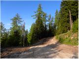 2
2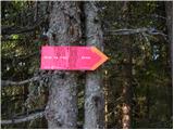 3
3 4
4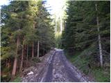 5
5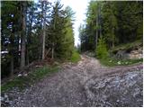 6
6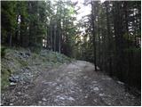 7
7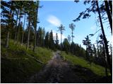 8
8 9
9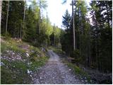 10
10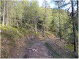 11
11 12
12 13
13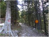 14
14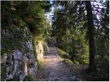 15
15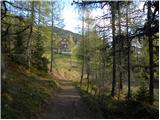 16
16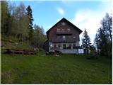 17
17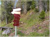 18
18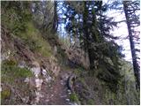 19
19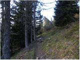 20
20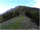 21
21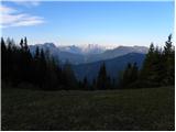 22
22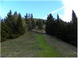 23
23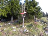 24
24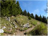 25
25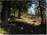 26
26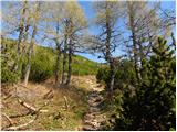 27
27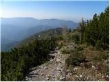 28
28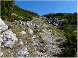 29
29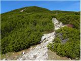 30
30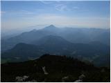 31
31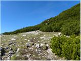 32
32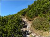 33
33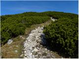 34
34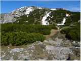 35
35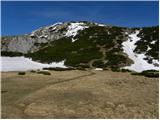 36
36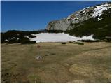 37
37 38
38 39
39 40
40 41
41 42
42 43
43 44
44 45
45 46
46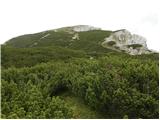 47
47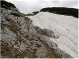 48
48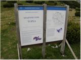 49
49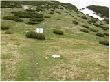 50
50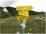 51
51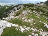 52
52 53
53