Jasna - Mojčin dom na Vitrancu (on ridge)
Starting point: Jasna (830 m)
| Latitude/Longitude: | 46,47530°N 13,78190°E |
| |
Route name: on ridge
Walking time: 2 h 15 min
Difficulty: easy marked way
Elevation gain: 725 m
Elevation difference along the route: 755 m
Map: Kranjska Gora 1:30.000
Recommended equipment (summer):
Recommended equipment (winter): ice axe, crampons
Views: 50.112
 | 2 people like this post |
Access to starting point:
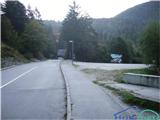
A) First, we drive to Kranjska Gora, and then we continue driving towards Vršič. Soon after Kranjska Gora ends, we cross the Pišnica river and just some 10 meters further we turn right onto a larger parking lot, where we park by Lake Jasna.
B) We drive to Trenta, and then over the Vršič pass we drive towards Kranjska Gora. When we arrive at Lake Jasna, we park on a large macadam parking lot by the lake (the parking lot is located on the left side of the main road).
Route description:
From the parking lot, we continue a few meters back towards Kranjska Gora to the dam at the power station, where we head onto the path which continues horizontally by the river. After a few meters, we cross the riverbed and the path brings us further into the forest, where already after a few meters of ascent we come to a junction at the bench.
We continue sharply left and a sign interrupts the path: path to Mala Pišnica CLOSED. We continue on this path which starts ascending steeply in zigzags. When the steepness eases we come to a fork, where the path to Mala Pišnica branches off to the left (this path is blocked), and to the right we follow the sign for Vitranc and Ciprnik. We continue straight upwards on a narrower and somewhat less visible path, which ascends steeply again. Just a few meters further, the path brings us to a vantage point, from which a nice view opens up on the Martuljek group of mountains. The path then ascends for a short time and then turns right, where with some ascents and descents it crosses slopes towards the Kranjska Gora ski slopes.
When the path in zigzags again steeply ascends, we come to the next fork, where the sign "Vitranc-Ciprnik" directs us left (straight leads the path towards the scree and further to the ski slopes). After the fork the path very steeply ascends and becomes harder to follow for some time. The steep ascent brings us from forested terrain to grassy slopes right below the rocky walls and continues steeply ascending. After some time by the path we notice a wooden arrow, which shows the path downwards by which we came. A few tens of meters later the steep path turns right and the still very steep ascent continues along the ridge.
After some time the ridge path leads past a rocky gully, which on the right opens a nice view on Kranjska Gora. Soon after the steepness eases a little and we come to a fork, where we can continue on the left path below the ridge or view the panorama from the ridge. Both paths join ten meters later, and the steepness of the ridge increases again. The last ten meters of ascent along the ridge leads through dense dwarf pines, then the path flattens. Then on the right we spot the pylon of the cargo cableway, which leads to Vitranc; after a few meters of gentle walking we come to a crossroads, where the path from Kranjska Gora joins from the left.
From the crossroads ahead awaits us around 300 meters of walking on the path which crosses the slope below the Dom na Vitrancu. Soon on the right we spot the abandoned Dom na Vitrancu and a few steps further the Mojčin dom na Vitrancu newly opened a few years ago.

Photos:
 1
1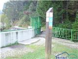 2
2 3
3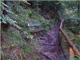 4
4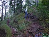 5
5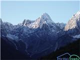 6
6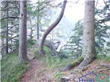 7
7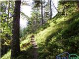 8
8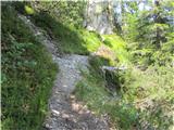 9
9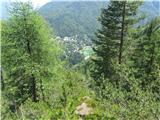 10
10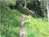 11
11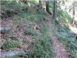 12
12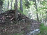 13
13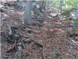 14
14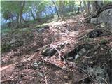 15
15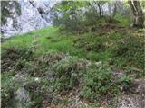 16
16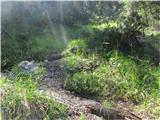 17
17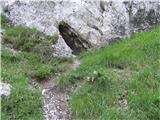 18
18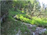 19
19 20
20 21
21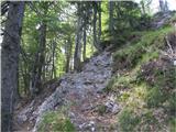 22
22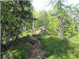 23
23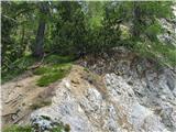 24
24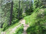 25
25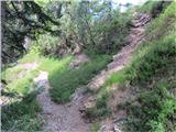 26
26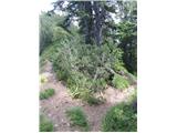 27
27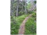 28
28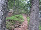 29
29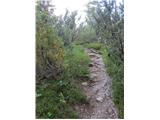 30
30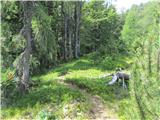 31
31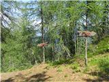 32
32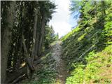 33
33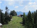 34
34
Discussion about the trip Jasna - Mojčin dom na Vitrancu (on ridge)
|
| Alessp7. 11. 2015 |
We just got back. The path is super marked, but in case of rain before, I would advise against it in autumn. Lots of roots and leaves can be a bit tricky. Otherwise the tour description is fine. But I'm not quite clear how this is classified as an easy tour. You do about 700m elevation gain in less than 2h. But great for recreation! We then extended to Ciprnik, which I absolutely recommend, and returned via ski slopes. All good, just watch the elevation if thinking about kids. Total adds up to 800-900m! Otherwise recommend!
|
|
|
|
| Daaam9. 11. 2015 |
@Alessp The classification of the hike doesn't depend on how many vertical meters you have to climb but on the technical difficulties. So, if on the path you don't need to use your hands, it's an easy trail regardless of length. On demanding trails, the first safety features appear (cables, pegs, staples) which are mostly just for better feeling and not necessarily needed for progress, whereas on very demanding trails their use is necessary.
|
|
|
|
| jana196620. 08. 2016 |
Today to Ciprnik from Jasna - a trip for enjoying nature, full praise to the staff at Mojčin dom for friendliness and service, return via Bedančev dom to Kranjska Gora, otherwise I agree with Alessp...Fairy tale
|
|
|
|
| prizup25. 04. 2018 |
The path Lake Jasna - Mojčin dom on Vitranc is snow-free. Mojčin dom on Vitranc is open!
|
|
|
|
| CarpeDiem24712. 03. 2021 |
Has anyone been there in the past few days? I'm interested in the conditions.
|
|
|
|
| Vrhovka28. 04. 2026 18:39:04 |
Trail without special features, very well marked and scenic. Encounter with a snake, so caution is advised. The hut was closed today descent via the ski slope. descent via the ski slope.
|
|
|
|
| michael6630. 04. 2026 13:25:25 |
I was there on Sunday. There is no snow, but the second half is quite steep. Mojčin dom is supposed to be closed until mid-June.
|
|
|
To post a comment you must log in:
If you do not yet have a username, you must first
register.