Jasna - Mojčin dom na Vitrancu (on ski slope)
Starting point: Jasna (830 m)
| Latitude/Longitude: | 46,47530°N 13,78190°E |
| |
Route name: on ski slope
Walking time: 2 h 30 min
Difficulty: easy unmarked way
Elevation gain: 725 m
Elevation difference along the route: 850 m
Map: Kranjska Gora 1:30.000
Recommended equipment (summer):
Recommended equipment (winter): ice axe, crampons
Views: 18.209
 | 1 person like this post |
Access to starting point:
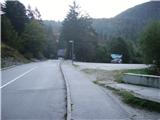
A) First, we drive to Kranjska Gora, and then we continue driving towards Vršič. Already soon after Kranjska Gora ends, we cross the Pišnica river and just some 10 meters further we turn right onto a larger parking lot, where we park by the lake Jasna.
B) We drive to Trenta, and then through the Vršič pass we drive towards Kranjska Gora. When we arrive at the lake Jasna we park on a large macadam parking lot by the lake (the parking lot is located on the left side of the main road).
Route description:
From the parking lot, we continue a few meters back towards Kranjska Gora to the dam at the power station, where we head onto the path which continues horizontally along the river. After a few meters, we cross the riverbed and the path brings us further into the forest, where already after a few meters of ascent we come to a junction at the bench.
We continue sharply left and the path is interrupted by the sign, path to Mala Pišnica CLOSED. We continue on this path which starts ascending steeply in zigzags. When the steepness eases we again notice the sign, path to Mala Pišnica CLOSED. Here we leave the path which leads to Mala Pišnica and turns left. We continue straight uphill on a poorly visible trail, which steeply ascends again. Just a few meters further the path brings us to a viewpoint, from which a nice view opens up on the Martuljek group of mountains. The path then ascends for a short time, higher it turns right, where with some ascents and descents it crosses the slopes towards Kranjska Gora ski slopes. This part of the path is slightly exposed in some places, but without major dangers. The trail, which is harder to follow in places, brings us to the ski slope just a few dozen meters above the summer sledding area. Further, we continue left uphill along the ski run (during the ski slope operation, walking is possible along the edge of the ski slope). The path further crosses the one-seater chairlift, which leads to the hut on Vitranc and brings us to the upper station of the four-seater chairlift in Podkoren.
Here we continue left uphill along the permanently closed ski run. The path a little higher withdraws from the ski slope into the forest, where it steeply ascends under the one-seater chairlift (the chairlift which leads to Vitranc has not been operating for several years). The path, which is quite steep in places, then brings us to the ridge, where on the left side we notice Mojčin dom na Vitrancu, which we reach in a few steps of further walking.

Photos:
 1
1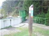 2
2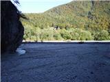 3
3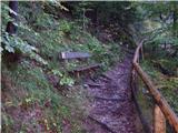 4
4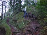 5
5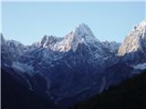 6
6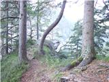 7
7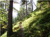 8
8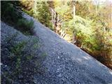 9
9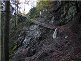 10
10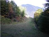 11
11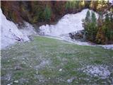 12
12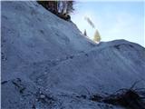 13
13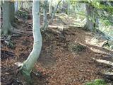 14
14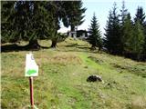 15
15 16
16
Discussion about the trip Jasna - Mojčin dom na Vitrancu (on ski slope)
|
| irska11. 07. 2011 |
Wow, this one is long  It really drags on, but if you want peace and quiet, you have more than enough at least until the single chairlift And the lady in the wooden hut-snack bar is seeeeery friendly, the guys at the single chairlift are too It really drags on, but if you want peace and quiet, you have more than enough at least until the single chairlift And the lady in the wooden hut-snack bar is seeeeery friendly, the guys at the single chairlift are too 
|
|
|
|
| LidijaJesih16. 05. 2015 |
This path is now also marked, next to the summer toboggan run there's a new friendly log cabin, Pri Bedancu.
|
|
|
|
| prizup10. 06. 2015 |
The path from Planica to Ciprnik-Vitranc, which until recently was full of fallen trees, is now cleared and nicely passable. Soon a tourist bus will run to Planica and it will be possible to make a nice circular tour along the ridge to Jasna.
|
|
|
To post a comment you must log in:
If you do not yet have a username, you must first
register.