Javorje - Mali Raskovec (via Lepa Suha)
Starting point: Javorje (1050 m)
| Latitude/Longitude: | 46,24960°N 13,86750°E |
| |
Route name: via Lepa Suha
Walking time: 3 h 30 min
Difficulty: difficult marked way, easy pathless terrain
Elevation gain: 896 m
Elevation difference along the route: 960 m
Map: TNP 1:50.000
Recommended equipment (summer):
Recommended equipment (winter): ice axe, crampons
Views: 745
 | 1 person like this post |
Access to starting point:
From the Ljubljana-Jesenice highway, take the Lesce exit and follow the road towards Bled and then towards Bohinjska Bistrica and Lake Bohinj. After the settlement Laški Rovt, we will arrive at a smaller crossroads, where the road leading towards the starting points of the paths to Rodica, mountain pasture Suha, Šija, Vogel... and the scout camp Laški Rovt branches off to the left. The macadam road immediately enters the forest and first ascends past the mentioned scout camp, and then ascends relatively steeply for a few kilometres. After a little less than 6.5 km of driving on macadam, we will arrive at a somewhat larger crossroads, where the road towards mountain pasture Planina Storeča raven (starting point of the path to Vogel) branches off to the right. Here we continue straight and after approximately 50 m of additional driving, we arrive at the left turn, where the starting point of the path towards Planina Suha is. We park on an appropriate place by the road.
Route description:
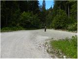
From the starting point, we continue on the marked mountain path in the direction of Planina Suha. The path first ascends beside a torrent, then turns right, where for a short time it ascends gently through the forest. After a few minutes of easy walking, the path turns left and starts to ascend steeply across a steep slope. During the steep ascent, a nice view opens up towards the north for a while, then the path flattens again. This is followed by a few minutes of gentle walking, then the blazes direct us slightly left onto a path that starts to ascend somewhat more steeply, crossing the slopes to the right. Higher up, we cross the torrent once again, then ascend beside it to the lower edge of Planina Suha, where we also exit the forest. From there, only a short moderate ascent follows, and the path brings us to the central part of the mountain pasture, where a few shepherd huts stand.
From the mountain pasture, we continue past a shepherd hut beside the deposit of torrential gravel. In places a very poorly visible path in the upper part of the mountain pasture turns slightly left. Further on, the path, which starts to turn slightly right, is much easier to follow. After a short ascent, we bypass the hunting hut, which we notice on the right side.
The path then starts to ascend more steeply up the slope, which is partly overgrown with dwarf pines. This increasingly scenic path brings us higher to a somewhat larger cairn, where there is a junction (straight ahead marked path to the saddle Čez Suho, left unmarked path over Lepo Suho).
We continue left along an initially poorly visible path, which for a short time crosses to the left, then starts to ascend moderately across increasingly panoramic slopes. The path continues by ascending transversely across a few smaller depressions, then passes onto steep slopes, which we continue to cross in the same direction. The slope soon flattens, and the path brings us into a small but distinct depression west of Mala Rodica. Further on, we ascend gently along an increasingly poorly visible path that continues along the torrent gully of the aforementioned depression. During the ascent through the depression, we can observe the expansive grassy slopes of Lepa Suha, but we no longer follow the path, instead proceeding over easier pathless terrain. Throughout the ascent, we follow the left "branches" of the torrent, and the increasingly steep "path" brings us to a grassy ridge, where we approach the marked path completely. Here we continue left and proceed with the ascent along a well-followable but unmarked path, by which we ascend to an indistinct saddle between Mala Rodica on the left and Rodica on the right. Here we continue right and after a good 5 minutes of further ascent along an increasingly panoramic ridge, we arrive at the summit.
From the summit of Rodica, we continue along the ridge in the direction of Črna prst. The path first descends along the ridge, then passes onto the southern slopes, where a few metres below the ridge it crosses occasionally quite steep slopes. The very panoramic path at the foot of Suha Rodica (Novi vrh) passes onto shady slopes, where it crosses the slopes of the aforementioned summit (snow patch that persists until the start of summer). When the path returns to the main ridge, we leave the marked path and continue left, slightly downhill along the left side of the sinkhole that we see between the two Raskovci. When we approach the dwarf pines, we detour to the right, then head straight up the steep grassy slope. After 20 minutes of walking over pathless terrain, we reach the panoramic Mali Raskovec.
Javorje - Planina Suha 1:00, Planina Suha - Rodica 1:30, Rodica - Mali Raskovec 1:00.

Photos:
 1
1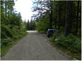 2
2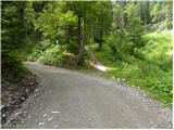 3
3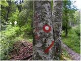 4
4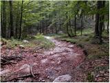 5
5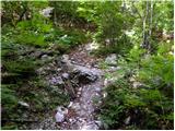 6
6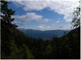 7
7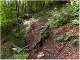 8
8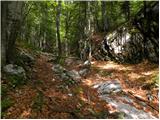 9
9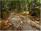 10
10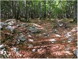 11
11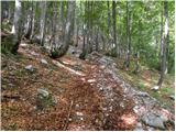 12
12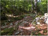 13
13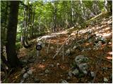 14
14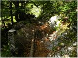 15
15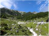 16
16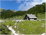 17
17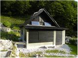 18
18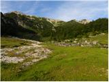 19
19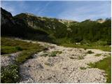 20
20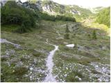 21
21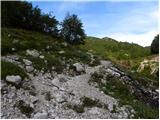 22
22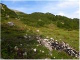 23
23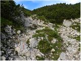 24
24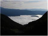 25
25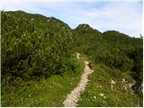 26
26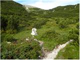 27
27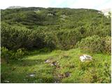 28
28 29
29 30
30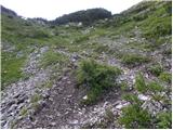 31
31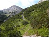 32
32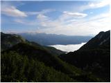 33
33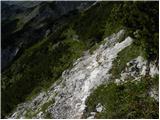 34
34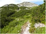 35
35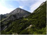 36
36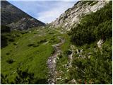 37
37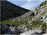 38
38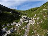 39
39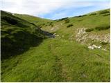 40
40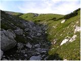 41
41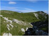 42
42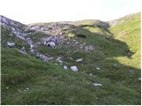 43
43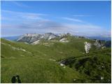 44
44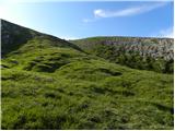 45
45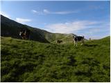 46
46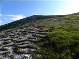 47
47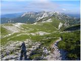 48
48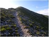 49
49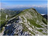 50
50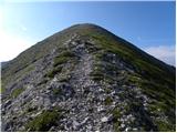 51
51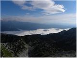 52
52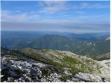 53
53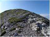 54
54 55
55 56
56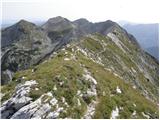 57
57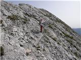 58
58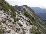 59
59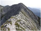 60
60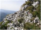 61
61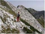 62
62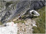 63
63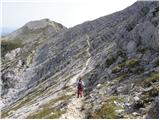 64
64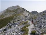 65
65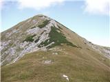 66
66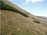 67
67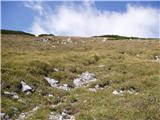 68
68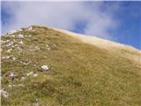 69
69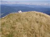 70
70
Discussion about the trip Javorje - Mali Raskovec (via Lepa Suha)
To post a comment you must log in:
If you do not yet have a username, you must first
register.