Javorje - Raskovec (via Rodica)
Starting point: Javorje (1050 m)
| Latitude/Longitude: | 46,24960°N 13,86750°E |
| |
Route name: via Rodica
Walking time: 3 h 45 min
Difficulty: difficult marked way, easy pathless terrain
Elevation gain: 917 m
Elevation difference along the route: 1050 m
Map: TNP 1:50.000
Recommended equipment (summer):
Recommended equipment (winter): ice axe, crampons
Views: 5.457
 | 1 person like this post |
Access to starting point:
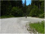
From the highway Ljubljana - Jesenice, we take the Lesce exit and follow the road towards Bled and further towards Bohinjska Bistrica and Bohinj Lake. After the settlement Laški Rovt, we will get to a smaller crossroad, where the road which leads towards the starting points of the paths on Rodica, mountain pasture Suha, Šija, Vogel... and scout camp Laški Rovt branches off to the left. The macadam road immediately enters the forest and first ascends past the mentioned scout camp, and then ascends relatively steeply for a few kilometres. After a little less than 6.5 km of driving on macadam, we will get to a somewhat bigger crossroad, where the road towards mountain pasture Planina Storeča raven (starting point of the path to Vogel) branches off to the right. Here we continue straight and after approximately 50 m of additional driving we arrive at the left turn, where the starting point of the path towards Planina Suha is. We park at an appropriate place by the road.
Route description:
Near the parking lot, on the west side of the torrent we notice a marked footpath which leads towards Planina Suha. The path initially ascends on the right side of the torrent, and then joins it. After a few steps of walking on the torrential gravel, the marked path turns to the right and levels out completely. The gentle walk is quickly interrupted by a steep ascent over a relatively steep slope. The steepness then eases somewhat and the well-marked path leads us through dense forest on and beside the torrent upwards. A little higher, the marked path withdraws from the torrent to the left and after a few minutes joins it again. The path, which then runs on the right side of the torrent, soon brings us out of the forest onto the expansive Planina Suha.
From the Planina we continue past the shepherd hut beside the deposits of torrential gravel. Occasionally very poorly visible trail in the upper part of the Planina turns slightly left. Further on, the path, which starts to turn slightly to the right, is much easier to follow. After a short ascent, we bypass the hunting cottage, which we notice on the right side.
The path then starts to ascend more steeply on the slope which is partly overgrown with dwarf pines. This increasingly scenic path brings us higher to a somewhat larger cairn, where there is a junction (straight marked path to saddle Čez Suho, left unmarked path over Lepo Suho).
We continue straight on the marked path, which ascends between dwarf pines and rare trees. Higher up the trees disappear and the path reaches a sinkhole below the saddle Čez Suho. The path bypasses it on the left side and soon after brings us to the junction at saddle Čez Suho. Here stands an old military bunker on which there are signposts.
We turn left onto a wide scenic grassy ridge. The path here is not steep but has a few short descents. Soon the scenic path brings us to the summit pyramid of scenic Rodica.
We continue slightly right (left unmarked path) on the marked path, to which a little higher the path from Ruta also joins. There follow a few minutes of walking to the summit of Rodica along the indistinct summit ridge.
From the summit of Rodica we continue along the ridge in the direction of Črna prst. The path first starts descending along the ridge, then passes to the south slopes, where just a few metres below the ridge it crosses occasionally quite steep slopes. The very scenic path at the foot of Suha Rodica passes to shady slopes, where it crosses the slopes of the mentioned summit (snow patch which persists until the start of summer). When the path returns to the main ridge, we leave the marked path and continue along the ridge (southwest ridge of Raskovec) beside which we notice a very poorly visible trail, which brings us to the summit in 10 minutes of ascent along the summit slope.
Javorje - Planina Suha 1:00, Planina Suha - Rodica 1:45, Rodica - Raskovec 1:00.

Photos:
 1
1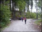 2
2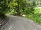 3
3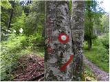 4
4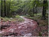 5
5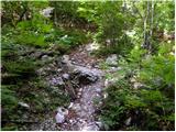 6
6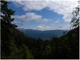 7
7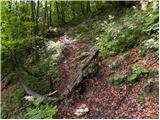 8
8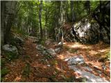 9
9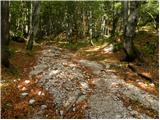 10
10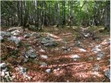 11
11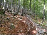 12
12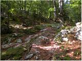 13
13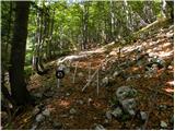 14
14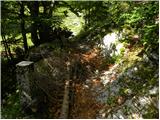 15
15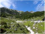 16
16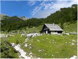 17
17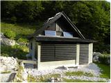 18
18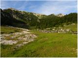 19
19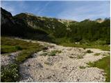 20
20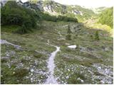 21
21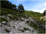 22
22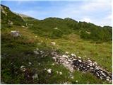 23
23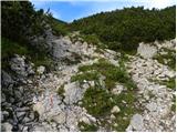 24
24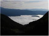 25
25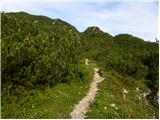 26
26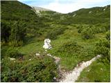 27
27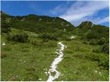 28
28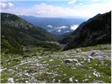 29
29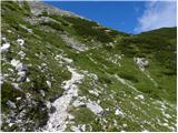 30
30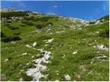 31
31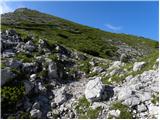 32
32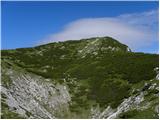 33
33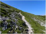 34
34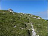 35
35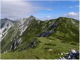 36
36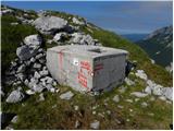 37
37 38
38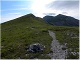 39
39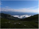 40
40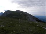 41
41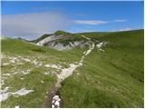 42
42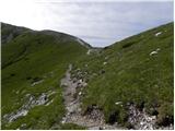 43
43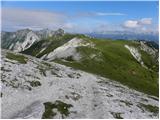 44
44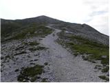 45
45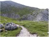 46
46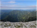 47
47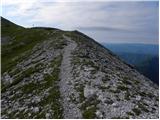 48
48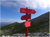 49
49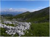 50
50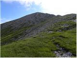 51
51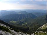 52
52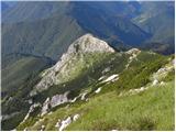 53
53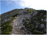 54
54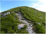 55
55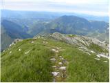 56
56 57
57 58
58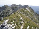 59
59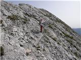 60
60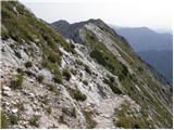 61
61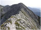 62
62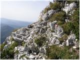 63
63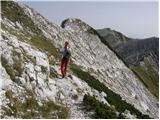 64
64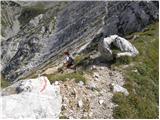 65
65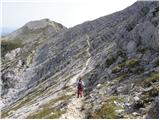 66
66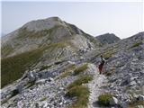 67
67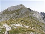 68
68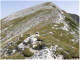 69
69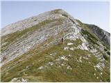 70
70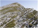 71
71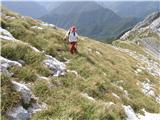 72
72 73
73
Discussion about the trip Javorje - Raskovec (via Rodica)
|
| BorStenar19. 11. 2022 19:06:28 |
hi
I recommend this path as descent to Raskovec, ascent via planina Poljana (description in the book "Bohinjske gore".) I included in the tour also a viewpoint (1786m, via unmarked path the first mountain west of saddle Čez Suho.)
|
|
|
To post a comment you must log in:
If you do not yet have a username, you must first
register.