Jazne (Lanišar) - Krog (Ledinski grič)
Starting point: Jazne (Lanišar) (660 m)
| Latitude/Longitude: | 46,07320°N 14,02420°E |
| |
Walking time: 1 h 35 min
Difficulty: easy unmarked way
Elevation gain: 280 m
Elevation difference along the route: 335 m
Map: Škofjeloško in Cerkljansko hribovje 1:50.000
Recommended equipment (summer):
Recommended equipment (winter):
Views: 240
 | 1 person like this post |
Access to starting point:
A) First, we drive to Gorenjo vas in Poljanska dolina (to here from Škofja Loka via the new bypass road that bypasses Škofja Loka, Horjul or Polhov Gradec), then we continue driving towards Žiri and Cerkno. After the settlement Trebija and just before the bridge over Poljanska Sora, we leave the main road towards Žiri and continue driving right in the direction of Cerkno. Further on, we drive on a somewhat more winding road, along which we quickly arrive at the settlement Sovodenj, where in the middle of the settlement we turn left onto the road that continues between the fire station and the cooperative house. Further on, we drive on the road that leads us along the stream Javorščica; after the settlement Koprivnik, at the smaller crossroad we continue right in the direction of Jazne-Otalež (straight Ledine, Javorjev dol, Mrzli vrh and Sivka). From the mentioned crossroad we drive approximately another 200 m, then we arrive at a hamlet with a few houses, where we notice red hiking signposts. We park in a suitable place near the crossroad, or we can drive a little further in the direction of the marked path to Sivka and then park in a suitable place by the road.
B) We drive to Žiri (to here from Vrhnika or Logatec), then we continue driving towards Škofja Loka. Before the settlement Trebija we turn left onto the road in the direction of Cerkno. Further on, we drive on a somewhat more winding road, along which we quickly arrive at the settlement Sovodenj, where in the middle of the settlement we turn left onto the road that continues between the fire station and the cooperative house. Further on, we drive on the road that leads us along the stream Javorščica; after the settlement Koprivnik, at the smaller crossroad we continue right in the direction of Jazne-Otalež (straight Ledine, Javorjev dol, Mrzli vrh and Sivka). From the mentioned crossroad we drive approximately another 200 m, then we arrive at a hamlet with a few houses, where we notice red hiking signposts. We park in a suitable place near the crossroad, or we can drive a little further in the direction of the marked path to Sivka and then park in a suitable place by the road.
C) We leave the main road Idrija - Straža - Želin at the turn-off for the settlement Jazne, then we ascend to the mentioned settlement, from where we continue driving towards Sovodenj. After a smaller saddle, where the marked path to Bevkov vrh branches off to the left, the road starts to descend, and we drive on it to a smaller hamlet beside which we notice red signposts for Sivka. We park in a suitable place near the crossroad, or we can drive a little further in the direction of the marked path to Sivka and then park in a suitable place by the road.
Route description:
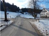
From the starting point, we head onto the road in the direction of Sivka, where the path leads past a few houses. Above the hamlet, when the road enters the forest at "rio mlinček", we continue left uphill on the cart track in the direction of Sivka. The cart track ascends transversely and quickly brings us to houses, where we step onto the road. A short descent follows to the place where the road turns right. In the middle of the bend, we leave the road and continue straight on a wide cart track, which after a further few dozen steps brings us to the hiking signposts.
We continue right on a worse cart track that climbs across a meadow. The cart track then crosses a strip of forest and brings us to the road, where we continue right past houses. We follow the road, which makes a sharp left bend between the houses, for some time. When the road brings us to the next houses, it ends. Just a few steps before the houses, we head slightly left onto the cart track in the direction of Sivka; after a few steps, when we reach the ridge southeast of Likarjeva Sivka, the path from Sovodenj joins us from the left.
We continue on the cart track in the direction of Sivka; a little further ahead the path forks, and we go straight (left are yellow markers for Mrzli vrh, the path leads us near Planinska koča Mrzl'k). Walking follows along the edge of a panoramic hayfield, where on the right we notice the forested Sivka, and a little further we step onto the asphalt road.
When we step onto the road, we continue right in the direction of Sivka (left to Koča Mrzl'k and Sovodenj via the asphalt road). The path ahead leads past the Vodičar farm; a little further, at the nearby barn, is the next junction.
We continue left in the direction of Ledinica, Breznica and Žiri (slightly right to Sivka and Ledine); the path briefly continues along an increasingly panoramic road, then at the right bend we notice markers for Mrzli vrh and the information board for Poti po rapalski meji.
Here a path to Mrzli vrh branches off slightly to the right, and we continue along the road, which descends with fine views to a smaller saddle.
Here the asphalt road descends right downhill, and we continue slightly left to the hiking signpost a few steps away, where the path forks again. Slightly left the marked path continues toward Ledinica, and we continue on the unmarked path, which proceeds along an indistinct ridge. The path ahead leads past the cottage Na Krog, after which we quickly ascend to the summit of Krog.

Photos:
 1
1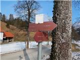 2
2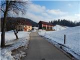 3
3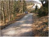 4
4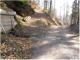 5
5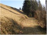 6
6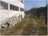 7
7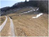 8
8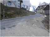 9
9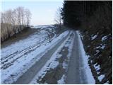 10
10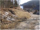 11
11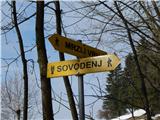 12
12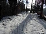 13
13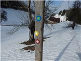 14
14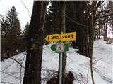 15
15 16
16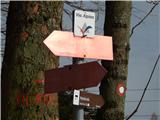 17
17 18
18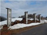 19
19 20
20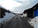 21
21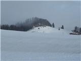 22
22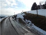 23
23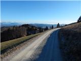 24
24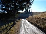 25
25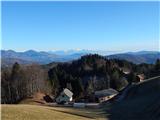 26
26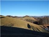 27
27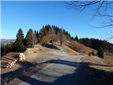 28
28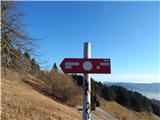 29
29 30
30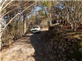 31
31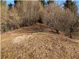 32
32 33
33 34
34 35
35 36
36
Discussion about the trip Jazne (Lanišar) - Krog (Ledinski grič)
To post a comment you must log in:
If you do not yet have a username, you must first
register.