Starting point: Jekarica (1017 m)
| Latitude/Longitude: | 46,36020°N 14,42440°E |
| |
Walking time: 2 h 10 min
Difficulty: easy marked way
Elevation gain: 727 m
Elevation difference along the route: 730 m
Map: Karavanke - osrednji del 1:50.000
Recommended equipment (summer):
Recommended equipment (winter): ice axe, crampons
Views: 31.941
 | 1 person like this post |
Access to starting point:
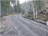
From the Ljubljana - Jesenice motorway, take the Kranj - east exit and continue along the road towards Jezersko, but only to the Kanonir inn, where we turn left and follow the initially still asphalted road. At all intersections, follow the signs for Storžič. When the road makes a sharp right turn, notice the signposts for Kališče and Storžič. Park at the parking lot near the signpost, so as not to obstruct forestry work. The road is CLOSED from 20.7. to 20.10. When the road is closed, park lower down, which extends the ascent by one hour.
Route description:
At the bend, head onto the track to the left of the signposts. Already after a few metres, notice the marker on a tree, which tells us we are on the right path. After a good five minutes of walking, a sign directs us left onto the footpath. The path, which begins to ascend moderately, soon brings us to a track, which we merely cross. The path crosses the track again just a minute further on, then ascends more steeply. It gradually turns slightly to the left and leads us to a small ridgelet, where we come very close to the track. For a while we ascend alongside the track, then a pathlet takes us to a viewpoint with a bench. The path continues back to the track, but this time to the point where it ends. Access via the track is also possible (if opting to ascend along the track, keep to the left directions at all junctions, the start is the same). The path ahead is somewhat harder to follow as large quantities of fallen timber prevent ascent along the marked path, so it is necessary to find passages, which are only partially trodden. Once this section is overcome, the path is easier to follow again, but only briefly. The path then approaches a clearing located below Storžič and turns left among the fallen trees. Again, search for passages between the trees. A few metres before Praprotnikova koča, step onto the marked path again, which leads to the hut in a few steps.
Behind the hut, continue along the marked path, which begins to ascend steeply again, then temporarily levels at a boulder. Beyond the boulder, the path temporarily enters the bed of a torrent, then starts to ascend transversely to the right. A steeper ascent follows through fairly picturesque terrain, from which a fine view opens onto the surrounding peaks. When entering the dwarf pine belt, a path branches right leading under or along the slopes of Storžič towards the aforementioned Javorniški preval; we continue straight and reach the junction at Bašeljski preval in a few minutes.
At the signposts on Bašeljsko sedlo, head left towards Kališče (right Storžič), but follow the path to the mountain hut for only a few metres, as markers for Bašeljski vrh then direct us left onto grassy-rocky slopes. Continue ascending slightly leftward to the point where dwarf pines block passage. If the correct path was missed during ascent, find it somewhat further left. A short ascent to the forepeak follows, from which Bašeljski vrh is nicely visible. From the forepeak to the summit is just one minute along the ridge, which is slippery and dangerous in snow.
Trailhead - Praprotnikova koča 1:10, Praprotnikova koča - junction below Bašeljski preval 0:30, junction below Bašeljski preval - Bašeljski preval 0:10, Bašeljski preval - Bašeljski vrh 0:20.

Along the route: Praprotnikova koča (1380m), Razpotje pod Bašeljskim prevalom (1571m), Bašeljski preval (1630m), Razpotje nad Bašeljskim prevalom (1639m)
The trip can be extended to the following destinations: Mali Grintovec
Photos:
 1
1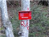 2
2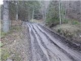 3
3 4
4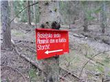 5
5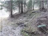 6
6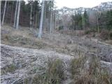 7
7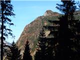 8
8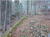 9
9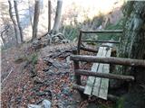 10
10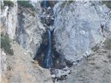 11
11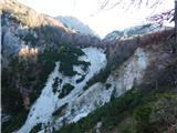 12
12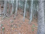 13
13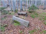 14
14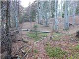 15
15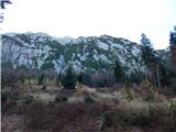 16
16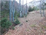 17
17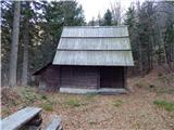 18
18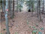 19
19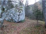 20
20 21
21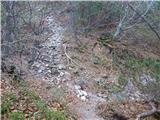 22
22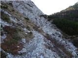 23
23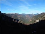 24
24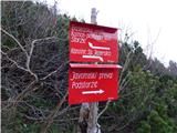 25
25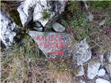 26
26 27
27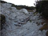 28
28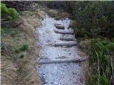 29
29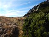 30
30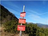 31
31 32
32 33
33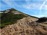 34
34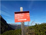 35
35 36
36 37
37 38
38 39
39 40
40 41
41 42
42 43
43 44
44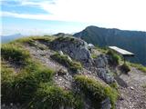 45
45
Discussion about the trip Jekarica - Bašeljski vrh
|
| velkavrh25. 06. 2010 |
Started from Jekarica already at 7 am today. The barrier is up. There's a no-entry sign. This year no notice when full closure, just the sign, so probably risking a fine if caught at the end of the path. Weather very suitable, not too hot, not too cold. Path as always very pleasant, without crowds typical of the path from Mač. At Bašeljsko sedlo in really one hour, then short ascent to Bašeljski vrh. Great viewpoint to Storžič and the valley. Then descent to the hut where they serve friendly as always. Nice introduction to the hiking season!
|
|
|
|
| PINOKIO27. 03. 2017 |
Has anyone hiked this trail recently? I'm curious about the road closure situation and where that hut is that "velkavrh" describes. I need an answer right away because I plan to go there tomorrow. Thanks for the reply. 
|
|
|
|
| Daaam27. 03. 2017 |
He probably meant the hut on Kališče. Tomorrow it's probably closed, so don't count on any service. I don't know anything about the closure.. but you can choose another starting point just in case. Best regards
|
|
|
|
| PINOKIO27. 03. 2017 |
Thanks Daaam, service is no problem, we'll see about the closure how and what. 
|
|
|
|
| PINOKIO30. 03. 2017 |
On 28.03.2017 I walked the described path. I have one compliment and one complaint:
- COMPLIMENT to PD Kranj for the very well-marked path,
- COMPLAINT to PD Kranj, because the summit logbook at Bašeljski vrh is full, and otherwise already in very poor condition and it would be appropriate to replace it with a new one.
|
|
|
|
| ucakakla1. 04. 2017 |
PINOKIO - how was it with the roadblock afterwards, where did you park? And what about the path to the summit, completely dry?
|
|
|
|
| Anansie1. 04. 2017 |
No closures... the road is in surprisingly good condition.
best regards
|
|
|
|
| SunnyDay17. 07. 2017 |
The road is officially closed - allowed only for users/owners of forest land, but the barrier was still open on 15.7. (at the "parking lot" at the start of the described tour there were three cars). From 20.7. onwards complete closure applies.
Otherwise quite steep, excellently marked and undemanding, mostly shady trail, where we met only one hiker.
We descended via Javorški preval; so Jekarica-Bašeljski preval and summit-Dom na Kališču-Bašeljski preval-Javorški preval-Jekarica.
|
|
|
To post a comment you must log in:
If you do not yet have a username, you must first
register.