Jekarica - Dom na Kališču
Starting point: Jekarica (1017 m)
| Latitude/Longitude: | 46,36020°N 14,42440°E |
| |
Walking time: 2 h 5 min
Difficulty: easy marked way
Elevation gain: 517 m
Elevation difference along the route: 620 m
Map: Karavanke - osrednji del 1:50.000
Recommended equipment (summer):
Recommended equipment (winter): ice axe, crampons
Views: 29.518
 | 1 person like this post |
Access to starting point:
From the Ljubljana - Jesenice motorway, take the Kranj - east exit and continue following the road towards Jezersko, but only to the Kanonir inn, where we turn left and follow the initially still asphalted road. At all intersections, follow the signs for Storžič. When the road makes a sharp right bend, notice the signposts for Kališče and Storžič. Park at the parking lot near the signpost so as not to obstruct forestry work. The road is CLOSED from 20.7. to 20.10. When the road is closed, park lower down, which extends the ascent by one hour.
Route description:
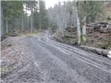
At the bend, turn onto the cart track to the left of the signposts. Already after a few metres, notice the marker on the tree, which tells us we are on the right path. After a good five minutes of walking, a signpost directs us left onto the footpath. The path, starting with a moderate ascent, soon leads us to a cart track, which we merely cross. The path crosses the cart track again just a minute further on, then ascends more steeply. It gradually turns slightly to the left and leads us to a small ridge where we come very close to the cart track. For some time we ascend alongside the cart track, then a narrow path takes us to a viewpoint with a bench. The path continues back to the cart track, but this time to the point where it ends. Access via the cart track is also possible (if opting for the cart track ascent, keep to the left directions at all junctions, the start is the same). The path ahead is somewhat harder to follow as large amounts of fallen timber prevent ascent along the marked path, so passages must be sought, which are only partially trodden. Once this section is overcome, the path is easier to follow again, but only briefly. The path approaches a clearing below Storžič and turns left among the fallen trees. Again, seek passages between the trees. A few metres before Praprotnikova koča, step back onto the marked path, reaching the hut in a few steps.
Behind the hut, continue along the marked path, which resumes a steeper ascent, then temporarily levels at a boulder. Behind the boulder, the path temporarily enters the torrent bed, then begins a traverse ascent to the right. A steeper ascent follows through fairly picturesque terrain, offering fine views of the surrounding peaks. Upon entering the dwarf pine belt, a path branches right leading under or along the slopes of Storžič towards the aforementioned Javorniški preval, while we continue straight, reaching the junction at Bašeljski preval in a few minutes.
Continue left towards Kališče (right Storžič) and traverse the slopes of Bašeljski vrh. After about 10 minutes of traversing or slight descent, reach a marked junction, continuing straight ahead (sharp left Bašeljski vrh, sharp right Mala and Velika Poljana); the path leads onto a scenic ridge along which we descend easily for a few more minutes to Dom na Kališču.
Starting point - Praprotnikova koča 1:10, Praprotnikova koča - junction below Bašeljski preval 0:30, junction below Bašeljski preval - Bašeljski preval 0:10, Bašeljski preval - junction above Kališče 0:10, junction above Kališče - Dom na Kališču 0:05.

Along the route: Praprotnikova koča (1380m), Razpotje pod Bašeljskim prevalom (1571m), Bašeljski preval (1630m), Razpotje nad Bašeljskim prevalom (1639m), Razpotje nad Kališčem (1570m)
Photos:
 1
1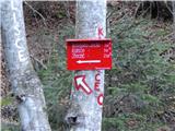 2
2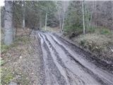 3
3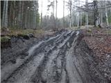 4
4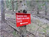 5
5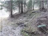 6
6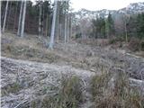 7
7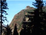 8
8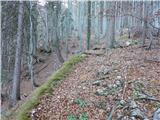 9
9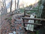 10
10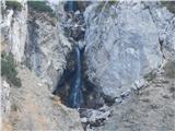 11
11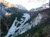 12
12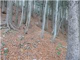 13
13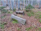 14
14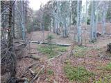 15
15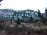 16
16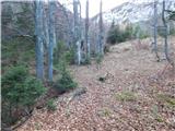 17
17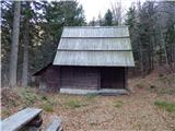 18
18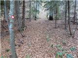 19
19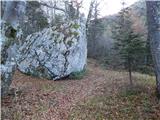 20
20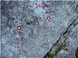 21
21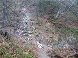 22
22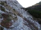 23
23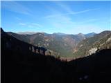 24
24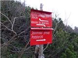 25
25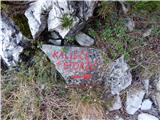 26
26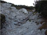 27
27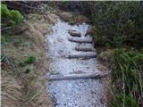 28
28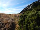 29
29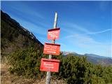 30
30 31
31 32
32 33
33 34
34 35
35 36
36 37
37 38
38 39
39 40
40 41
41
Discussion about the trip Jekarica - Dom na Kališču
|
| Gost22. 07. 2007 |
Brane V.-Nice short, easy hike, which is however greatly extended by the closed road. But because of the beautiful two waterfalls and the flowing water on some rocks covered in green moss along the road soon after the barrier, it's worth just walking. In this heat it feels very good.
|
|
|
|
| malena10. 06. 2013 |
Yesterday my daughter and 6-year-old niece and I took this path to Kališče. Luckily we had the route description with us, as the markings are really deficient in places. We didn't meet any hikers on this path.
The štruklji in the hut are excellent, but prices for both drinks and food are quite high.
|
|
|
|
| balon5. 07. 2013 |
Is the notice that the hut will be closed for 3 months still current or is it from the past.
|
|
|
|
| balon15. 10. 2013 |
Does anyone have info whether the road to the parking lot will be open after 20.10?
thanks for the reply
|
|
|
|
| balon20. 07. 2014 |
is the road closed or....?
|
|
|
|
| Borut11. 09. 2014 |
Does the mentioned road closure apply this year too? Thanks.
|
|
|
|
| SunnyDay17. 07. 2017 |
The road is officially closed - allowed only for users/owners of forest land, but the barrier was still open on 15.7.2017 (at the "parking lot" at the start of the described tour there were three cars). From 20.7. onwards complete closure applies.
|
|
|
|
| simon796. 05. 2019 |
2.5.2019 - barrier lifted, drove by car another ca. 3 km where forestry works were taking place. Then ca. 20 minutes on foot to the starting point in the 1st picture. Perhaps update the description, the path is now nicely marked and easily followable, no obstacles. 5 minutes before the hut a bluethroat crossed the path.
|
|
|
To post a comment you must log in:
If you do not yet have a username, you must first
register.