Jekarica - Mali Grintovec
Starting point: Jekarica (1017 m)
| Latitude/Longitude: | 46,36020°N 14,42440°E |
| |
Walking time: 2 h 55 min
Difficulty: easy marked way
Elevation gain: 796 m
Elevation difference along the route: 920 m
Map: Karavanke - osrednji del 1:50.000
Recommended equipment (summer):
Recommended equipment (winter): ice axe, crampons
Views: 29.479
 | 1 person like this post |
Access to starting point:
From the Ljubljana - Jesenice motorway, take the Kranj - east exit and continue along the road towards Jezersko, but only to the Kanonir inn, where we turn left and follow the initially still asphalted road. At all intersections, follow the signs for Storžič. When the road makes a sharp right bend, notice the signposts for Kališče and Storžič. Park in the parking area near the signpost, so as not to obstruct forestry work. The road is CLOSED from 20.7. to 20.10. When the road is closed, park lower down, which extends the ascent by one hour.
Route description:
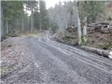
At the bend, head onto the track to the left of the signposts. After just a few metres, notice the marker on a tree, which tells us we are on the right path. After a good five minutes of walking, a sign directs us left onto the footpath. The path, which begins to ascend moderately, soon brings us to a track, which we merely cross. The path crosses the track again just a minute further on, then ascends more steeply. It then gradually turns slightly to the left and leads us to a small ridgelet, where we come right up to the track. For a while we ascend alongside the track, then a pathlet takes us to a viewpoint where there is a bench. The path ahead brings us back to the track, but this time to the point where it ends. It is also possible to approach via the track (if we decide to ascend along the track, keep to the left directions at all junctions, the start is the same). The path further on is somewhat harder to follow as large quantities of fallen timber prevent ascent along the marked path, so it is necessary to find passages, which are only partially trodden. Once we get through this section, the path is easier to follow again, but only for a short time. The path then approaches a clearing located below Storžič and turns left among the fallen trees. Again we search for passages between the trees. A few metres before Praprotnikova koča we step back onto the marked path, along which we reach the hut in a few steps.
Beyond the hut, continue along the marked path, which begins to ascend steeply again, then levels off temporarily at a boulder. Beyond the boulder, the path temporarily enters the bed of a torrent, then begins to ascend transversely to the right. This is followed by a steeper ascent through fairly picturesque terrain, from which we get a fine view of the surrounding mountains. When we enter the belt of dwarf pines, a path branches off to the right leading below or along the slopes of Storžič towards the aforementioned Javorniški preval, while we continue straight ahead and reach a junction at Bašeljski preval in a few minutes.
At the signposts on Bašeljsko sedlo, head left towards Kališče (right Storžič), but follow the path to the mountain hut for only a few metres, as the markers for Bašeljski vrh then direct us left onto grassy - rocky slopes. Continue ascending slightly to the left to the point where dwarf pines block the way. If we missed the right path during the ascent, we find it a bit further to the left. This is followed by a short ascent to the subpeak, from which Bašeljski vrh is clearly visible. From the subpeak to the summit, it is just one minute of walking along the ridge, which is slippery in snow.
From Bašeljski vrh, we begin a relatively steep descent towards the east to northeast along a path that runs along and on the ridge, which is mostly covered with dwarf pines; where there are none, a bit more care is needed. After about 15 minutes, the descent ends and the path brings us to Mačensko sedlo, where a marked path from Kališče and an unmarked path along the Suha valley join us.
Continue straight towards Mali Grintovec along a path that begins to ascend relatively steeply up the western slope of the said mountain. After about half an hour of walking from Mačensko sedlo, we reach a marked junction where the path from Dolga njiva joins from the right. Continue left and after a further ten or so steps reach the summit of Mali Grintovec.
Starting point - Praprotnikova koča 1:10, Praprotnikova koča - junction below Bašeljski preval 0:30, junction below Bašeljski preval - Bašeljski preval 0:10, Bašeljski preval - Bašeljski vrh 0:20, Bašeljski vrh - Mačensko sedlo 0:15, Mačensko sedlo - Mali Grintovec 0:30.

Photos:
 1
1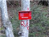 2
2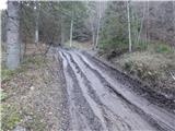 3
3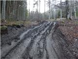 4
4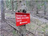 5
5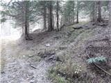 6
6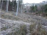 7
7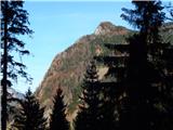 8
8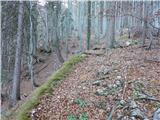 9
9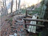 10
10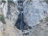 11
11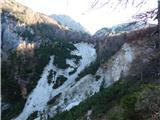 12
12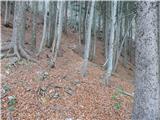 13
13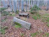 14
14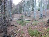 15
15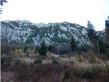 16
16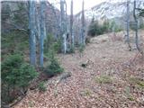 17
17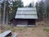 18
18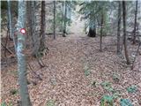 19
19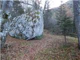 20
20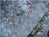 21
21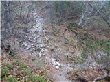 22
22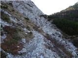 23
23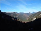 24
24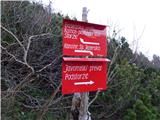 25
25 26
26 27
27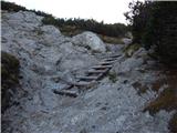 28
28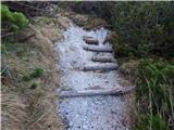 29
29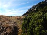 30
30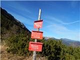 31
31 32
32 33
33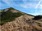 34
34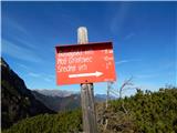 35
35 36
36 37
37 38
38 39
39 40
40 41
41 42
42 43
43 44
44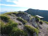 45
45 46
46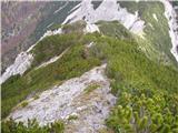 47
47 48
48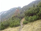 49
49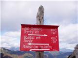 50
50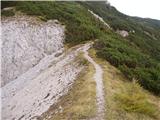 51
51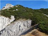 52
52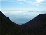 53
53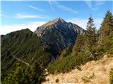 54
54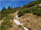 55
55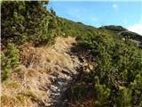 56
56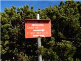 57
57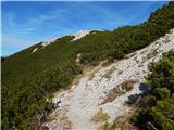 58
58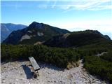 59
59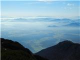 60
60 61
61
Discussion about the trip Jekarica - Mali Grintovec
|
| plaNinaPirsMajcen16. 05. 2026 18:00:39 |
Hi.
The path is nicely renovated up to Bašeljski preval. The starting point Jekarica is nicer than here above in the picture, a large gravel parking lot. However, the road is not for a low car.
I recorded some parts of the path and you can watch them in the video:
https://youtu.be/-_grtcXKpRo?is=Rg1SnjCKWs46MvNp
From Mali Grintovec it is worth extending to Srednji vrh and Cjanovce.
Really nice path, I recommend.
Lp, Nina
|
|
|
To post a comment you must log in:
If you do not yet have a username, you must first
register.