Jekarica - Praprotnikova koča
Starting point: Jekarica (1017 m)
| Latitude/Longitude: | 46,36020°N 14,42440°E |
| |
Walking time: 1 h 10 min
Difficulty: easy marked way
Elevation gain: 363 m
Elevation difference along the route: 363 m
Map: Karavanke - osrednji del 1:50.000
Recommended equipment (summer):
Recommended equipment (winter): ice axe, crampons
Views: 6.105
 | 1 person like this post |
Access to starting point:
From the Ljubljana - Jesenice motorway, take the Kranj - east exit and continue on the road towards Jezersko, but only to the Kanonir inn, where we turn left and follow the initially still asphalted road. At all intersections, head towards the signs for Storžič. When the road makes a sharp right turn, notice the signposts for Kališče and Storžič. Park in the parking lot near the signpost, so as not to obstruct forestry work. The road is CLOSED from July 20 to October 20. When the road is closed, park lower down, which extends the ascent by one hour.
Route description:
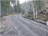
At the bend, head onto the cart track left of the signposts. After just a few metres, notice the marker on a tree, which tells us we are on the right path. After a good five minutes of walking, a sign directs us left onto the footpath. The path, starting to ascend moderately, soon brings us to a cart track, which we merely cross. The path crosses the cart track again just a minute further on, then ascends more steeply. It gradually turns slightly to the left and leads us to a small ridgelet, where we come very close to the cart track. For a while we ascend alongside the cart track, then a pathlet takes us to a viewpoint where there is a bench. The path continues back to the cart track, but this time to the point where it ends. Access via the cart track is also possible (if opting for the cart track ascent, keep to the left directions at all forks, the start is the same). The path ahead is somewhat harder to follow as large quantities of fallen trees prevent ascent on the marked path, so it is necessary to find passages, which are only partially trodden. Once we overcome this section, the path is easier to follow again, but only briefly. The path then approaches a clearing located under Storžič and turns left among the fallen trees. Again, we search for passages through the trees. A few metres before Praprotnikova koča, we step back onto the marked path, which takes us to the hut in a few steps.

Photos:
 1
1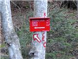 2
2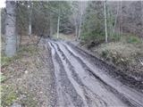 3
3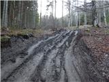 4
4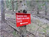 5
5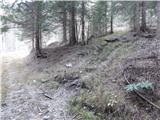 6
6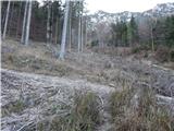 7
7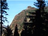 8
8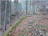 9
9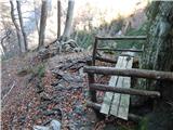 10
10 11
11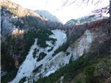 12
12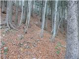 13
13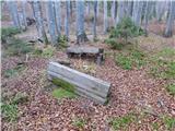 14
14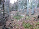 15
15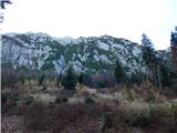 16
16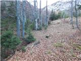 17
17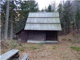 18
18
Discussion about the trip Jekarica - Praprotnikova koča
To post a comment you must log in:
If you do not yet have a username, you must first
register.